Property Record
20 Mayo Rd, Edgewater, MD 21037
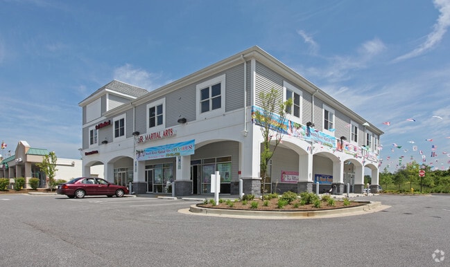

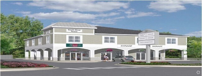
Property Detail
20 Mayo Rd
01-000-90224736
LT 2R SOUTH RIVER CROSSING
Storebuilding
Anne Arundel
C3
Maryland
B and X Area of moderate flood hazard, usually the area between the limits of the 100-year and 500-year floods.
2r
2024
2.06 AC
2025
Southern Anne Arundel
701104
Baltimore
10,658 SF
Baltimore-Columbia-Towson, MD
NEARBY LISTINGS FOR SALE OR LEASE
DEMOGRAPHICS near 20 Mayo Rd
1 mile
3 mile
5 mile
2025 Total Population
7,992
34,134
101,929
2030 Population
8,048
34,631
103,740
Pop Growth 2025-2030
+ 0.70%
+ 1.46%
+ 1.78%
Average Age
42
43
43
2025 Total Households
3,077
13,286
41,754
HH Growth 2025-2030
+ 0.65%
+ 1.55%
+ 1.82%
Median Household Inc
$106,893
$127,726
$118,473
Avg Household Size
2.50
2.50
2.30
2025 Avg HH Vehicles
2.00
2.00
2.00
Median Home Value
$448,783
$581,033
$601,299
Median Year Built
1978
1985
1982
Nearby Places
Map Layers
Map Styles
 Street
 Aerial
Transit
 Traffic
 Biking
Places
Listings with unknown addresses are not visible on the map
- Restaurants
- Banks
- Shops
- Fitness
- Groceries
PUBLIC TRANSPORTATION
AIRPORT
Baltimore/Washington International Thurgood Marshall
Drive
Walk
Distance
Baltimore/Washington International Thurgood Marshall
36 min
24.6 mi
Ronald Reagan Washington Ntl
Drive
Walk
Distance
Ronald Reagan Washington Ntl
53 min
36.3 mi
Freight Ports
Port of Baltimore
Drive
Walk
Distance
Port of Baltimore
42 min
29.9 mi
SALE & LEASE HISTORY
LISTING DATE
SALE/LEASE

Sep 29, 2017
For Sale
Sep 25, 2016
For Lease
Oct 04, 2017
For Sale
Feb 01, 2018
For Sale
Nearby Properties
Address
Land Use
TOTAL SIZE
Lot Size
Zoning
Address
Land Use
TOTAL SIZE
Lot Size
Zoning
296,790 SF
27.74 AC
TC
Address
Land Use
TOTAL SIZE
Lot Size
Zoning
313,440 SF
23.43 AC
TC
Address
Land Use
TOTAL SIZE
Lot Size
Zoning
441,482 SF
3.85 AC
W1
Address
Land Use
TOTAL SIZE
Lot Size
Zoning
365,268 SF
4.85 AC
W1
Address
Land Use
TOTAL SIZE
Lot Size
Zoning
97,888 SF
59.42 AC
C2
Address
Land Use
TOTAL SIZE
Lot Size
Zoning
589,210 SF
111.38 AC
RA
Address
Land Use
TOTAL SIZE
Lot Size
Zoning
309,756 SF
0.01 AC
R-22
Address
Land Use
TOTAL SIZE
Lot Size
Zoning
285,174 SF
24 AC
R2
Address
Land Use
TOTAL SIZE
Lot Size
Zoning
254,969 SF
13.73 AC
W1A
Address
Land Use
TOTAL SIZE
Lot Size
Zoning
73.33 AC
R2
Address
Land Use
TOTAL SIZE
Lot Size
Zoning
25,990 SF
32.06 AC
C2
Address
Land Use
TOTAL SIZE
Lot Size
Zoning
74,527 SF
16.62 AC
TC
Address
Land Use
TOTAL SIZE
Lot Size
Zoning
91.22 AC
C2
Address
Land Use
TOTAL SIZE
Lot Size
Zoning
138,592 SF
8.47 AC
W1
Address
Land Use
TOTAL SIZE
Lot Size
Zoning
2.43 AC
TC
Address
Land Use
TOTAL SIZE
Lot Size
Zoning
15 AC
C2
Address
Land Use
TOTAL SIZE
Lot Size
Zoning
134,693 SF
6 AC
R2
Address
Land Use
TOTAL SIZE
Lot Size
Zoning
124,626 SF
4.73 AC
C2
Address
Land Use
TOTAL SIZE
Lot Size
Zoning
9.15 AC
C2
Address
Land Use
TOTAL SIZE
Lot Size
Zoning
117,008 SF
1.40 AC
C4
Address
Land Use
TOTAL SIZE
Lot Size
Zoning
194,350 SF
8.29 AC
R-22
Address
Land Use
TOTAL SIZE
Lot Size
Zoning
150,240 SF
16.02 AC
TC
Address
Land Use
TOTAL SIZE
Lot Size
Zoning
39.83 AC
R2
Address
Land Use
TOTAL SIZE
Lot Size
Zoning
52,228 SF
4.94 AC
C2
Address
Land Use
TOTAL SIZE
Lot Size
Zoning
149,300 SF
2.93 AC
C2
Address
Land Use
TOTAL SIZE
Lot Size
Zoning
132,000 SF
5.55 AC
W1B
Address
Land Use
TOTAL SIZE
Lot Size
Zoning
82,022 SF
50.50 AC
RA
Address
Land Use
TOTAL SIZE
Lot Size
Zoning
112,662 SF
14.44 AC
C3
Address
Land Use
TOTAL SIZE
Lot Size
Zoning
77,261 SF
3.56 AC
C3
Address
Land Use
TOTAL SIZE
Lot Size
Zoning
94,932 SF
9.52 AC
C4
The World's #1 Commercial Real Estate Marketplace
Connect with us
© 2026 CoStar Group
The information above has been obtained from sources believed reliable. While we do not doubt its accuracy we have not verified it and make no guarantee, warranty or representation about it. It is your responsibility to independently confirm its accuracy and completeness. Any projections, opinions, assumptions, or estimates used are for example only and do not represent the current or future performance of the property. The value of this transaction to you depends on tax and other factors which should be evaluated by your tax, financial, and legal advisors. You and your advisors should conduct a careful, independent investigation of the property to determine to your satisfaction the suitability of the property for your needs.