Property Record
20 Myrtle Ave, Stamford, CT 06902


NEARBY LISTINGS FOR SALE OR LEASE
Property Detail
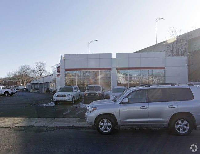
20 Myrtle Ave
Commercialbuilding
Fairfield
X
Connecticut
09001C0517G
1.23 AC
2024
Stamford
2025
Westchester/So Connecticut
020102
Bridgeport-Stamford-Danbury, CT
13,311 SF
STAM-000004-000000-003073
DEMOGRAPHICS near 20 Myrtle Ave
1 mile
3 mile
5 mile
2024 Total Population
45,173
135,565
187,157
2029 Population
45,724
136,557
188,402
Pop Growth 2024-2029
+ 1.22%
+ 0.73%
+ 0.67%
Average Age
38
38
39
2024 Total Households
19,613
53,476
71,303
HH Growth 2024-2029
+ 1.66%
+ 1.02%
+ 0.85%
Median Household Inc
$88,276
$101,997
$116,068
Avg Household Size
2.20
2.40
2.50
2024 Avg HH Vehicles
1.00
2.00
2.00
Median Home Value
$400,235
$635,874
$787,904
Median Year Built
1974
1973
1970
Nearby Places
Map Layers
Map Styles
 Street
 Aerial
Transit
 Traffic
 Biking
Places
Listings with unknown addresses are not visible on the map
- Restaurants
- Banks
- Shops
- Fitness
- Groceries
PUBLIC TRANSPORTATION
COMMUTER RAIL
Stamford Station (New Haven Line - Shore Line East, Shore Line East - Shore Line East)
Drive
Walk
Distance
Stamford Station (New Haven Line - Shore Line East, Shore Line East - Shore Line East)
3 min
1.2 mi
Glenbrook Station (New Haven Line - Metro-North Commuter Railroad Company (Metro-North))
Drive
Walk
Distance
Glenbrook Station (New Haven Line - Metro-North Commuter Railroad Company (Metro-North))
3 min
1.9 mi
AIRPORT
Westchester County
Drive
Walk
Distance
Westchester County
25 min
13.8 mi
LaGuardia
Drive
Walk
Distance
LaGuardia
51 min
33.0 mi
Freight Ports
NY - Red Hook Container Terminal
Drive
Walk
Distance
NY - Red Hook Container Terminal
66 min
43.5 mi
Nearby Properties
Address
Land Use
TOTAL SIZE
Lot Size
Zoning
Address
Land Use
TOTAL SIZE
Lot Size
Zoning
13.21 AC
CSCD
Address
Land Use
TOTAL SIZE
Lot Size
Zoning
8.91 AC
DC
Address
Land Use
TOTAL SIZE
Lot Size
Zoning
336,000 SF
40 AC
MU
Address
Land Use
TOTAL SIZE
Lot Size
Zoning
5.10 AC
MXD
Address
Land Use
TOTAL SIZE
Lot Size
Zoning
Address
Land Use
TOTAL SIZE
Lot Size
Zoning
397,378 SF
4.25 AC
CC
Address
Land Use
TOTAL SIZE
Lot Size
Zoning
352,296 SF
CC
Address
Land Use
TOTAL SIZE
Lot Size
Zoning
344,483 SF
CC
Address
Land Use
TOTAL SIZE
Lot Size
Zoning
543,005 SF
2.23 AC
RHD
Address
Land Use
TOTAL SIZE
Lot Size
Zoning
411,596 SF
3.30 AC
MZN
Address
Land Use
TOTAL SIZE
Lot Size
Zoning
4.13 AC
CC
Address
Land Use
TOTAL SIZE
Lot Size
Zoning
358,662 SF
CC
Address
Land Use
TOTAL SIZE
Lot Size
Zoning
Address
Land Use
TOTAL SIZE
Lot Size
Zoning
46,302 SF
23.50 AC
MG
Address
Land Use
TOTAL SIZE
Lot Size
Zoning
9.62 AC
MZN
Address
Land Use
TOTAL SIZE
Lot Size
Zoning
119,364 SF
1.55 AC
SRDS
Address
Land Use
TOTAL SIZE
Lot Size
Zoning
17.54 AC
DWD
Address
Land Use
TOTAL SIZE
Lot Size
Zoning
359,686 SF
1.67 AC
CCN
Address
Land Use
TOTAL SIZE
Lot Size
Zoning
377,754 SF
2.06 AC
PD
Address
Land Use
TOTAL SIZE
Lot Size
Zoning
79.29 AC
P
Address
Land Use
TOTAL SIZE
Lot Size
Zoning
32.68 AC
MD
Address
Land Use
TOTAL SIZE
Lot Size
Zoning
8.21 AC
CWD
Address
Land Use
TOTAL SIZE
Lot Size
Zoning
369,364 SF
2.50 AC
SRDN
Address
Land Use
TOTAL SIZE
Lot Size
Zoning
359,260 SF
1.50 AC
SRDS
Address
Land Use
TOTAL SIZE
Lot Size
Zoning
304,617 SF
CI
Address
Land Use
TOTAL SIZE
Lot Size
Zoning
0.49 AC
CC
Address
Land Use
TOTAL SIZE
Lot Size
Zoning
377,918 SF
22.42 AC
MZN
Address
Land Use
TOTAL SIZE
Lot Size
Zoning
207,592 SF
1.32 AC
SRDS
Address
Land Use
TOTAL SIZE
Lot Size
Zoning
304,345 SF
1.15 AC
PD
Address
Land Use
TOTAL SIZE
Lot Size
Zoning
277,740 SF
2.82 AC
TCDD
The World's #1 Commercial Real Estate Marketplace
Connect with us
© 2026 CoStar Group
The information above has been obtained from sources believed reliable. While we do not doubt its accuracy we have not verified it and make no guarantee, warranty or representation about it. It is your responsibility to independently confirm its accuracy and completeness. Any projections, opinions, assumptions, or estimates used are for example only and do not represent the current or future performance of the property. The value of this transaction to you depends on tax and other factors which should be evaluated by your tax, financial, and legal advisors. You and your advisors should conduct a careful, independent investigation of the property to determine to your satisfaction the suitability of the property for your needs.