Property Record
20 N Ridge Rd E, Ashtabula, OH 44004

NEARBY LISTINGS FOR SALE OR LEASE
-
-
View all Ashtabula listings for sale on LoopNet.com
Property Detail
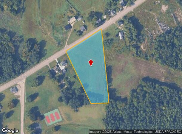
20 N Ridge Rd E
Cleveland-Elyria, OH
PE #18P SHELLHAMMER PCL PT OF LOTS 12 & 15
030000016500
Ashtabula
Utilities
Ohio
X
12,15
39007C0065E
4.24 AC
2024
Ashtabula County
2024
Cleveland
000701
DEMOGRAPHICS near 20 N Ridge Rd E
1 Mile
3 Mile
5 Mile
2024 Total Population
702
8,448
28,968
2029 Population
700
8,408
28,782
Pop Growth 2024-2029
(0.28%)
(0.47%)
(0.64%)
Average Age
45
43
41
2024 Total Households
309
3,670
12,232
HH Growth 2024-2029
(0.32%)
(0.57%)
(0.76%)
Median Household Inc
$43,749
$47,026
$41,915
Avg Household Size
2.30
2.20
2.20
2024 Avg HH Vehicles
2.00
2.00
2.00
Median Home Value
$132,000
$93,183
$96,047
Median Year Built
1963
1956
1955
Nearby Places
Map Layers
Map Styles
 Street
 Aerial
- Restaurants
- Banks
- Shops
- Fitness
- Groceries
SALE & LEASE HISTORY
LISTING DATE
SALE/LEASE

Feb 22, 2017
For Sale
Nearby Properties
Address
Land Use
TOTAL SIZE
Lot Size
Zoning
Address
Land Use
TOTAL SIZE
Lot Size
Zoning
219,369 SF
21.87 AC
Address
Land Use
TOTAL SIZE
Lot Size
Zoning
417,667 SF
91.53 AC
Address
Land Use
TOTAL SIZE
Lot Size
Zoning
148,372 SF
18 AC
Address
Land Use
TOTAL SIZE
Lot Size
Zoning
113,353 SF
72.10 AC
Address
Land Use
TOTAL SIZE
Lot Size
Zoning
302,473 SF
31.70 AC
Address
Land Use
TOTAL SIZE
Lot Size
Zoning
124,358 SF
49.11 AC
Address
Land Use
TOTAL SIZE
Lot Size
Zoning
116,000 SF
44.51 AC
Address
Land Use
TOTAL SIZE
Lot Size
Zoning
683,606 SF
61.73 AC
Address
Land Use
TOTAL SIZE
Lot Size
Zoning
30,530 SF
2.72 AC
Address
Land Use
TOTAL SIZE
Lot Size
Zoning
98,831 SF
13.28 AC
Address
Land Use
TOTAL SIZE
Lot Size
Zoning
116,093 SF
28.16 AC
Address
Land Use
TOTAL SIZE
Lot Size
Zoning
60,687 SF
3.91 AC
Address
Land Use
TOTAL SIZE
Lot Size
Zoning
Address
Land Use
TOTAL SIZE
Lot Size
Zoning
146,940 SF
28.52 AC
Address
Land Use
TOTAL SIZE
Lot Size
Zoning
31,912 SF
1.45 AC
Address
Land Use
TOTAL SIZE
Lot Size
Zoning
48,864 SF
9.36 AC
Address
Land Use
TOTAL SIZE
Lot Size
Zoning
33,618 SF
24.42 AC
Address
Land Use
TOTAL SIZE
Lot Size
Zoning
8,618 SF
46.05 AC
Address
Land Use
TOTAL SIZE
Lot Size
Zoning
51,416 SF
3.17 AC
Address
Land Use
TOTAL SIZE
Lot Size
Zoning
4,576 SF
208.55 AC
Address
Land Use
TOTAL SIZE
Lot Size
Zoning
60,109 SF
10 AC
Address
Land Use
TOTAL SIZE
Lot Size
Zoning
95,523 SF
40.30 AC
Address
Land Use
TOTAL SIZE
Lot Size
Zoning
54,845 SF
4.59 AC
Address
Land Use
TOTAL SIZE
Lot Size
Zoning
92,720 SF
40.53 AC
Address
Land Use
TOTAL SIZE
Lot Size
Zoning
34,810 SF
7.96 AC
Address
Land Use
TOTAL SIZE
Lot Size
Zoning
18,112 SF
5 AC
Address
Land Use
TOTAL SIZE
Lot Size
Zoning
374,572 SF
104.60 AC
Address
Land Use
TOTAL SIZE
Lot Size
Zoning
20,725 SF
2.57 AC
Address
Land Use
TOTAL SIZE
Lot Size
Zoning
25,596 SF
3.38 AC
Address
Land Use
TOTAL SIZE
Lot Size
Zoning
19,491 SF
1.09 AC
The World's #1 Commercial Real Estate Marketplace
Connect with us
© 2026 CoStar Group
The information above has been obtained from sources believed reliable. While we do not doubt its accuracy we have not verified it and make no guarantee, warranty or representation about it. It is your responsibility to independently confirm its accuracy and completeness. Any projections, opinions, assumptions, or estimates used are for example only and do not represent the current or future performance of the property. The value of this transaction to you depends on tax and other factors which should be evaluated by your tax, financial, and legal advisors. You and your advisors should conduct a careful, independent investigation of the property to determine to your satisfaction the suitability of the property for your needs.