Property Record
20 N Ridge Rd E, Ashtabula, OH 44004
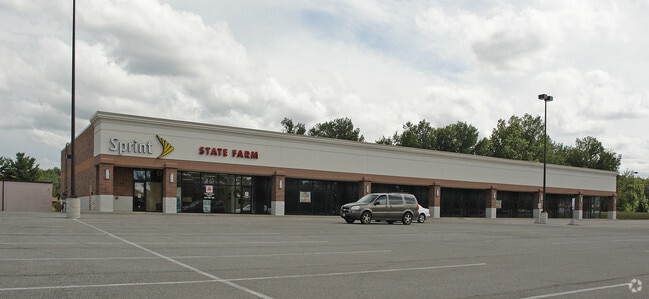
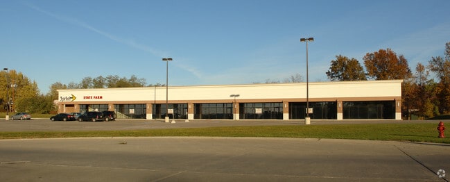
Property Detail
20 N Ridge Rd E
Cleveland-Elyria, OH
LOT #3 MARKET PLACE SUB
030560000400
ASHTABULA
Commercialacreage
Ohio
B and X Area of moderate flood hazard, usually the area between the limits of the 100-year and 500-year floods.
3
2024
1.90 AC
2024
Ashtabula County
000300
Cleveland
NEARBY LISTINGS FOR SALE OR LEASE
DEMOGRAPHICS near 20 N Ridge Rd E
1 mile
3 mile
5 mile
2025 Total Population
1,241
13,962
29,653
2030 Population
1,233
13,929
29,488
Pop Growth 2025-2030
(0.64%)
(0.24%)
(0.56%)
Average Age
46
41
41
2025 Total Households
531
6,055
12,542
HH Growth 2025-2030
(0.56%)
(0.40%)
(0.69%)
Median Household Inc
$57,777
$50,862
$53,505
Avg Household Size
2.30
2.20
2.20
2025 Avg HH Vehicles
2.00
2.00
2.00
Median Home Value
$156,851
$113,244
$134,589
Median Year Built
1961
1952
1955
Nearby Places
Map Layers
Map Styles
 Street
 Aerial
Transit
 Traffic
 Biking
Places
Listings with unknown addresses are not visible on the map
- Restaurants
- Banks
- Shops
- Fitness
- Groceries
SALE & LEASE HISTORY
LISTING DATE
SALE/LEASE

Mar 10, 2017
For Lease
Nearby Properties
Address
Land Use
TOTAL SIZE
Lot Size
Zoning
Address
Land Use
TOTAL SIZE
Lot Size
Zoning
297,379 SF
2.03 AC
Address
Land Use
TOTAL SIZE
Lot Size
Zoning
421,253 SF
260.15 AC
Address
Land Use
TOTAL SIZE
Lot Size
Zoning
0.36 AC
Address
Land Use
TOTAL SIZE
Lot Size
Zoning
219,369 SF
21.87 AC
Address
Land Use
TOTAL SIZE
Lot Size
Zoning
417,667 SF
91.53 AC
Address
Land Use
TOTAL SIZE
Lot Size
Zoning
148,372 SF
18 AC
Address
Land Use
TOTAL SIZE
Lot Size
Zoning
113,353 SF
72.10 AC
Address
Land Use
TOTAL SIZE
Lot Size
Zoning
302,473 SF
31.70 AC
Address
Land Use
TOTAL SIZE
Lot Size
Zoning
124,358 SF
49.11 AC
Address
Land Use
TOTAL SIZE
Lot Size
Zoning
116,000 SF
44.51 AC
Address
Land Use
TOTAL SIZE
Lot Size
Zoning
683,606 SF
61.73 AC
Address
Land Use
TOTAL SIZE
Lot Size
Zoning
59,222 SF
6.76 AC
Address
Land Use
TOTAL SIZE
Lot Size
Zoning
21,912 SF
1.47 AC
Address
Land Use
TOTAL SIZE
Lot Size
Zoning
30,530 SF
2.72 AC
Address
Land Use
TOTAL SIZE
Lot Size
Zoning
25,607 SF
1.56 AC
Address
Land Use
TOTAL SIZE
Lot Size
Zoning
30,642 SF
0.12 AC
Address
Land Use
TOTAL SIZE
Lot Size
Zoning
119,090 SF
8.49 AC
Address
Land Use
TOTAL SIZE
Lot Size
Zoning
98,831 SF
13.28 AC
Address
Land Use
TOTAL SIZE
Lot Size
Zoning
116,093 SF
28.16 AC
Address
Land Use
TOTAL SIZE
Lot Size
Zoning
26,026 SF
2.08 AC
Address
Land Use
TOTAL SIZE
Lot Size
Zoning
60,687 SF
3.91 AC
Address
Land Use
TOTAL SIZE
Lot Size
Zoning
40,222 SF
3.03 AC
Address
Land Use
TOTAL SIZE
Lot Size
Zoning
Address
Land Use
TOTAL SIZE
Lot Size
Zoning
59,936 SF
0.31 AC
Address
Land Use
TOTAL SIZE
Lot Size
Zoning
146,940 SF
28.52 AC
Address
Land Use
TOTAL SIZE
Lot Size
Zoning
31,912 SF
1.45 AC
Address
Land Use
TOTAL SIZE
Lot Size
Zoning
31,454 SF
0.84 AC
Address
Land Use
TOTAL SIZE
Lot Size
Zoning
48,864 SF
9.36 AC
Address
Land Use
TOTAL SIZE
Lot Size
Zoning
33,618 SF
24.42 AC
Address
Land Use
TOTAL SIZE
Lot Size
Zoning
8,618 SF
46.05 AC
The World's #1 Commercial Real Estate Marketplace
Connect with us
© 2026 CoStar Group
The information above has been obtained from sources believed reliable. While we do not doubt its accuracy we have not verified it and make no guarantee, warranty or representation about it. It is your responsibility to independently confirm its accuracy and completeness. Any projections, opinions, assumptions, or estimates used are for example only and do not represent the current or future performance of the property. The value of this transaction to you depends on tax and other factors which should be evaluated by your tax, financial, and legal advisors. You and your advisors should conduct a careful, independent investigation of the property to determine to your satisfaction the suitability of the property for your needs.