Property Record
20 Public Way, Hartford, VT 05047

NEARBY LISTINGS FOR SALE OR LEASE
-
-
View all Hartford listings for sale on LoopNet.com
Property Detail
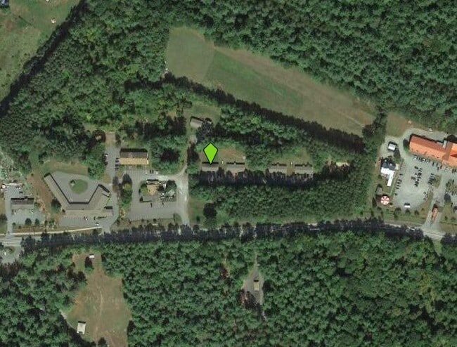
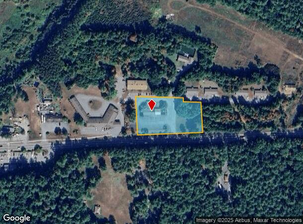
20 Public Way
Lebanon-Claremont, NH-VT
356 RESTAURANT
285-090-14795
Windsor
Restaurantbuilding
Vermont
2024
1.72 AC
2024
Vermont South Area
965502
Other Market Areas
4,039 SF
DEMOGRAPHICS near 20 Public Way
1 Mile
3 Mile
5 Mile
2024 Total Population
479
2,579
11,299
2029 Population
468
2,488
11,293
Pop Growth 2024-2029
(2.30%)
(3.53%)
(0.05%)
Average Age
44
45
44
2024 Total Households
210
1,104
5,172
HH Growth 2024-2029
(2.38%)
(3.62%)
(0.04%)
Median Household Inc
$60,625
$69,843
$70,129
Avg Household Size
2.20
2.30
2.10
2024 Avg HH Vehicles
2.00
2.00
2.00
Median Home Value
$322,414
$341,987
$285,587
Median Year Built
1979
1979
1977
Nearby Places
Map Layers
Map Styles
 Street
 Aerial
- Restaurants
- Banks
- Shops
- Fitness
- Groceries
PUBLIC TRANSPORTATION
COMMUTER RAIL
White River Junction Amtrak Station (Vermonter - Amtrak)
DRIVE
WALK
Distance
White River Junction Amtrak Station (Vermonter - Amtrak)
11 min
6.6 mi
Freight Ports
Albany, NY Port
DRIVE
WALK
Distance
Albany, NY Port
198 min
134.8 mi
SALE & LEASE HISTORY
LISTING DATE
SALE/LEASE

Nov 13, 2022
For Sale
Nearby Properties
Address
Land Use
TOTAL SIZE
Lot Size
Zoning
Address
Land Use
TOTAL SIZE
Lot Size
Zoning
44,695 SF
35.80 AC
HC
Address
Land Use
TOTAL SIZE
Lot Size
Zoning
Address
Land Use
TOTAL SIZE
Lot Size
Zoning
19.47 AC
QG
Address
Land Use
TOTAL SIZE
Lot Size
Zoning
560 AC
FC
Address
Land Use
TOTAL SIZE
Lot Size
Zoning
17.70 AC
RL10
Address
Land Use
TOTAL SIZE
Lot Size
Zoning
49,863 SF
13.89 AC
RL1
Address
Land Use
TOTAL SIZE
Lot Size
Zoning
355.30 AC
Address
Land Use
TOTAL SIZE
Lot Size
Zoning
683.89 AC
QMC
Address
Land Use
TOTAL SIZE
Lot Size
Zoning
9.40 AC
QMC
Address
Land Use
TOTAL SIZE
Lot Size
Zoning
28,454 SF
1.90 AC
IC2
Address
Land Use
TOTAL SIZE
Lot Size
Zoning
2,976 SF
47 AC
RL1
Address
Land Use
TOTAL SIZE
Lot Size
Zoning
85.15 AC
MULT
Address
Land Use
TOTAL SIZE
Lot Size
Zoning
18,576 SF
3.48 AC
QMP
Address
Land Use
TOTAL SIZE
Lot Size
Zoning
47.12 AC
RL1
Address
Land Use
TOTAL SIZE
Lot Size
Zoning
11.08 AC
R3
Address
Land Use
TOTAL SIZE
Lot Size
Zoning
3.92 AC
MULT
Address
Land Use
TOTAL SIZE
Lot Size
Zoning
177.58 AC
QMC
Address
Land Use
TOTAL SIZE
Lot Size
Zoning
5.41 AC
QMP
Address
Land Use
TOTAL SIZE
Lot Size
Zoning
43,550 SF
10 AC
MULT
Address
Land Use
TOTAL SIZE
Lot Size
Zoning
11.01 AC
RL1
Address
Land Use
TOTAL SIZE
Lot Size
Zoning
8.10 AC
MULT
Address
Land Use
TOTAL SIZE
Lot Size
Zoning
4,750 SF
2.02 AC
MULT
Address
Land Use
TOTAL SIZE
Lot Size
Zoning
19,850 SF
21.39 AC
HC
Address
Land Use
TOTAL SIZE
Lot Size
Zoning
4,650 SF
18.50 AC
QMP
Address
Land Use
TOTAL SIZE
Lot Size
Zoning
0.50 AC
RL10
Address
Land Use
TOTAL SIZE
Lot Size
Zoning
6.94 AC
QG
Address
Land Use
TOTAL SIZE
Lot Size
Zoning
4,347 SF
0.23 AC
MULT
Address
Land Use
TOTAL SIZE
Lot Size
Zoning
4,748 SF
15.10 AC
Address
Land Use
TOTAL SIZE
Lot Size
Zoning
5,242 SF
197.97 AC
QMP
Address
Land Use
TOTAL SIZE
Lot Size
Zoning
83.80 AC
The World's #1 Commercial Real Estate Marketplace
Connect with us
© 2026 CoStar Group
The information above has been obtained from sources believed reliable. While we do not doubt its accuracy we have not verified it and make no guarantee, warranty or representation about it. It is your responsibility to independently confirm its accuracy and completeness. Any projections, opinions, assumptions, or estimates used are for example only and do not represent the current or future performance of the property. The value of this transaction to you depends on tax and other factors which should be evaluated by your tax, financial, and legal advisors. You and your advisors should conduct a careful, independent investigation of the property to determine to your satisfaction the suitability of the property for your needs.