Property Record
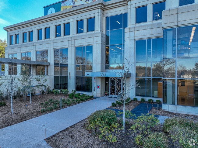
20 Riverside Rd, Weston, MA 02493


Current Lease Availabilities
Property Detail
20 Riverside Rd
WEST-000053-000020
Middlesex
Officebuilding
Massachusetts
BB
20
B and X Area of moderate flood hazard, usually the area between the limits of the 100-year and 500-year floods.
6.63 AC
2025
Concord/Maynard
2025
Boston
367200
Boston-Cambridge-Newton, MA-NH
80,702 SF
NEARBY LISTINGS FOR SALE OR LEASE
DEMOGRAPHICS near 20 Riverside Rd
1 mile
3 mile
5 mile
2025 Total Population
7,742
92,425
261,704
2030 Population
8,073
95,557
270,550
Pop Growth 2025-2030
+ 4.28%
+ 3.39%
+ 3.38%
Average Age
41
40
41
2025 Total Households
2,583
34,116
96,416
HH Growth 2025-2030
+ 4.41%
+ 3.49%
+ 3.60%
Median Household Inc
$211,670
$160,248
$159,969
Avg Household Size
2.50
2.50
2.50
2025 Avg HH Vehicles
2.00
2.00
2.00
Median Home Value
$1,111,810
$1,073,492
$1,033,139
Median Year Built
1953
1949
1954
Nearby Places
Map Layers
Map Styles
 Street
 Aerial
Transit
 Traffic
 Biking
Places
Listings with unknown addresses are not visible on the map
- Restaurants
- Banks
- Shops
- Fitness
- Groceries
PUBLIC TRANSPORTATION
COMMUTER RAIL
Wellesley Farms (Framingham/Worcester Line - Massachusetts Bay Transportation Authority Commuter Rail (Purple Line))
Drive
Walk
Distance
Wellesley Farms (Framingham/Worcester Line - Massachusetts Bay Transportation Authority Commuter Rail (Purple Line))
6 min
2.2 mi
Auburndale (Framingham/Worcester Line - Massachusetts Bay Transportation Authority Commuter Rail (Purple Line))
Drive
Walk
Distance
Auburndale (Framingham/Worcester Line - Massachusetts Bay Transportation Authority Commuter Rail (Purple Line))
13 min
8.3 mi
AIRPORT
General Edward Lawrence Logan International
Drive
Walk
Distance
General Edward Lawrence Logan International
24 min
15.3 mi
Freight Ports
Port of Boston
Drive
Walk
Distance
Port of Boston
22 min
13.6 mi
Nearby Properties
Address
Land Use
TOTAL SIZE
Lot Size
Zoning
Address
Land Use
TOTAL SIZE
Lot Size
Zoning
447,312 SF
62.01 AC
Address
Land Use
TOTAL SIZE
Lot Size
Zoning
165,986 SF
4.32 AC
Address
Land Use
TOTAL SIZE
Lot Size
Zoning
105,982 SF
4.50 AC
Address
Land Use
TOTAL SIZE
Lot Size
Zoning
387,965 SF
3.90 AC
Address
Land Use
TOTAL SIZE
Lot Size
Zoning
317,256 SF
17.48 AC
Address
Land Use
TOTAL SIZE
Lot Size
Zoning
10.87 AC
SRD 10
Address
Land Use
TOTAL SIZE
Lot Size
Zoning
118,696 SF
65.79 AC
A
Address
Land Use
TOTAL SIZE
Lot Size
Zoning
179,834 SF
8.57 AC
PUB
Address
Land Use
TOTAL SIZE
Lot Size
Zoning
402,419 SF
73.98 AC
BB
Address
Land Use
TOTAL SIZE
Lot Size
Zoning
293,195 SF
11.55 AC
BU5
Address
Land Use
TOTAL SIZE
Lot Size
Zoning
391,781 SF
8.22 AC
Address
Land Use
TOTAL SIZE
Lot Size
Zoning
3.86 AC
Address
Land Use
TOTAL SIZE
Lot Size
Zoning
6.33 AC
SR10
Address
Land Use
TOTAL SIZE
Lot Size
Zoning
189,858 SF
61.45 AC
A
Address
Land Use
TOTAL SIZE
Lot Size
Zoning
Address
Land Use
TOTAL SIZE
Lot Size
Zoning
144,584 SF
4.86 AC
PUB
Address
Land Use
TOTAL SIZE
Lot Size
Zoning
179,963 SF
41.28 AC
A
Address
Land Use
TOTAL SIZE
Lot Size
Zoning
11.17 AC
Address
Land Use
TOTAL SIZE
Lot Size
Zoning
15.60 AC
Address
Land Use
TOTAL SIZE
Lot Size
Zoning
72,748 SF
31.39 AC
A
Address
Land Use
TOTAL SIZE
Lot Size
Zoning
30,027 SF
96.45 AC
ORD
Address
Land Use
TOTAL SIZE
Lot Size
Zoning
170,966 SF
2.84 AC
MU4
Address
Land Use
TOTAL SIZE
Lot Size
Zoning
80,447 SF
6.52 AC
PUB
Address
Land Use
TOTAL SIZE
Lot Size
Zoning
15.08 AC
SR10
Address
Land Use
TOTAL SIZE
Lot Size
Zoning
203,738 SF
6.94 AC
Address
Land Use
TOTAL SIZE
Lot Size
Zoning
84.78 AC
Address
Land Use
TOTAL SIZE
Lot Size
Zoning
2,537 SF
14.43 AC
SR3
Address
Land Use
TOTAL SIZE
Lot Size
Zoning
190,483 SF
2.57 AC
Address
Land Use
TOTAL SIZE
Lot Size
Zoning
Address
Land Use
TOTAL SIZE
Lot Size
Zoning
49.88 AC
T
The World's #1 Commercial Real Estate Marketplace
Connect with us
© 2026 CoStar Group
The information above has been obtained from sources believed reliable. While we do not doubt its accuracy we have not verified it and make no guarantee, warranty or representation about it. It is your responsibility to independently confirm its accuracy and completeness. Any projections, opinions, assumptions, or estimates used are for example only and do not represent the current or future performance of the property. The value of this transaction to you depends on tax and other factors which should be evaluated by your tax, financial, and legal advisors. You and your advisors should conduct a careful, independent investigation of the property to determine to your satisfaction the suitability of the property for your needs.