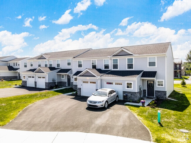
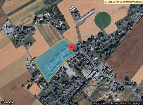
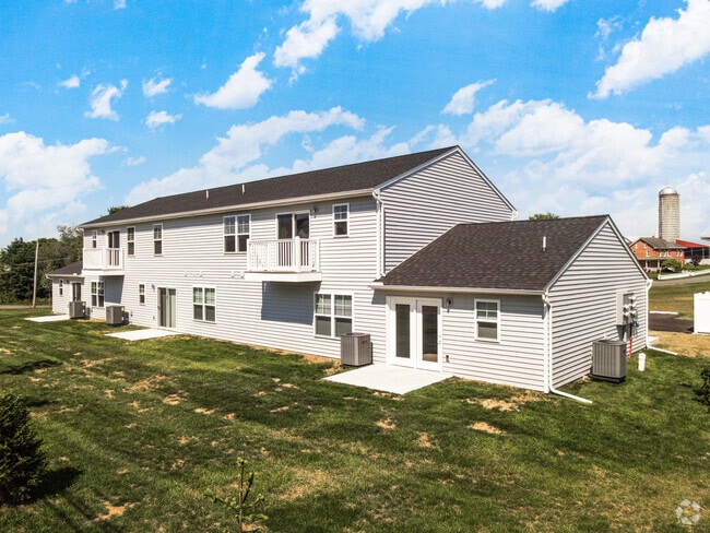
Property Record
20 S Line Rd, Stevens, PA 17578
NEARBY LISTINGS FOR SALE OR LEASE
Property Detail
20 S Line Rd
Apartment
Lancaster
X
Pennsylvania
42071C0184F
12.83 AC
2024
Denver/Adamstown
2025
Philadelphia
010104
Lancaster, PA
73,290 SF
090-31744-0-0000
DEMOGRAPHICS near 20 S Line Rd
1 Mile
3 Mile
5 Mile
2024 Total Population
1,411
26,856
55,465
2029 Population
1,422
26,989
55,719
Pop Growth 2024-2029
+ 0.78%
+ 0.50%
+ 0.46%
Average Age
43
40
40
2024 Total Households
558
10,140
21,033
HH Growth 2024-2029
+ 0.72%
+ 0.51%
+ 0.50%
Median Household Inc
$58,653
$71,134
$72,450
Avg Household Size
2.40
2.60
2.60
2024 Avg HH Vehicles
2.00
2.00
2.00
Median Home Value
$173,595
$230,885
$236,390
Median Year Built
1979
1975
1977
Nearby Places
Map Layers
Map Styles
 Street
 Aerial
- Restaurants
- Banks
- Shops
- Fitness
- Groceries
Nearby Properties
Address
Land Use
TOTAL SIZE
Lot Size
Zoning
Address
Land Use
TOTAL SIZE
Lot Size
Zoning
273,832 SF
57.10 AC
INS
Address
Land Use
TOTAL SIZE
Lot Size
Zoning
287,197 SF
40.40 AC
INS
Address
Land Use
TOTAL SIZE
Lot Size
Zoning
251,634 SF
16.28 AC
Address
Land Use
TOTAL SIZE
Lot Size
Zoning
419,345 SF
48.05 AC
I-1
Address
Land Use
TOTAL SIZE
Lot Size
Zoning
226,686 SF
28 AC
RLD
Address
Land Use
TOTAL SIZE
Lot Size
Zoning
155,373 SF
4.50 AC
Address
Land Use
TOTAL SIZE
Lot Size
Zoning
1,350 SF
28.77 AC
Address
Land Use
TOTAL SIZE
Lot Size
Zoning
513,058 SF
36.40 AC
I-1
Address
Land Use
TOTAL SIZE
Lot Size
Zoning
69,993 SF
Address
Land Use
TOTAL SIZE
Lot Size
Zoning
152,537 SF
17.20 AC
HC
Address
Land Use
TOTAL SIZE
Lot Size
Zoning
57,966 SF
6.03 AC
Address
Land Use
TOTAL SIZE
Lot Size
Zoning
213,220 SF
22.80 AC
I-1
Address
Land Use
TOTAL SIZE
Lot Size
Zoning
107,888 SF
28.30 AC
I-2
Address
Land Use
TOTAL SIZE
Lot Size
Zoning
91,630 SF
16.56 AC
I-1
Address
Land Use
TOTAL SIZE
Lot Size
Zoning
87,504 SF
59.27 AC
Address
Land Use
TOTAL SIZE
Lot Size
Zoning
33,134 SF
0.42 AC
NC-2
Address
Land Use
TOTAL SIZE
Lot Size
Zoning
44,302 SF
9.58 AC
RLD
Address
Land Use
TOTAL SIZE
Lot Size
Zoning
96,337 SF
34.60 AC
I
Address
Land Use
TOTAL SIZE
Lot Size
Zoning
50,888 SF
5.70 AC
RLD
Address
Land Use
TOTAL SIZE
Lot Size
Zoning
35,237 SF
13.70 AC
R-1
Address
Land Use
TOTAL SIZE
Lot Size
Zoning
40,793 SF
4 AC
C-1
Address
Land Use
TOTAL SIZE
Lot Size
Zoning
199,506 SF
20.60 AC
I
Address
Land Use
TOTAL SIZE
Lot Size
Zoning
118,332 SF
8.80 AC
RLD
Address
Land Use
TOTAL SIZE
Lot Size
Zoning
142,935 SF
6.51 AC
I
Address
Land Use
TOTAL SIZE
Lot Size
Zoning
41,648 SF
5.82 AC
Address
Land Use
TOTAL SIZE
Lot Size
Zoning
54,298 SF
5 AC
HC
Address
Land Use
TOTAL SIZE
Lot Size
Zoning
48,150 SF
19.73 AC
I
Address
Land Use
TOTAL SIZE
Lot Size
Zoning
47,810 SF
5.08 AC
RLD
Address
Land Use
TOTAL SIZE
Lot Size
Zoning
83,288 SF
5.86 AC
RHD
The World's #1 Commercial Real Estate Marketplace
Connect with us
© 2025 CoStar Group
The information above has been obtained from sources believed reliable. While we do not doubt its accuracy we have not verified it and make no guarantee, warranty or representation about it. It is your responsibility to independently confirm its accuracy and completeness. Any projections, opinions, assumptions, or estimates used are for example only and do not represent the current or future performance of the property. The value of this transaction to you depends on tax and other factors which should be evaluated by your tax, financial, and legal advisors. You and your advisors should conduct a careful, independent investigation of the property to determine to your satisfaction the suitability of the property for your needs.