Property Record
20 S Reamstown Rd, Stevens, PA 17578
NEARBY LISTINGS FOR SALE OR LEASE
-
-
View all Stevens listings for sale on LoopNet.com
Property Detail
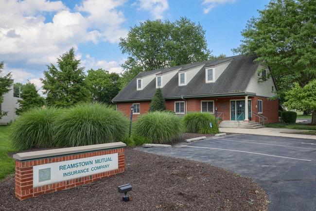
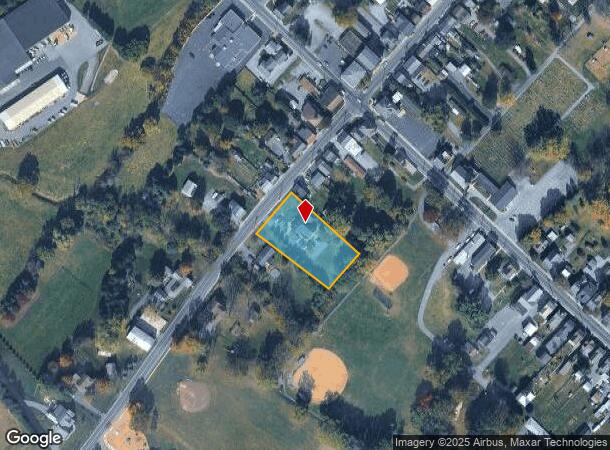
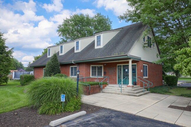
20 S Reamstown Rd
Lancaster, PA
Reamstown Mutual Insurance Company
080-58106-0-0000
20 S REAMSTOWN RD
Officebuilding
Lancaster
X
Pennsylvania
42071C0203F
2
2024
0.95 AC
2025
Lancaster County
012502
Philadelphia
4,573 SF
DEMOGRAPHICS near 20 S Reamstown Rd
1 Mile
3 Mile
5 Mile
2024 Total Population
3,562
18,364
52,090
2029 Population
3,525
18,374
52,284
Pop Growth 2024-2029
(1.04%)
+ 0.05%
+ 0.37%
Average Age
41
40
40
2024 Total Households
1,331
6,698
19,413
HH Growth 2024-2029
(1.20%)
+ 0.01%
+ 0.41%
Median Household Inc
$70,116
$83,455
$73,980
Avg Household Size
2.60
2.70
2.60
2024 Avg HH Vehicles
2.00
2.00
2.00
Median Home Value
$221,829
$236,532
$241,506
Median Year Built
1975
1977
1978
Nearby Places
Map Layers
Map Styles
 Street
 Aerial
- Restaurants
- Banks
- Shops
- Fitness
- Groceries
SALE & LEASE HISTORY
LISTING DATE
SALE/LEASE

Jul 29, 2019
For Sale
Nearby Properties
Address
Land Use
TOTAL SIZE
Lot Size
Zoning
Address
Land Use
TOTAL SIZE
Lot Size
Zoning
1,588,498 SF
150.55 AC
I-1
Address
Land Use
TOTAL SIZE
Lot Size
Zoning
273,832 SF
57.10 AC
INS
Address
Land Use
TOTAL SIZE
Lot Size
Zoning
287,197 SF
40.40 AC
INS
Address
Land Use
TOTAL SIZE
Lot Size
Zoning
13,192 SF
9.20 AC
C-1
Address
Land Use
TOTAL SIZE
Lot Size
Zoning
419,345 SF
48.05 AC
I-1
Address
Land Use
TOTAL SIZE
Lot Size
Zoning
561,324 SF
114.10 AC
I-1
Address
Land Use
TOTAL SIZE
Lot Size
Zoning
97,573 SF
33.72 AC
I1
Address
Land Use
TOTAL SIZE
Lot Size
Zoning
1,350 SF
28.77 AC
Address
Land Use
TOTAL SIZE
Lot Size
Zoning
513,058 SF
36.40 AC
I-1
Address
Land Use
TOTAL SIZE
Lot Size
Zoning
170,735 SF
18.76 AC
Address
Land Use
TOTAL SIZE
Lot Size
Zoning
95,121 SF
23.68 AC
Address
Land Use
TOTAL SIZE
Lot Size
Zoning
117,000 SF
12.98 AC
I-1
Address
Land Use
TOTAL SIZE
Lot Size
Zoning
57,966 SF
6.03 AC
Address
Land Use
TOTAL SIZE
Lot Size
Zoning
213,220 SF
22.80 AC
I-1
Address
Land Use
TOTAL SIZE
Lot Size
Zoning
107,888 SF
28.30 AC
I-2
Address
Land Use
TOTAL SIZE
Lot Size
Zoning
91,630 SF
16.56 AC
I-1
Address
Land Use
TOTAL SIZE
Lot Size
Zoning
87,504 SF
59.27 AC
Address
Land Use
TOTAL SIZE
Lot Size
Zoning
73,290 SF
12.83 AC
Address
Land Use
TOTAL SIZE
Lot Size
Zoning
41,012 SF
2.49 AC
C-1
Address
Land Use
TOTAL SIZE
Lot Size
Zoning
270,732 SF
9.50 AC
I-1
Address
Land Use
TOTAL SIZE
Lot Size
Zoning
96,337 SF
34.60 AC
I
Address
Land Use
TOTAL SIZE
Lot Size
Zoning
35,237 SF
13.70 AC
R-1
Address
Land Use
TOTAL SIZE
Lot Size
Zoning
50,389 SF
10.07 AC
C-1
Address
Land Use
TOTAL SIZE
Lot Size
Zoning
40,793 SF
4 AC
C-1
Address
Land Use
TOTAL SIZE
Lot Size
Zoning
199,506 SF
20.60 AC
I
Address
Land Use
TOTAL SIZE
Lot Size
Zoning
118,332 SF
8.80 AC
RLD
Address
Land Use
TOTAL SIZE
Lot Size
Zoning
142,935 SF
6.51 AC
I
Address
Land Use
TOTAL SIZE
Lot Size
Zoning
48,150 SF
19.73 AC
I
Address
Land Use
TOTAL SIZE
Lot Size
Zoning
128,000 SF
8.28 AC
I-1
Address
Land Use
TOTAL SIZE
Lot Size
Zoning
139,615 SF
11.20 AC
GI
The World's #1 Commercial Real Estate Marketplace
Connect with us
© 2025 CoStar Group
The information above has been obtained from sources believed reliable. While we do not doubt its accuracy we have not verified it and make no guarantee, warranty or representation about it. It is your responsibility to independently confirm its accuracy and completeness. Any projections, opinions, assumptions, or estimates used are for example only and do not represent the current or future performance of the property. The value of this transaction to you depends on tax and other factors which should be evaluated by your tax, financial, and legal advisors. You and your advisors should conduct a careful, independent investigation of the property to determine to your satisfaction the suitability of the property for your needs.