Property Record
20 Se Thompson Dr, Lees Summit, MO 64081
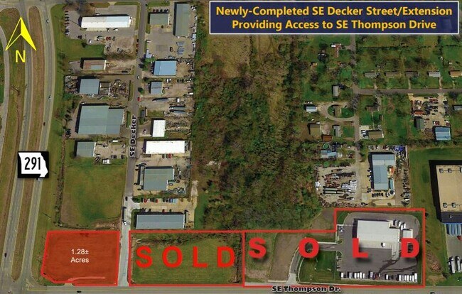

NEARBY LISTINGS FOR SALE OR LEASE
Property Detail
20 Se Thompson Dr
Kansas City, MO-KS
Lemone-Smith Business & Rail Center Plat
61-800-13-08-00-0-00-000
LEMONE-SMITH BUSINESS & RAIL CENTER PLAT 8---LOT 13
Commercialacreage
Jackson
X
Missouri
29095C0438G
13
2024
1.30 AC
2025
Southeast Jackson County
013708
Kansas City
DEMOGRAPHICS near 20 Se Thompson Dr
1 Mile
3 Mile
5 Mile
2024 Total Population
1,683
44,544
92,327
2029 Population
1,658
44,254
92,359
Pop Growth 2024-2029
(1.49%)
(0.65%)
+ 0.03%
Average Age
39
39
40
2024 Total Households
676
18,035
34,956
HH Growth 2024-2029
(1.63%)
(0.67%)
+ 0.01%
Median Household Inc
$88,112
$86,137
$102,449
Avg Household Size
2.50
2.40
2.60
2024 Avg HH Vehicles
2.00
2.00
2.00
Median Home Value
$229,613
$243,414
$283,379
Median Year Built
1999
1985
1992
Nearby Places
Map Layers
Map Styles
 Street
 Aerial
- Restaurants
- Banks
- Shops
- Fitness
- Groceries
PUBLIC TRANSPORTATION
COMMUTER RAIL
Lee's Summit Amtrak (Lincoln Service Missouri River Runner - Amtrak, Missouri River Runner - Amtrak)
DRIVE
WALK
Distance
Lee's Summit Amtrak (Lincoln Service Missouri River Runner - Amtrak, Missouri River Runner - Amtrak)
4 min
1.9 mi
Freight Ports
Tulsa Port Of Catoosa
DRIVE
WALK
Distance
Tulsa Port Of Catoosa
256 min
235.7 mi
SALE & LEASE HISTORY
LISTING DATE
SALE/LEASE

Sep 24, 2016
For Sale
Nearby Properties
Address
Land Use
TOTAL SIZE
Lot Size
Zoning
Address
Land Use
TOTAL SIZE
Lot Size
Zoning
264,963 SF
Address
Land Use
TOTAL SIZE
Lot Size
Zoning
246,379 SF
51.99 AC
Address
Land Use
TOTAL SIZE
Lot Size
Zoning
107,210 SF
17.13 AC
Address
Land Use
TOTAL SIZE
Lot Size
Zoning
249,821 SF
87.90 AC
Address
Land Use
TOTAL SIZE
Lot Size
Zoning
209,098 SF
Address
Land Use
TOTAL SIZE
Lot Size
Zoning
52,030 SF
11.81 AC
Address
Land Use
TOTAL SIZE
Lot Size
Zoning
227,052 SF
12.78 AC
Address
Land Use
TOTAL SIZE
Lot Size
Zoning
100,573 SF
2.89 AC
Address
Land Use
TOTAL SIZE
Lot Size
Zoning
104,368 SF
13.90 AC
Address
Land Use
TOTAL SIZE
Lot Size
Zoning
383,280 SF
0.91 AC
Address
Land Use
TOTAL SIZE
Lot Size
Zoning
563,000 SF
40.34 AC
Address
Land Use
TOTAL SIZE
Lot Size
Zoning
281,235 SF
70.15 AC
Address
Land Use
TOTAL SIZE
Lot Size
Zoning
200,526 SF
Address
Land Use
TOTAL SIZE
Lot Size
Zoning
18,509 SF
20.39 AC
Address
Land Use
TOTAL SIZE
Lot Size
Zoning
72,168 SF
Address
Land Use
TOTAL SIZE
Lot Size
Zoning
104,704 SF
11.28 AC
Address
Land Use
TOTAL SIZE
Lot Size
Zoning
192,014 SF
20.95 AC
Address
Land Use
TOTAL SIZE
Lot Size
Zoning
155,194 SF
21.03 AC
Address
Land Use
TOTAL SIZE
Lot Size
Zoning
59,820 SF
6.22 AC
Address
Land Use
TOTAL SIZE
Lot Size
Zoning
140,194 SF
29.50 AC
Address
Land Use
TOTAL SIZE
Lot Size
Zoning
99,891 SF
9.71 AC
Address
Land Use
TOTAL SIZE
Lot Size
Zoning
65,290 SF
15.70 AC
Address
Land Use
TOTAL SIZE
Lot Size
Zoning
48,764 SF
8.25 AC
Address
Land Use
TOTAL SIZE
Lot Size
Zoning
171,504 SF
16.58 AC
Address
Land Use
TOTAL SIZE
Lot Size
Zoning
150,619 SF
19.95 AC
Address
Land Use
TOTAL SIZE
Lot Size
Zoning
74,741 SF
20 AC
Address
Land Use
TOTAL SIZE
Lot Size
Zoning
90,597 SF
7.84 AC
Address
Land Use
TOTAL SIZE
Lot Size
Zoning
37,489 SF
9.22 AC
Address
Land Use
TOTAL SIZE
Lot Size
Zoning
145,562 SF
28.46 AC
Address
Land Use
TOTAL SIZE
Lot Size
Zoning
118,310 SF
10.55 AC
The World's #1 Commercial Real Estate Marketplace
Connect with us
© 2025 CoStar Group
The information above has been obtained from sources believed reliable. While we do not doubt its accuracy we have not verified it and make no guarantee, warranty or representation about it. It is your responsibility to independently confirm its accuracy and completeness. Any projections, opinions, assumptions, or estimates used are for example only and do not represent the current or future performance of the property. The value of this transaction to you depends on tax and other factors which should be evaluated by your tax, financial, and legal advisors. You and your advisors should conduct a careful, independent investigation of the property to determine to your satisfaction the suitability of the property for your needs.