Property Record
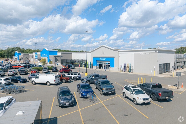
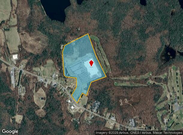
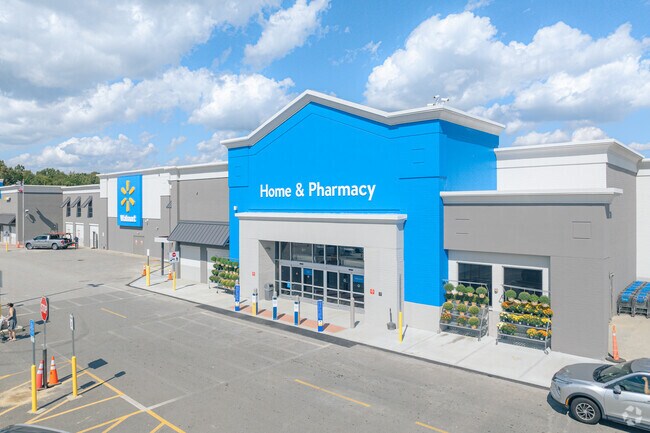
20 Soojian Dr, Leicester, MA 01524
NEARBY LISTINGS FOR SALE OR LEASE
Property Detail
20 Soojian Dr
Departmentstore
Worcester
X
Massachusetts
25027C0595F
55.33 AC
2025
Outlying Worcester
2025
Boston
735100
Worcester, MA-CT
206,992 SF
LEIC-000017-B000404
DEMOGRAPHICS near 20 Soojian Dr
1 Mile
3 Mile
5 Mile
2024 Total Population
765
11,957
51,533
2029 Population
761
11,964
51,168
Pop Growth 2024-2029
(0.52%)
+ 0.06%
(0.71%)
Average Age
43
43
42
2024 Total Households
292
4,803
19,716
HH Growth 2024-2029
(1.03%)
0.00%
(0.72%)
Median Household Inc
$95,774
$78,635
$83,595
Avg Household Size
2.60
2.40
2.50
2024 Avg HH Vehicles
2.00
2.00
2.00
Median Home Value
$413,043
$350,349
$332,536
Median Year Built
1983
1970
1963
Nearby Places
Map Layers
Map Styles
 Street
 Aerial
- Restaurants
- Banks
- Shops
- Fitness
- Groceries
PUBLIC TRANSPORTATION
COMMUTER RAIL
Worcester Union Station (Lake Shore Limited - Amtrak)
DRIVE
WALK
Distance
Worcester Union Station (Lake Shore Limited - Amtrak)
15 min
8.7 mi
Worcester (Framingham/Worcester Line - Massachusetts Bay Transportation Authority Commuter Rail (Purple Line))
DRIVE
WALK
Distance
Worcester (Framingham/Worcester Line - Massachusetts Bay Transportation Authority Commuter Rail (Purple Line))
16 min
8.8 mi
AIRPORT
Worcester Regional
DRIVE
WALK
Distance
Worcester Regional
17 min
7.2 mi
Freight Ports
Port of Boston
DRIVE
WALK
Distance
Port of Boston
75 min
53.9 mi
Nearby Properties
Address
Land Use
TOTAL SIZE
Lot Size
Zoning
Address
Land Use
TOTAL SIZE
Lot Size
Zoning
49.08 AC
SA
Address
Land Use
TOTAL SIZE
Lot Size
Zoning
78,309 SF
33.51 AC
Address
Land Use
TOTAL SIZE
Lot Size
Zoning
1,408 SF
42.06 AC
HB1
Address
Land Use
TOTAL SIZE
Lot Size
Zoning
24,000 SF
10.60 AC
SA
Address
Land Use
TOTAL SIZE
Lot Size
Zoning
78,145 SF
20.75 AC
Address
Land Use
TOTAL SIZE
Lot Size
Zoning
40 AC
B
Address
Land Use
TOTAL SIZE
Lot Size
Zoning
76,586 SF
20.44 AC
R2
Address
Land Use
TOTAL SIZE
Lot Size
Zoning
68,052 SF
44 AC
Address
Land Use
TOTAL SIZE
Lot Size
Zoning
3,576 SF
13 AC
Address
Land Use
TOTAL SIZE
Lot Size
Zoning
17 AC
HB1
Address
Land Use
TOTAL SIZE
Lot Size
Zoning
9.40 AC
HB1
Address
Land Use
TOTAL SIZE
Lot Size
Zoning
51,755 SF
5.93 AC
R1
Address
Land Use
TOTAL SIZE
Lot Size
Zoning
39,660 SF
1.28 AC
Address
Land Use
TOTAL SIZE
Lot Size
Zoning
18,970 SF
1.91 AC
R2
Address
Land Use
TOTAL SIZE
Lot Size
Zoning
16,444 SF
0.93 AC
CB
Address
Land Use
TOTAL SIZE
Lot Size
Zoning
329.37 AC
HB1
Address
Land Use
TOTAL SIZE
Lot Size
Zoning
6.86 AC
HB1
Address
Land Use
TOTAL SIZE
Lot Size
Zoning
54,068 SF
7.80 AC
SA
Address
Land Use
TOTAL SIZE
Lot Size
Zoning
44,769 SF
22.40 AC
Address
Land Use
TOTAL SIZE
Lot Size
Zoning
9,221 SF
15.08 AC
B
Address
Land Use
TOTAL SIZE
Lot Size
Zoning
4,070 SF
7.59 AC
Address
Land Use
TOTAL SIZE
Lot Size
Zoning
21,770 SF
4.34 AC
Address
Land Use
TOTAL SIZE
Lot Size
Zoning
23,296 SF
2.35 AC
R2
Address
Land Use
TOTAL SIZE
Lot Size
Zoning
27,357 SF
2 AC
R2
Address
Land Use
TOTAL SIZE
Lot Size
Zoning
19 AC
R2
Address
Land Use
TOTAL SIZE
Lot Size
Zoning
9,070 SF
0.69 AC
R2
Address
Land Use
TOTAL SIZE
Lot Size
Zoning
31.58 AC
SA
Address
Land Use
TOTAL SIZE
Lot Size
Zoning
262.02 AC
OR4
Address
Land Use
TOTAL SIZE
Lot Size
Zoning
18,628 SF
1.17 AC
The World's #1 Commercial Real Estate Marketplace
Connect with us
© 2026 CoStar Group
The information above has been obtained from sources believed reliable. While we do not doubt its accuracy we have not verified it and make no guarantee, warranty or representation about it. It is your responsibility to independently confirm its accuracy and completeness. Any projections, opinions, assumptions, or estimates used are for example only and do not represent the current or future performance of the property. The value of this transaction to you depends on tax and other factors which should be evaluated by your tax, financial, and legal advisors. You and your advisors should conduct a careful, independent investigation of the property to determine to your satisfaction the suitability of the property for your needs.