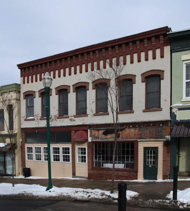
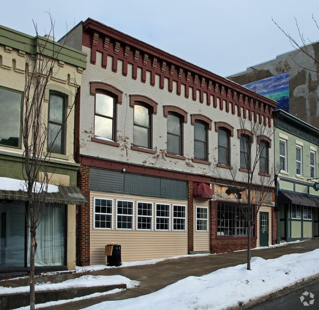
Property Record
20 State St, Auburn, NY 13021
NEARBY LISTINGS FOR SALE OR LEASE
-
-
View all Auburn listings for sale on LoopNet.com
Property Detail
20 State St
Auburn, NY
Cayuga
055200 117.00-1-8.1
New York
Residentialacreage
16.001
2025
2 AC
2024
Syracuse Surrounding
042100
Other Market Areas
DEMOGRAPHICS near 20 State St
1 Mile
3 Mile
5 Mile
2024 Total Population
16,888
32,095
36,135
2029 Population
16,640
31,689
35,680
Pop Growth 2024-2029
(1.47%)
(1.26%)
(1.26%)
Average Age
41
43
43
2024 Total Households
7,338
13,874
15,513
HH Growth 2024-2029
(1.47%)
(1.41%)
(1.40%)
Median Household Inc
$40,223
$55,039
$58,178
Avg Household Size
2.10
2.10
2.10
2024 Avg HH Vehicles
1.00
1.00
2.00
Median Home Value
$131,037
$155,397
$164,406
Median Year Built
1947
1949
1950
Nearby Places
- Restaurants
- Banks
- Shops
- Fitness
- Groceries
PUBLIC TRANSPORTATION
AIRPORT
Syracuse Hancock International
DRIVE
WALK
Distance
Syracuse Hancock International
45 min
30.8 mi
Freight Ports
Albany, NY Port
DRIVE
WALK
Distance
Albany, NY Port
209 min
170.1 mi
Nearby Properties
Address
Land Use
TOTAL SIZE
Lot Size
Zoning
Address
Land Use
TOTAL SIZE
Lot Size
Zoning
2,496 SF
15.27 AC
R1
Address
Land Use
TOTAL SIZE
Lot Size
Zoning
165,775 SF
39.40 AC
R1
Address
Land Use
TOTAL SIZE
Lot Size
Zoning
190,229 SF
29.04 AC
HC
Address
Land Use
TOTAL SIZE
Lot Size
Zoning
201,003 SF
16.44 AC
HC
Address
Land Use
TOTAL SIZE
Lot Size
Zoning
113,388 SF
12.15 AC
R1
Address
Land Use
TOTAL SIZE
Lot Size
Zoning
449,222 SF
191.49 AC
I
Address
Land Use
TOTAL SIZE
Lot Size
Zoning
35,518 SF
30.50 AC
AR
Address
Land Use
TOTAL SIZE
Lot Size
Zoning
109,990 SF
37.46 AC
R1
Address
Land Use
TOTAL SIZE
Lot Size
Zoning
205,125 SF
18.80 AC
CL
Address
Land Use
TOTAL SIZE
Lot Size
Zoning
18,000 SF
2.20 AC
D
Address
Land Use
TOTAL SIZE
Lot Size
Zoning
68,160 SF
7.25 AC
CL
Address
Land Use
TOTAL SIZE
Lot Size
Zoning
85,584 SF
1.97 AC
D
Address
Land Use
TOTAL SIZE
Lot Size
Zoning
33,549 SF
1.75 AC
D
Address
Land Use
TOTAL SIZE
Lot Size
Zoning
3,600 SF
61.50 AC
C
Address
Land Use
TOTAL SIZE
Lot Size
Zoning
27,300 SF
0.46 AC
C
Address
Land Use
TOTAL SIZE
Lot Size
Zoning
14,820 SF
2 AC
HC
Address
Land Use
TOTAL SIZE
Lot Size
Zoning
900 SF
7.22 AC
C
Address
Land Use
TOTAL SIZE
Lot Size
Zoning
14,988 SF
2.27 AC
HC
Address
Land Use
TOTAL SIZE
Lot Size
Zoning
868 SF
6.87 AC
C
Address
Land Use
TOTAL SIZE
Lot Size
Zoning
19,384 SF
5.07 AC
HC
Address
Land Use
TOTAL SIZE
Lot Size
Zoning
6,707 SF
1.43 AC
HC
Address
Land Use
TOTAL SIZE
Lot Size
Zoning
8,872 SF
7.16 AC
HC
Address
Land Use
TOTAL SIZE
Lot Size
Zoning
8,550 SF
6.70 AC
R1
Address
Land Use
TOTAL SIZE
Lot Size
Zoning
33,429 SF
9.30 AC
C
Address
Land Use
TOTAL SIZE
Lot Size
Zoning
10,500 SF
1.50 AC
SC
Address
Land Use
TOTAL SIZE
Lot Size
Zoning
25,048 SF
1.90 AC
R2
Address
Land Use
TOTAL SIZE
Lot Size
Zoning
84,288 SF
8.30 AC
AR
Address
Land Use
TOTAL SIZE
Lot Size
Zoning
150,600 SF
29.18 AC
C
Address
Land Use
TOTAL SIZE
Lot Size
Zoning
34,286 SF
5.60 AC
R2
Address
Land Use
TOTAL SIZE
Lot Size
Zoning
24,504 SF
2.16 AC
C
The World's #1 Commercial Real Estate Marketplace
Connect with us
© 2025 CoStar Group
The information above has been obtained from sources believed reliable. While we do not doubt its accuracy we have not verified it and make no guarantee, warranty or representation about it. It is your responsibility to independently confirm its accuracy and completeness. Any projections, opinions, assumptions, or estimates used are for example only and do not represent the current or future performance of the property. The value of this transaction to you depends on tax and other factors which should be evaluated by your tax, financial, and legal advisors. You and your advisors should conduct a careful, independent investigation of the property to determine to your satisfaction the suitability of the property for your needs.