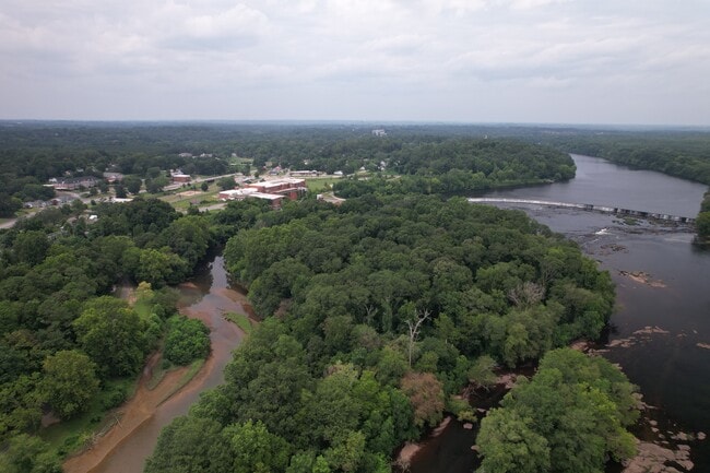
Property Record
20Th Ave, Valley, AL 36854

NEARBY LISTINGS FOR SALE OR LEASE
Property Detail
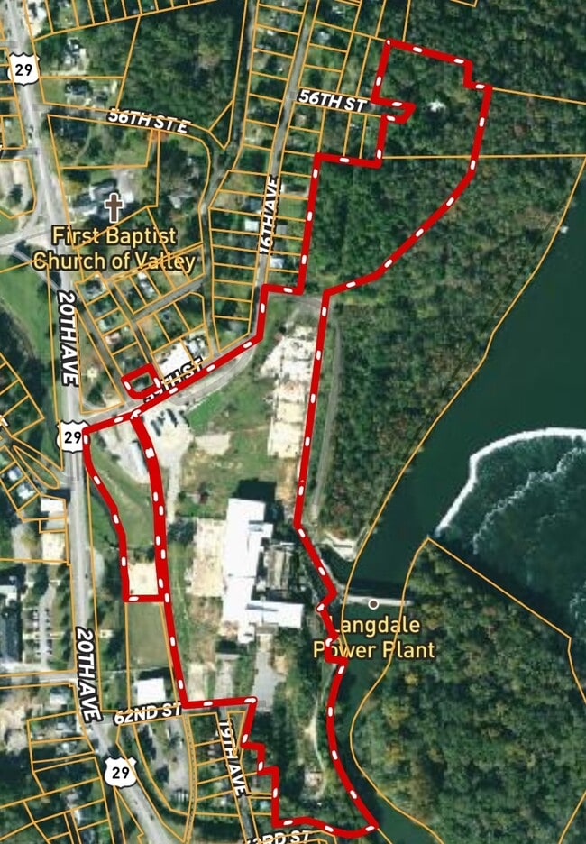
20Th Ave
18-04-18-1-001-001.002
BEG AT SE COR OF LOT 13 BLOCK 27 OF LANGDALE MILL VILLAGE, RUN NE'LY483.27', SE'LY214.42', NE'LY30'(S), E341'(S), SW'LY64'(S)
Officebuilding
Chambers
AE
Alabama
13285C0310F
13
2025
25.80 AC
2024
Chambers County
954700
Columbus GA
7,162 SF
LaGrange, GA-AL
DEMOGRAPHICS near 20Th Ave
1 Mile
3 Mile
5 Mile
2024 Total Population
1,531
10,409
25,479
2029 Population
1,500
10,086
25,276
Pop Growth 2024-2029
(2.02%)
(3.10%)
(0.80%)
Average Age
41
41
41
2024 Total Households
601
4,336
10,270
HH Growth 2024-2029
(1.83%)
(2.95%)
(0.69%)
Median Household Inc
$37,500
$45,939
$48,998
Avg Household Size
2.40
2.30
2.40
2024 Avg HH Vehicles
2.00
2.00
2.00
Median Home Value
$85,506
$101,869
$125,508
Median Year Built
1970
1972
1974
Nearby Places
Map Layers
Map Styles
 Street
 Aerial
- Restaurants
- Banks
- Shops
- Fitness
- Groceries
PUBLIC TRANSPORTATION
AIRPORT
Columbus
DRIVE
WALK
Distance
Columbus
51 min
38.3 mi
Freight Ports
Port of Panama City
DRIVE
WALK
Distance
Port of Panama City
281 min
215.1 mi
SALE & LEASE HISTORY
LISTING DATE
SALE/LEASE

Jul 23, 2023
For Sale
Nearby Properties
Address
Land Use
TOTAL SIZE
Lot Size
Zoning
Address
Land Use
TOTAL SIZE
Lot Size
Zoning
23,004 SF
38.40 AC
Address
Land Use
TOTAL SIZE
Lot Size
Zoning
375,360 SF
20.30 AC
Address
Land Use
TOTAL SIZE
Lot Size
Zoning
289,162 SF
44.30 AC
Address
Land Use
TOTAL SIZE
Lot Size
Zoning
6,990 SF
15.99 AC
Address
Land Use
TOTAL SIZE
Lot Size
Zoning
28,768 SF
9.40 AC
Address
Land Use
TOTAL SIZE
Lot Size
Zoning
64.60 AC
Address
Land Use
TOTAL SIZE
Lot Size
Zoning
507,508 SF
110 AC
Address
Land Use
TOTAL SIZE
Lot Size
Zoning
146,616 SF
9.10 AC
Address
Land Use
TOTAL SIZE
Lot Size
Zoning
152,084 SF
14.80 AC
Address
Land Use
TOTAL SIZE
Lot Size
Zoning
7,872 SF
8.41 AC
Address
Land Use
TOTAL SIZE
Lot Size
Zoning
8,264 SF
7.88 AC
Address
Land Use
TOTAL SIZE
Lot Size
Zoning
884.65 AC
004
Address
Land Use
TOTAL SIZE
Lot Size
Zoning
715.28 AC
004
Address
Land Use
TOTAL SIZE
Lot Size
Zoning
25,588 SF
28.85 AC
Address
Land Use
TOTAL SIZE
Lot Size
Zoning
1 SF
6.90 AC
Address
Land Use
TOTAL SIZE
Lot Size
Zoning
113,361 SF
8.31 AC
Address
Land Use
TOTAL SIZE
Lot Size
Zoning
60,534 SF
5.94 AC
Address
Land Use
TOTAL SIZE
Lot Size
Zoning
26,345 SF
17.60 AC
Address
Land Use
TOTAL SIZE
Lot Size
Zoning
32,997 SF
1.88 AC
Address
Land Use
TOTAL SIZE
Lot Size
Zoning
1 SF
16 AC
Address
Land Use
TOTAL SIZE
Lot Size
Zoning
8,000 SF
18.60 AC
Address
Land Use
TOTAL SIZE
Lot Size
Zoning
15,762 SF
7.23 AC
Address
Land Use
TOTAL SIZE
Lot Size
Zoning
1 SF
10 AC
Address
Land Use
TOTAL SIZE
Lot Size
Zoning
28,000 SF
4.05 AC
Address
Land Use
TOTAL SIZE
Lot Size
Zoning
15.20 AC
Address
Land Use
TOTAL SIZE
Lot Size
Zoning
1,504 SF
5.40 AC
Address
Land Use
TOTAL SIZE
Lot Size
Zoning
1 SF
10.50 AC
Address
Land Use
TOTAL SIZE
Lot Size
Zoning
6,220 SF
5.50 AC
Address
Land Use
TOTAL SIZE
Lot Size
Zoning
10,465 SF
0.14 AC
Address
Land Use
TOTAL SIZE
Lot Size
Zoning
2,856 SF
6.50 AC
The World's #1 Commercial Real Estate Marketplace
Connect with us
© 2026 CoStar Group
The information above has been obtained from sources believed reliable. While we do not doubt its accuracy we have not verified it and make no guarantee, warranty or representation about it. It is your responsibility to independently confirm its accuracy and completeness. Any projections, opinions, assumptions, or estimates used are for example only and do not represent the current or future performance of the property. The value of this transaction to you depends on tax and other factors which should be evaluated by your tax, financial, and legal advisors. You and your advisors should conduct a careful, independent investigation of the property to determine to your satisfaction the suitability of the property for your needs.