Property Record
20 Vac Corner Stw Ave E, Lancaster, CA 93534
Property Detail
20 Vac Corner Stw Ave E
Los Angeles-Long Beach-Glendale, CA
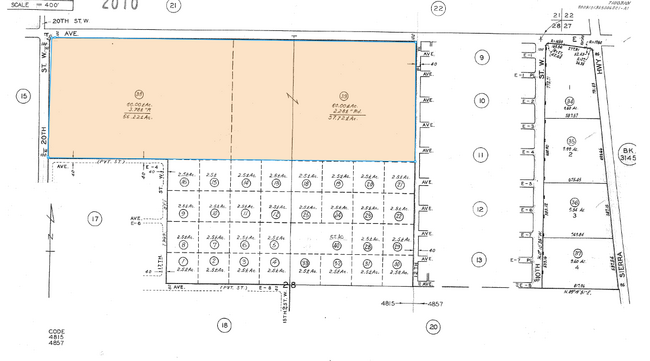
NW 1/4 OF NE 1/4 (EX OF ST) AND E 1/2 OF NE 1/4 OF NW 1/4 (EX OF ST) OF SEC 28 T 8N R 12W
3116-014-038
LOS ANGELES
Residentialacreage
California
LCD22*
28
B and X Area of moderate flood hazard, usually the area between the limits of the 100-year and 500-year floods.
57.24 AC
2024
Antelope Valley
2025
Los Angeles
900703
NEARBY LISTINGS FOR SALE OR LEASE
DEMOGRAPHICS near 20 Vac Corner Stw Ave E
1 mile
3 mile
5 mile
2025 Total Population
822
1,401
41,837
2030 Population
901
1,489
41,664
Pop Growth 2025-2030
+ 9.61%
+ 6.28%
(0.41%)
Average Age
58
50
37
2025 Total Households
434
617
13,266
HH Growth 2025-2030
+ 9.91%
+ 7.29%
(0.40%)
Median Household Inc
$44,711
$48,879
$59,002
Avg Household Size
1.90
2.20
3.00
2025 Avg HH Vehicles
1.00
2.00
2.00
Median Home Value
$119,791
$145,707
$354,599
Median Year Built
1988
1989
1980
Nearby Places
Map Layers
Map Styles
 Street
 Aerial
Layers
 Traffic
 Biking
Places
Listings with unknown addresses are not visible on the map
- Restaurants
- Banks
- Shops
- Fitness
- Groceries
PUBLIC TRANSPORTATION
COMMUTER RAIL
Lancaster (Antelope Valley Line - Southern California Regional Rail Authority (Metrolink))
Drive
Walk
Distance
Lancaster (Antelope Valley Line - Southern California Regional Rail Authority (Metrolink))
9 min
5.5 mi
Freight Ports
Port of Long Beach
Drive
Walk
Distance
Port of Long Beach
117 min
98.6 mi
Nearby Properties
Address
Land Use
TOTAL SIZE
Lot Size
Zoning
Address
Land Use
TOTAL SIZE
Lot Size
Zoning
2,922,905 SF
85.01 AC
LRLI
Address
Land Use
TOTAL SIZE
Lot Size
Zoning
552,178 SF
17.77 AC
LRHI*
Address
Land Use
TOTAL SIZE
Lot Size
Zoning
Address
Land Use
TOTAL SIZE
Lot Size
Zoning
552,178 SF
4.70 AC
LRHI
Address
Land Use
TOTAL SIZE
Lot Size
Zoning
37.45 AC
LRSP
Address
Land Use
TOTAL SIZE
Lot Size
Zoning
Address
Land Use
TOTAL SIZE
Lot Size
Zoning
58.68 AC
LCD22*
Address
Land Use
TOTAL SIZE
Lot Size
Zoning
Address
Land Use
TOTAL SIZE
Lot Size
Zoning
81.54 AC
LCD22*
Address
Land Use
TOTAL SIZE
Lot Size
Zoning
77.36 AC
LCD22*
Address
Land Use
TOTAL SIZE
Lot Size
Zoning
10,512 SF
33.67 AC
LRHI
Address
Land Use
TOTAL SIZE
Lot Size
Zoning
32.84 AC
LCD22*
Address
Land Use
TOTAL SIZE
Lot Size
Zoning
26.32 AC
LCM1
Address
Land Use
TOTAL SIZE
Lot Size
Zoning
17.50 AC
LCD21*
Address
Land Use
TOTAL SIZE
Lot Size
Zoning
35.05 AC
LCD21*
Address
Land Use
TOTAL SIZE
Lot Size
Zoning
30.68 AC
LRHI
Address
Land Use
TOTAL SIZE
Lot Size
Zoning
60 SF
29.74 AC
LCA22*
Address
Land Use
TOTAL SIZE
Lot Size
Zoning
39.96 AC
LCD22*
Address
Land Use
TOTAL SIZE
Lot Size
Zoning
19,050 SF
9.78 AC
LRHI
Address
Land Use
TOTAL SIZE
Lot Size
Zoning
10.32 AC
LRCPD
Address
Land Use
TOTAL SIZE
Lot Size
Zoning
39.23 AC
LCD2
Address
Land Use
TOTAL SIZE
Lot Size
Zoning
37.64 AC
LCD2
Address
Land Use
TOTAL SIZE
Lot Size
Zoning
4,540 SF
4.76 AC
LRA12*
Address
Land Use
TOTAL SIZE
Lot Size
Zoning
9.74 AC
LCA22*
Address
Land Use
TOTAL SIZE
Lot Size
Zoning
38.95 AC
LCD22*
Address
Land Use
TOTAL SIZE
Lot Size
Zoning
9,680 SF
2.95 AC
LCM2
Address
Land Use
TOTAL SIZE
Lot Size
Zoning
20.24 AC
LRSP
Address
Land Use
TOTAL SIZE
Lot Size
Zoning
9.45 AC
LRHI
The World's #1 Commercial Real Estate Marketplace
Connect with us
© 2026 CoStar Group
The information above has been obtained from sources believed reliable. While we do not doubt its accuracy we have not verified it and make no guarantee, warranty or representation about it. It is your responsibility to independently confirm its accuracy and completeness. Any projections, opinions, assumptions, or estimates used are for example only and do not represent the current or future performance of the property. The value of this transaction to you depends on tax and other factors which should be evaluated by your tax, financial, and legal advisors. You and your advisors should conduct a careful, independent investigation of the property to determine to your satisfaction the suitability of the property for your needs.