Property Record
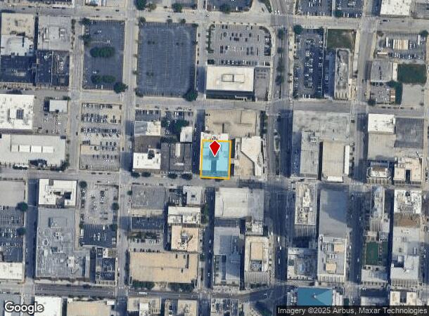
20 W 9Th St, Kansas City, MO 64105

Current Lease Availabilities
NEARBY LISTINGS FOR SALE OR LEASE
Property Detail
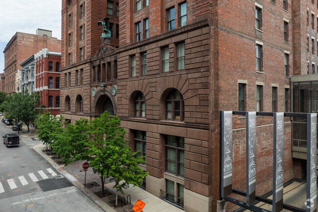
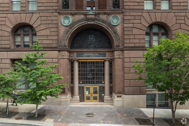
20 W 9Th St
29-220-23-02-03-0-00-000
Unity Gardens
Religious
SEC-05 TWP-49 RNG-33---PT NW 1/4 DAF: BEG NE COR OF 9TH & BA LTIMORE TH N 160 TH E 120 TH S TO N LI OF 9TH ST 160 TH W 120 TO POB (KNOWN AS PT TR-1 ON CERT SUR S-12 PG-97)
X
Jackson
29095C0252H
Missouri
2024
0.44 AC
2025
CBD
015701
Kansas City
76,886 SF
Kansas City, MO-KS
DEMOGRAPHICS near 20 W 9Th St
1 Mile
3 Mile
5 Mile
2024 Total Population
16,686
91,864
245,251
2029 Population
17,004
93,739
249,094
Pop Growth 2024-2029
+ 1.91%
+ 2.04%
+ 1.57%
Average Age
35
36
36
2024 Total Households
10,133
42,080
106,334
HH Growth 2024-2029
+ 1.92%
+ 2.33%
+ 1.76%
Median Household Inc
$65,648
$49,369
$49,487
Avg Household Size
1.50
2.00
2.20
2024 Avg HH Vehicles
1.00
1.00
1.00
Median Home Value
$243,315
$170,744
$148,887
Median Year Built
1967
1956
1954
Nearby Places
Map Layers
Map Styles
 Street
 Aerial
- Restaurants
- Banks
- Shops
- Fitness
- Groceries
PUBLIC TRANSPORTATION
TRANSIT/SUBWAY
Library On Main At 9Th St Nb (KC Streetcar - KCATA)
DRIVE
WALK
Distance
Library On Main At 9Th St Nb (KC Streetcar - KCATA)
1 min
1 min
0.1 mi
Library On Main At 9Th St Sb (KC Streetcar - KCATA)
DRIVE
WALK
Distance
Library On Main At 9Th St Sb (KC Streetcar - KCATA)
0 min
2 min
0.1 mi
North Loop On Main At 7Th St Sb (KC Streetcar - KCATA)
DRIVE
WALK
Distance
North Loop On Main At 7Th St Sb (KC Streetcar - KCATA)
0 min
3 min
0.2 mi
Metro Center On Main At 12Th St Sb (KC Streetcar - KCATA)
DRIVE
WALK
Distance
Metro Center On Main At 12Th St Sb (KC Streetcar - KCATA)
1 min
6 min
0.4 mi
City Market On Walnut At 5Th St Eb (KC Streetcar - KCATA)
DRIVE
WALK
Distance
City Market On Walnut At 5Th St Eb (KC Streetcar - KCATA)
1 min
8 min
0.5 mi
COMMUTER RAIL
Kansas City (Lincoln Service Missouri River Runner - Amtrak, Missouri River Runner - Amtrak, Southwest Chief - Amtrak)
DRIVE
WALK
Distance
Kansas City (Lincoln Service Missouri River Runner - Amtrak, Missouri River Runner - Amtrak, Southwest Chief - Amtrak)
5 min
1.8 mi
AIRPORT
Kansas City International
DRIVE
WALK
Distance
Kansas City International
26 min
18.9 mi
Freight Ports
Tulsa Port Of Catoosa
DRIVE
WALK
Distance
Tulsa Port Of Catoosa
268 min
238.9 mi
Nearby Properties
Address
Land Use
TOTAL SIZE
Lot Size
Zoning
Address
Land Use
TOTAL SIZE
Lot Size
Zoning
172,810 SF
Address
Land Use
TOTAL SIZE
Lot Size
Zoning
568,235 SF
9.59 AC
Address
Land Use
TOTAL SIZE
Lot Size
Zoning
126,962 SF
4.50 AC
KC0
Address
Land Use
TOTAL SIZE
Lot Size
Zoning
488,351 SF
8.34 AC
Address
Land Use
TOTAL SIZE
Lot Size
Zoning
132,304 SF
3.72 AC
KCD
Address
Land Use
TOTAL SIZE
Lot Size
Zoning
1,825,083 SF
25.77 AC
Address
Land Use
TOTAL SIZE
Lot Size
Zoning
63,748 SF
3.92 AC
Address
Land Use
TOTAL SIZE
Lot Size
Zoning
404,524 SF
5.51 AC
Address
Land Use
TOTAL SIZE
Lot Size
Zoning
711,196 SF
15.58 AC
Address
Land Use
TOTAL SIZE
Lot Size
Zoning
277,042 SF
0.40 AC
Address
Land Use
TOTAL SIZE
Lot Size
Zoning
257,647 SF
3.63 AC
Address
Land Use
TOTAL SIZE
Lot Size
Zoning
277,267 SF
4.18 AC
KCD
Address
Land Use
TOTAL SIZE
Lot Size
Zoning
44,491 SF
1.96 AC
C3A2
Address
Land Use
TOTAL SIZE
Lot Size
Zoning
81,578 SF
1.63 AC
Address
Land Use
TOTAL SIZE
Lot Size
Zoning
162,989 SF
3.92 AC
KC0
Address
Land Use
TOTAL SIZE
Lot Size
Zoning
115,627 SF
1.56 AC
Address
Land Use
TOTAL SIZE
Lot Size
Zoning
261,570 SF
1.82 AC
Address
Land Use
TOTAL SIZE
Lot Size
Zoning
157,488 SF
1.60 AC
Address
Land Use
TOTAL SIZE
Lot Size
Zoning
87,294 SF
0.70 AC
Address
Land Use
TOTAL SIZE
Lot Size
Zoning
803,812 SF
5.85 AC
Address
Land Use
TOTAL SIZE
Lot Size
Zoning
384,543 SF
5.40 AC
Address
Land Use
TOTAL SIZE
Lot Size
Zoning
614,978 SF
31.56 AC
Address
Land Use
TOTAL SIZE
Lot Size
Zoning
274,622 SF
1.35 AC
Address
Land Use
TOTAL SIZE
Lot Size
Zoning
342,989 SF
1.84 AC
Address
Land Use
TOTAL SIZE
Lot Size
Zoning
93,870 SF
3.31 AC
KC0
Address
Land Use
TOTAL SIZE
Lot Size
Zoning
238,003 SF
1.74 AC
Address
Land Use
TOTAL SIZE
Lot Size
Zoning
349,977 SF
2.21 AC
Address
Land Use
TOTAL SIZE
Lot Size
Zoning
191,753 SF
0.79 AC
M1
Address
Land Use
TOTAL SIZE
Lot Size
Zoning
27,292 SF
10.75 AC
Address
Land Use
TOTAL SIZE
Lot Size
Zoning
250,410 SF
3.74 AC
The World's #1 Commercial Real Estate Marketplace
Connect with us
© 2025 CoStar Group
The information above has been obtained from sources believed reliable. While we do not doubt its accuracy we have not verified it and make no guarantee, warranty or representation about it. It is your responsibility to independently confirm its accuracy and completeness. Any projections, opinions, assumptions, or estimates used are for example only and do not represent the current or future performance of the property. The value of this transaction to you depends on tax and other factors which should be evaluated by your tax, financial, and legal advisors. You and your advisors should conduct a careful, independent investigation of the property to determine to your satisfaction the suitability of the property for your needs.