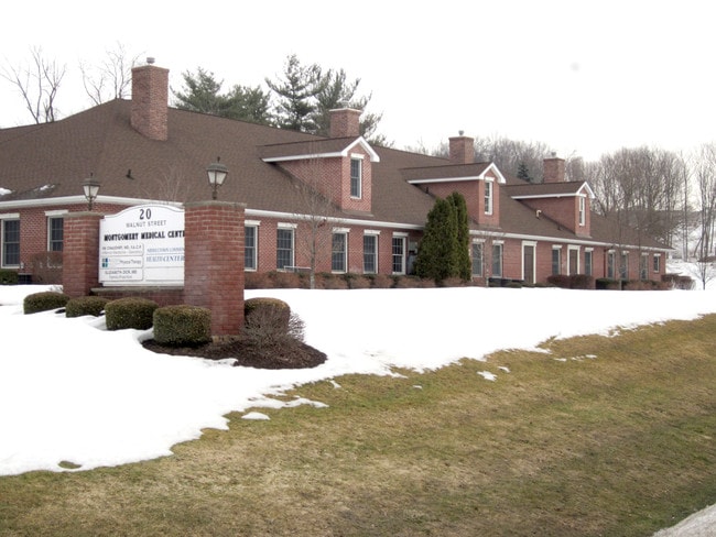
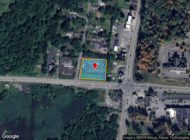
Property Record
20 Walnut St, Montgomery, NY 12549

NEARBY LISTINGS FOR SALE OR LEASE
Property Detail
20 Walnut St
New York-Jersey City-White Plains, NY-NJ
Cochecton Pl
334289-022-000-0002-010.000-0000
LTS 7<11 COCHECTON PL SUB
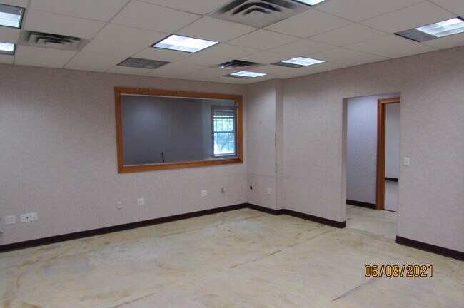
Commercialbuilding
Orange
X
New York
36071C0114E
10.00
2024
1 AC
2024
Middletown
010802
Northern New Jersey
14,510 SF
DEMOGRAPHICS near 20 Walnut St
1 Mile
3 Mile
5 Mile
2024 Total Population
1,248
17,472
27,681
2029 Population
1,274
17,768
28,164
Pop Growth 2024-2029
+ 2.08%
+ 1.69%
+ 1.74%
Average Age
42
40
40
2024 Total Households
312
6,281
9,891
HH Growth 2024-2029
+ 2.24%
+ 1.74%
+ 1.80%
Median Household Inc
$113,257
$88,382
$93,661
Avg Household Size
2.70
2.70
2.70
2024 Avg HH Vehicles
2.00
2.00
2.00
Median Home Value
$386,841
$293,380
$300,371
Median Year Built
1977
1974
1972
Nearby Places
Map Layers
Map Styles
 Street
 Aerial
- Restaurants
- Banks
- Shops
- Fitness
- Groceries
PUBLIC TRANSPORTATION
COMMUTER RAIL
Campbell Hall (Bergen County/Port Jervis Line - NJ Transit Commuter Rail (NJ Transit), Main/Port Jervis Line - NJ Transit Commuter Rail (NJ Transit))
DRIVE
WALK
Distance
Campbell Hall (Bergen County/Port Jervis Line - NJ Transit Commuter Rail (NJ Transit), Main/Port Jervis Line - NJ Transit Commuter Rail (NJ Transit))
16 min
8.8 mi
AIRPORT
New York Stewart International
DRIVE
WALK
Distance
New York Stewart International
13 min
7.6 mi
SALE & LEASE HISTORY
LISTING DATE
SALE/LEASE

Oct 03, 2019
For Lease
Dec 13, 2018
For Lease
Apr 05, 2021
For Lease
Nearby Properties
Address
Land Use
TOTAL SIZE
Lot Size
Zoning
Address
Land Use
TOTAL SIZE
Lot Size
Zoning
513,951 SF
112.80 AC
ID
Address
Land Use
TOTAL SIZE
Lot Size
Zoning
249,128 SF
43.72 AC
ID
Address
Land Use
TOTAL SIZE
Lot Size
Zoning
762,500 SF
80 AC
I1
Address
Land Use
TOTAL SIZE
Lot Size
Zoning
760,927 SF
51.60 AC
ID
Address
Land Use
TOTAL SIZE
Lot Size
Zoning
312,980 SF
42.30 AC
ID
Address
Land Use
TOTAL SIZE
Lot Size
Zoning
108.50 AC
Address
Land Use
TOTAL SIZE
Lot Size
Zoning
121,460 SF
42.70 AC
ID
Address
Land Use
TOTAL SIZE
Lot Size
Zoning
Address
Land Use
TOTAL SIZE
Lot Size
Zoning
103,857 SF
14.30 AC
B4
Address
Land Use
TOTAL SIZE
Lot Size
Zoning
26,500 SF
27.50 AC
B4
Address
Land Use
TOTAL SIZE
Lot Size
Zoning
100,300 SF
22.50 AC
I1
Address
Land Use
TOTAL SIZE
Lot Size
Zoning
221,958 SF
12.10 AC
ID
Address
Land Use
TOTAL SIZE
Lot Size
Zoning
109,108 SF
15.60 AC
B2
Address
Land Use
TOTAL SIZE
Lot Size
Zoning
172,720 SF
41.60 AC
Address
Land Use
TOTAL SIZE
Lot Size
Zoning
90,200 SF
7.50 AC
B4
Address
Land Use
TOTAL SIZE
Lot Size
Zoning
89,960 SF
10.90 AC
I1
Address
Land Use
TOTAL SIZE
Lot Size
Zoning
49,056 SF
20 AC
RM1
Address
Land Use
TOTAL SIZE
Lot Size
Zoning
32,505 SF
15.10 AC
I1
Address
Land Use
TOTAL SIZE
Lot Size
Zoning
48,131 SF
2.80 AC
B4
Address
Land Use
TOTAL SIZE
Lot Size
Zoning
38,624 SF
11.50 AC
I1
Address
Land Use
TOTAL SIZE
Lot Size
Zoning
Address
Land Use
TOTAL SIZE
Lot Size
Zoning
80,260 SF
9.30 AC
I1
Address
Land Use
TOTAL SIZE
Lot Size
Zoning
63,139 SF
5.40 AC
Address
Land Use
TOTAL SIZE
Lot Size
Zoning
62,557 SF
37.20 AC
ID
Address
Land Use
TOTAL SIZE
Lot Size
Zoning
72,852 SF
2.20 AC
Address
Land Use
TOTAL SIZE
Lot Size
Zoning
102,239 SF
62.90 AC
RA2
Address
Land Use
TOTAL SIZE
Lot Size
Zoning
1,200 SF
14.80 AC
ID
Address
Land Use
TOTAL SIZE
Lot Size
Zoning
88,416 SF
4.20 AC
R2
Address
Land Use
TOTAL SIZE
Lot Size
Zoning
64,191 SF
10 AC
06
Address
Land Use
TOTAL SIZE
Lot Size
Zoning
85,275 SF
70.20 AC
RA-.5
The World's #1 Commercial Real Estate Marketplace
Connect with us
© 2025 CoStar Group
The information above has been obtained from sources believed reliable. While we do not doubt its accuracy we have not verified it and make no guarantee, warranty or representation about it. It is your responsibility to independently confirm its accuracy and completeness. Any projections, opinions, assumptions, or estimates used are for example only and do not represent the current or future performance of the property. The value of this transaction to you depends on tax and other factors which should be evaluated by your tax, financial, and legal advisors. You and your advisors should conduct a careful, independent investigation of the property to determine to your satisfaction the suitability of the property for your needs.