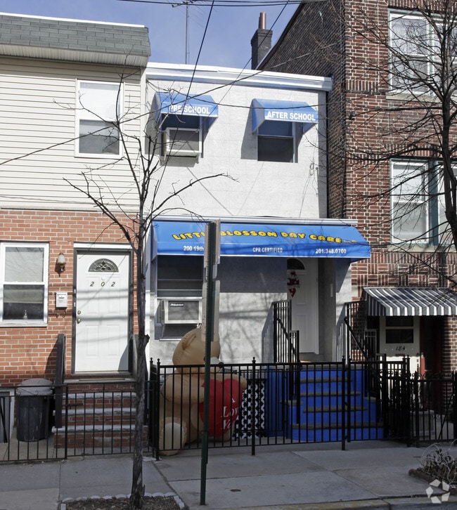
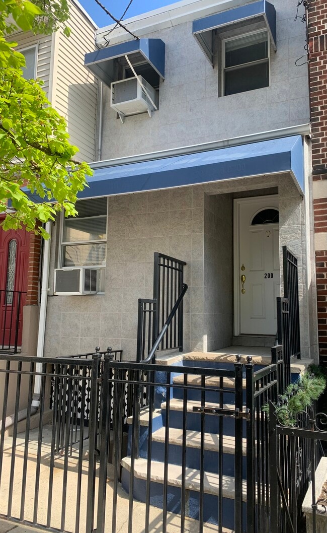
Property Record
200 19Th St, Union City, NJ 07087
NEARBY LISTINGS FOR SALE OR LEASE
Property Detail
200 19Th St
10-00175-0000-00081
Cynthia Blanco Etal
Apartment
Hudson
X
New Jersey
3604970069F
81
2024
0.03 AC
2025
Hudson Waterfront
017300
Northern New Jersey
1,400 SF
New York-Jersey City-White Plains, NY-NJ
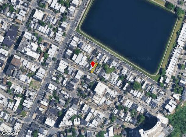
DEMOGRAPHICS near 200 19Th St
1 Mile
3 Mile
5 Mile
2024 Total Population
93,895
738,651
1,843,582
2029 Population
90,647
701,625
1,735,241
Pop Growth 2024-2029
(3.46%)
(5.01%)
(5.88%)
Average Age
38
39
40
2024 Total Households
36,541
348,931
877,771
HH Growth 2024-2029
(3.78%)
(5.48%)
(6.21%)
Median Household Inc
$83,605
$102,744
$102,773
Avg Household Size
2.50
2.00
2.00
2024 Avg HH Vehicles
1.00
1.00
.00
Median Home Value
$592,996
$798,644
$875,544
Median Year Built
1961
1963
1960
Nearby Places
Map Layers
Map Styles
 Street
 Aerial
- Restaurants
- Banks
- Shops
- Fitness
- Groceries
PUBLIC TRANSPORTATION
COMMUTER RAIL
Hoboken (Bergen County/Port Jervis Line - NJ Transit Commuter Rail (NJ Transit), Hoboken-33rd Street - NJ Transit Commuter Rail (NJ Transit), Hoboken-World Trade Center - NJ Transit Commuter Rail (NJ Transit), Main/Port Jervis Line - NJ Transit Commuter Rail (NJ Transit), Montclair-Boonton Line - NJ Transit Commuter Rail (NJ Transit), Morris & Essex Gladstone Branch - NJ Transit Commuter Rail (NJ Transit), Morris & Essex Morristown Line - NJ Transit Commuter Rail (NJ Transit), North Jersey Coast Line - NJ Transit Commuter Rail (NJ Transit), Pascack Valley Line - NJ Transit Commuter Rail (NJ Transit), Raritan Valley Line - NJ Transit Commuter Rail (NJ Transit))
DRIVE
WALK
Distance
Hoboken (Bergen County/Port Jervis Line - NJ Transit Commuter Rail (NJ Transit), Hoboken-33rd Street - NJ Transit Commuter Rail (NJ Transit), Hoboken-World Trade Center - NJ Transit Commuter Rail (NJ Transit), Main/Port Jervis Line - NJ Transit Commuter Rail (NJ Transit), Montclair-Boonton Line - NJ Transit Commuter Rail (NJ Transit), Morris & Essex Gladstone Branch - NJ Transit Commuter Rail (NJ Transit), Morris & Essex Morristown Line - NJ Transit Commuter Rail (NJ Transit), North Jersey Coast Line - NJ Transit Commuter Rail (NJ Transit), Pascack Valley Line - NJ Transit Commuter Rail (NJ Transit), Raritan Valley Line - NJ Transit Commuter Rail (NJ Transit))
8 min
2.5 mi
Ny Moynihan Train Hall At Penn Station (Crescent - Amtrak, Ethan Allen Express - Amtrak, Keystone Service - Amtrak, Lake Shore Limited - Amtrak, Northeast Regional - Amtrak)
DRIVE
WALK
Distance
Ny Moynihan Train Hall At Penn Station (Crescent - Amtrak, Ethan Allen Express - Amtrak, Keystone Service - Amtrak, Lake Shore Limited - Amtrak, Northeast Regional - Amtrak)
12 min
4.2 mi
AIRPORT
Newark Liberty International
DRIVE
WALK
Distance
Newark Liberty International
15 min
11.5 mi
LaGuardia
DRIVE
WALK
Distance
LaGuardia
28 min
12.7 mi
John F Kennedy International
DRIVE
WALK
Distance
John F Kennedy International
36 min
20.8 mi
Freight Ports
NY - Red Hook Container Terminal
DRIVE
WALK
Distance
NY - Red Hook Container Terminal
22 min
9.0 mi
SALE & LEASE HISTORY
LISTING DATE
SALE/LEASE

May 29, 2022
For Lease
Nearby Properties
Address
Land Use
TOTAL SIZE
Lot Size
Zoning
Address
Land Use
TOTAL SIZE
Lot Size
Zoning
4,060,596 SF
22.09 AC
M2-3
Address
Land Use
TOTAL SIZE
Lot Size
Zoning
2,245,112 SF
2.02 AC
C6-6
Address
Land Use
TOTAL SIZE
Lot Size
Zoning
2,521,850 SF
1.59 AC
C6-4
Address
Land Use
TOTAL SIZE
Lot Size
Zoning
1,445,092 SF
3.10 AC
C6-4
Address
Land Use
TOTAL SIZE
Lot Size
Zoning
2,221,336 SF
1.55 AC
C6-4
Address
Land Use
TOTAL SIZE
Lot Size
Zoning
2,636,182 SF
2.35 AC
C65.5
Address
Land Use
TOTAL SIZE
Lot Size
Zoning
9.33 AC
C-1
Address
Land Use
TOTAL SIZE
Lot Size
Zoning
2,161,994 SF
3.79 AC
M1-5
Address
Land Use
TOTAL SIZE
Lot Size
Zoning
2,734,038 SF
4.24 AC
C52.5
Address
Land Use
TOTAL SIZE
Lot Size
Zoning
1,678,135 SF
1.01 AC
C5-3
Address
Land Use
TOTAL SIZE
Lot Size
Zoning
1,897,491 SF
2.06 AC
C52.5
Address
Land Use
TOTAL SIZE
Lot Size
Zoning
1,638,259 SF
1.43 AC
C52.5
Address
Land Use
TOTAL SIZE
Lot Size
Zoning
2,360,627 SF
2.08 AC
C6-7
Address
Land Use
TOTAL SIZE
Lot Size
Zoning
1,642,675 SF
1.05 AC
C6-7
Address
Land Use
TOTAL SIZE
Lot Size
Zoning
1,984,228 SF
1.95 AC
C65.5
Address
Land Use
TOTAL SIZE
Lot Size
Zoning
1,048,620 SF
5.67 AC
C6-4
Address
Land Use
TOTAL SIZE
Lot Size
Zoning
1,586,876 SF
1.87 AC
C5-3
Address
Land Use
TOTAL SIZE
Lot Size
Zoning
1,962,900 SF
1.89 AC
C66.5
Address
Land Use
TOTAL SIZE
Lot Size
Zoning
1,946,157 SF
1.49 AC
C6-4
Address
Land Use
TOTAL SIZE
Lot Size
Zoning
1,842,991 SF
2.08 AC
C66.5
Address
Land Use
TOTAL SIZE
Lot Size
Zoning
2,535,958 SF
2.94 AC
C6-4
Address
Land Use
TOTAL SIZE
Lot Size
Zoning
1,178,640 SF
0.92 AC
C6-4
Address
Land Use
TOTAL SIZE
Lot Size
Zoning
1,751,641 SF
1.84 AC
C6-4
Address
Land Use
TOTAL SIZE
Lot Size
Zoning
6,877 SF
27.74 AC
UD
Address
Land Use
TOTAL SIZE
Lot Size
Zoning
1,613,847 SF
1.84 AC
C66.5
Address
Land Use
TOTAL SIZE
Lot Size
Zoning
1,596,521 SF
1.34 AC
C6-4
Address
Land Use
TOTAL SIZE
Lot Size
Zoning
2,344,406 SF
1.84 AC
C5-3
Address
Land Use
TOTAL SIZE
Lot Size
Zoning
1,805,894 SF
1.42 AC
C6-4
Address
Land Use
TOTAL SIZE
Lot Size
Zoning
264,420 SF
7.26 AC
C4-7
Address
Land Use
TOTAL SIZE
Lot Size
Zoning
431,963 SF
C67T
The World's #1 Commercial Real Estate Marketplace
Connect with us
© 2025 CoStar Group
The information above has been obtained from sources believed reliable. While we do not doubt its accuracy we have not verified it and make no guarantee, warranty or representation about it. It is your responsibility to independently confirm its accuracy and completeness. Any projections, opinions, assumptions, or estimates used are for example only and do not represent the current or future performance of the property. The value of this transaction to you depends on tax and other factors which should be evaluated by your tax, financial, and legal advisors. You and your advisors should conduct a careful, independent investigation of the property to determine to your satisfaction the suitability of the property for your needs.