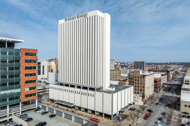
Property Record
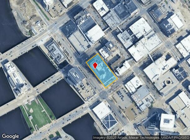
200 1St St Se, Cedar Rapids, IA 52401
Current Lease Availabilities
NEARBY LISTINGS FOR SALE OR LEASE
Property Detail
200 1St St Se
Cedar Rapids, IA
City Of Cedar Rapids
14282-01003-00000
O T LOTS 1, 2, 3, 4, & STR/LB 5 4
Officebuilding
Linn
AE
Iowa
19113C0410E
1-5
2024
0.97 AC
2025
Downtown Cedar Rapids
001900
Other Market Areas
125,013 SF
DEMOGRAPHICS near 200 1St St Se
1 Mile
3 Mile
5 Mile
2024 Total Population
10,411
74,874
139,576
2029 Population
10,707
74,724
139,205
Pop Growth 2024-2029
+ 2.84%
(0.20%)
(0.27%)
Average Age
37
40
40
2024 Total Households
4,594
32,084
60,063
HH Growth 2024-2029
+ 3.16%
(0.20%)
(0.27%)
Median Household Inc
$46,864
$57,884
$60,924
Avg Household Size
2.10
2.20
2.20
2024 Avg HH Vehicles
1.00
2.00
2.00
Median Home Value
$138,894
$156,880
$168,263
Median Year Built
1968
1961
1971
Nearby Places
Map Layers
Map Styles
 Street
 Aerial
- Restaurants
- Banks
- Shops
- Fitness
- Groceries
PUBLIC TRANSPORTATION
AIRPORT
The Eastern Iowa
DRIVE
WALK
Distance
The Eastern Iowa
17 min
9.1 mi
Nearby Properties
Address
Land Use
TOTAL SIZE
Lot Size
Zoning
Address
Land Use
TOTAL SIZE
Lot Size
Zoning
429,314 SF
14.92 AC
Address
Land Use
TOTAL SIZE
Lot Size
Zoning
355,567 SF
14.60 AC
Address
Land Use
TOTAL SIZE
Lot Size
Zoning
1,012,084 SF
45.85 AC
Address
Land Use
TOTAL SIZE
Lot Size
Zoning
171,842 SF
4.16 AC
Address
Land Use
TOTAL SIZE
Lot Size
Zoning
264,086 SF
21.44 AC
Address
Land Use
TOTAL SIZE
Lot Size
Zoning
218,747 SF
9.45 AC
Address
Land Use
TOTAL SIZE
Lot Size
Zoning
308,309 SF
17.97 AC
Address
Land Use
TOTAL SIZE
Lot Size
Zoning
65,970 SF
2.07 AC
Address
Land Use
TOTAL SIZE
Lot Size
Zoning
73,012 SF
2.60 AC
Address
Land Use
TOTAL SIZE
Lot Size
Zoning
276,234 SF
44.53 AC
Address
Land Use
TOTAL SIZE
Lot Size
Zoning
60,910 SF
2.48 AC
Address
Land Use
TOTAL SIZE
Lot Size
Zoning
97,612 SF
0.89 AC
Address
Land Use
TOTAL SIZE
Lot Size
Zoning
74,015 SF
6.59 AC
Address
Land Use
TOTAL SIZE
Lot Size
Zoning
67,971 SF
Address
Land Use
TOTAL SIZE
Lot Size
Zoning
220,128 SF
71.19 AC
Address
Land Use
TOTAL SIZE
Lot Size
Zoning
36,803 SF
2.53 AC
Address
Land Use
TOTAL SIZE
Lot Size
Zoning
23,585 SF
1.05 AC
Address
Land Use
TOTAL SIZE
Lot Size
Zoning
110,583 SF
15.56 AC
Address
Land Use
TOTAL SIZE
Lot Size
Zoning
80,530 SF
2.96 AC
Address
Land Use
TOTAL SIZE
Lot Size
Zoning
156,678 SF
21.85 AC
Address
Land Use
TOTAL SIZE
Lot Size
Zoning
32,855 SF
1.37 AC
Address
Land Use
TOTAL SIZE
Lot Size
Zoning
56,178 SF
0.97 AC
Address
Land Use
TOTAL SIZE
Lot Size
Zoning
315,459 SF
13.85 AC
Address
Land Use
TOTAL SIZE
Lot Size
Zoning
45,012 SF
0.85 AC
Address
Land Use
TOTAL SIZE
Lot Size
Zoning
22,400 SF
0.40 AC
Address
Land Use
TOTAL SIZE
Lot Size
Zoning
45,098 SF
3.02 AC
Address
Land Use
TOTAL SIZE
Lot Size
Zoning
198,251 SF
16.85 AC
Address
Land Use
TOTAL SIZE
Lot Size
Zoning
39,271 SF
0.66 AC
Address
Land Use
TOTAL SIZE
Lot Size
Zoning
47,710 SF
0.71 AC
The World's #1 Commercial Real Estate Marketplace
Connect with us
© 2025 CoStar Group
The information above has been obtained from sources believed reliable. While we do not doubt its accuracy we have not verified it and make no guarantee, warranty or representation about it. It is your responsibility to independently confirm its accuracy and completeness. Any projections, opinions, assumptions, or estimates used are for example only and do not represent the current or future performance of the property. The value of this transaction to you depends on tax and other factors which should be evaluated by your tax, financial, and legal advisors. You and your advisors should conduct a careful, independent investigation of the property to determine to your satisfaction the suitability of the property for your needs.