Property Record
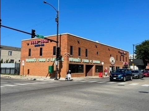
3451 S Indiana Ave, Chicago, IL 60616
This Property Is For Sale
NEARBY LISTINGS FOR SALE OR LEASE
Property Detail
3451 S Indiana Ave
Chicago-Naperville-Elgin, IL-IN
Harriet Farlin
17-34-120-040-0000
Cook
Commercialnec
Illinois
X
21,22
17031C0528K
0.71 AC
2023
South Chicago
2025
Chicago
841000
DEMOGRAPHICS near 3451 S Indiana Ave
1 Mile
3 Mile
5 Mile
2024 Total Population
37,151
244,120
693,932
2029 Population
35,975
234,972
668,806
Pop Growth 2024-2029
(3.17%)
(3.75%)
(3.62%)
Average Age
40
38
37
2024 Total Households
17,268
111,206
313,560
HH Growth 2024-2029
(3.39%)
(3.66%)
(3.15%)
Median Household Inc
$35,484
$62,252
$68,554
Avg Household Size
2.00
2.10
2.10
2024 Avg HH Vehicles
1.00
1.00
1.00
Median Home Value
$341,727
$356,352
$363,197
Median Year Built
1969
1966
1968
Nearby Places
Map Layers
Map Styles
 Street
 Aerial
- Restaurants
- Banks
- Shops
- Fitness
- Groceries
PUBLIC TRANSPORTATION
TRANSIT/SUBWAY
35Th-Bronzeville-Iit Station (Green Line - Chicago Transit Authority "L" Trains (The "L"))
DRIVE
WALK
Distance
35Th-Bronzeville-Iit Station (Green Line - Chicago Transit Authority "L" Trains (The "L"))
1 min
7 min
0.4 mi
Sox/35Th Street Station (Red Line - Chicago Transit Authority "L" Trains (The "L"))
DRIVE
WALK
Distance
Sox/35Th Street Station (Red Line - Chicago Transit Authority "L" Trains (The "L"))
6 min
11 min
0.6 mi
Indiana Station (Green Line - Chicago Transit Authority "L" Trains (The "L"))
DRIVE
WALK
Distance
Indiana Station (Green Line - Chicago Transit Authority "L" Trains (The "L"))
2 min
13 min
0.7 mi
COMMUTER RAIL
35Th St. - Lou Jones (Rock Island - Metra)
DRIVE
WALK
Distance
35Th St. - Lou Jones (Rock Island - Metra)
1 min
8 min
0.5 mi
27Th Street Station (Metra Electric Line - Northeast Illinois Regional Commuter Railroad (Metra))
DRIVE
WALK
Distance
27Th Street Station (Metra Electric Line - Northeast Illinois Regional Commuter Railroad (Metra))
4 min
1.7 mi
AIRPORT
Chicago Midway International
DRIVE
WALK
Distance
Chicago Midway International
15 min
8.0 mi
Chicago O'Hare International
DRIVE
WALK
Distance
Chicago O'Hare International
33 min
21.4 mi
Freight Ports
Port Milwaukee
DRIVE
WALK
Distance
Port Milwaukee
111 min
89.6 mi
Nearby Properties
Address
Land Use
TOTAL SIZE
Lot Size
Zoning
Address
Land Use
TOTAL SIZE
Lot Size
Zoning
1,215,367 SF
3.76 AC
PD 675
Address
Land Use
TOTAL SIZE
Lot Size
Zoning
590,844 SF
0.80 AC
PD 26
Address
Land Use
TOTAL SIZE
Lot Size
Zoning
1,527,000 SF
1.65 AC
DX-16
Address
Land Use
TOTAL SIZE
Lot Size
Zoning
1,252,885 SF
0.99 AC
PD 499
Address
Land Use
TOTAL SIZE
Lot Size
Zoning
1,081,939 SF
0.68 AC
PD 1323
Address
Land Use
TOTAL SIZE
Lot Size
Zoning
662,088 SF
4.91 AC
PD 504
Address
Land Use
TOTAL SIZE
Lot Size
Zoning
474,979 SF
29.67 AC
PD 553
Address
Land Use
TOTAL SIZE
Lot Size
Zoning
979,674 SF
6.01 AC
PD 924
Address
Land Use
TOTAL SIZE
Lot Size
Zoning
314,666 SF
0.32 AC
PD 669
Address
Land Use
TOTAL SIZE
Lot Size
Zoning
717,953 SF
1.37 AC
DX-16
Address
Land Use
TOTAL SIZE
Lot Size
Zoning
626,055 SF
1.86 AC
PD 523
Address
Land Use
TOTAL SIZE
Lot Size
Zoning
408,203 SF
2.02 AC
DS-5
Address
Land Use
TOTAL SIZE
Lot Size
Zoning
0.85 AC
DS-3
Address
Land Use
TOTAL SIZE
Lot Size
Zoning
Address
Land Use
TOTAL SIZE
Lot Size
Zoning
0.28 AC
PD 38
Address
Land Use
TOTAL SIZE
Lot Size
Zoning
531,320 SF
Address
Land Use
TOTAL SIZE
Lot Size
Zoning
325,558 SF
Address
Land Use
TOTAL SIZE
Lot Size
Zoning
Address
Land Use
TOTAL SIZE
Lot Size
Zoning
375,900 SF
0.77 AC
DX-12
Address
Land Use
TOTAL SIZE
Lot Size
Zoning
587,125 SF
1.10 AC
PD 1298
Address
Land Use
TOTAL SIZE
Lot Size
Zoning
496,992 SF
1.86 AC
PD 523
Address
Land Use
TOTAL SIZE
Lot Size
Zoning
4.11 AC
M2-3
Address
Land Use
TOTAL SIZE
Lot Size
Zoning
611,160 SF
2.36 AC
PD 523
Address
Land Use
TOTAL SIZE
Lot Size
Zoning
460,333 SF
2.62 AC
C2-3
Address
Land Use
TOTAL SIZE
Lot Size
Zoning
136,720 SF
0.54 AC
PD 1
Address
Land Use
TOTAL SIZE
Lot Size
Zoning
728,610 SF
PD 225
Address
Land Use
TOTAL SIZE
Lot Size
Zoning
542,503 SF
7.78 AC
PD 523
Address
Land Use
TOTAL SIZE
Lot Size
Zoning
1,302,463 SF
3.14 AC
PD 1211
Address
Land Use
TOTAL SIZE
Lot Size
Zoning
3.14 AC
PD 1211
Address
Land Use
TOTAL SIZE
Lot Size
Zoning
24,100 SF
0.31 AC
DX-12
The World's #1 Commercial Real Estate Marketplace
Connect with us
© 2026 CoStar Group
The information above has been obtained from sources believed reliable. While we do not doubt its accuracy we have not verified it and make no guarantee, warranty or representation about it. It is your responsibility to independently confirm its accuracy and completeness. Any projections, opinions, assumptions, or estimates used are for example only and do not represent the current or future performance of the property. The value of this transaction to you depends on tax and other factors which should be evaluated by your tax, financial, and legal advisors. You and your advisors should conduct a careful, independent investigation of the property to determine to your satisfaction the suitability of the property for your needs.