Property Record
234 Mitchell Dr, Plano, IL 60545
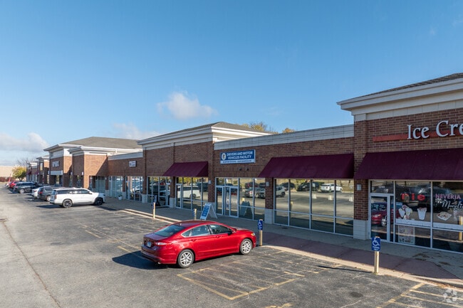
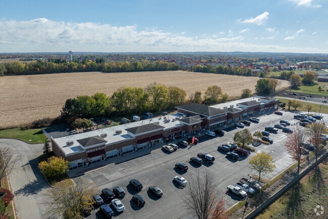
Property Detail
234 Mitchell Dr
Chicago-Naperville-Elgin, IL-IN
PT LOT 2 LAKEWOOD SPRINGS COMMONS CITY OF PLANO
01-25-100-013
Kendall
Commercialnec
Illinois
B and X Area of moderate flood hazard, usually the area between the limits of the 100-year and 500-year floods.
2
2024
2.30 AC
2024
Western East/West Corr
890501
Chicago
NEARBY LISTINGS FOR SALE OR LEASE
DEMOGRAPHICS near 234 Mitchell Dr
1 mile
3 mile
5 mile
2025 Total Population
6,187
21,483
41,384
2030 Population
6,563
23,015
44,500
Pop Growth 2025-2030
+ 6.08%
+ 7.13%
+ 7.53%
Average Age
34
37
38
2025 Total Households
1,949
7,211
14,176
HH Growth 2025-2030
+ 6.00%
+ 7.03%
+ 7.41%
Median Household Inc
$91,681
$98,577
$103,120
Avg Household Size
3.10
2.90
2.90
2025 Avg HH Vehicles
2.00
2.00
2.00
Median Home Value
$232,385
$258,918
$290,309
Median Year Built
2004
1999
2000
Nearby Places
Map Layers
Map Styles
 Street
 Aerial
Transit
 Traffic
 Biking
Places
Listings with unknown addresses are not visible on the map
- Restaurants
- Banks
- Shops
- Fitness
- Groceries
PUBLIC TRANSPORTATION
COMMUTER RAIL
Plano Amtrak Station (Carl Sandburg - Amtrak, Illinois Zephyr - Amtrak)
Drive
Walk
Distance
Plano Amtrak Station (Carl Sandburg - Amtrak, Illinois Zephyr - Amtrak)
5 min
2.1 mi
Freight Ports
Port Milwaukee
Drive
Walk
Distance
Port Milwaukee
155 min
124.9 mi
SALE & LEASE HISTORY
LISTING DATE
SALE/LEASE

Sep 23, 2016
For Sale
Mar 02, 2018
For Lease
Jun 20, 2018
For Lease
Jul 22, 2021
For Sale
Feb 22, 2018
For Sale
Nearby Properties
Address
Land Use
TOTAL SIZE
Lot Size
Zoning
Address
Land Use
TOTAL SIZE
Lot Size
Zoning
1,703,170 SF
266.50 AC
Address
Land Use
TOTAL SIZE
Lot Size
Zoning
64,667 SF
6.15 AC
Address
Land Use
TOTAL SIZE
Lot Size
Zoning
34,047 SF
7.36 AC
Address
Land Use
TOTAL SIZE
Lot Size
Zoning
120.35 AC
Address
Land Use
TOTAL SIZE
Lot Size
Zoning
177,481 SF
14.11 AC
Address
Land Use
TOTAL SIZE
Lot Size
Zoning
107,162 SF
10.49 AC
Address
Land Use
TOTAL SIZE
Lot Size
Zoning
21,800 SF
2.79 AC
Address
Land Use
TOTAL SIZE
Lot Size
Zoning
58,960 SF
1.27 AC
Address
Land Use
TOTAL SIZE
Lot Size
Zoning
62,648 SF
3.06 AC
Address
Land Use
TOTAL SIZE
Lot Size
Zoning
90,533 SF
7.18 AC
Address
Land Use
TOTAL SIZE
Lot Size
Zoning
20,850 SF
1.06 AC
Address
Land Use
TOTAL SIZE
Lot Size
Zoning
20,654 SF
2.38 AC
Address
Land Use
TOTAL SIZE
Lot Size
Zoning
15,632 SF
2.83 AC
Address
Land Use
TOTAL SIZE
Lot Size
Zoning
39,784 SF
3.79 AC
Address
Land Use
TOTAL SIZE
Lot Size
Zoning
43,276 SF
3.60 AC
Address
Land Use
TOTAL SIZE
Lot Size
Zoning
9.03 AC
Address
Land Use
TOTAL SIZE
Lot Size
Zoning
16,296 SF
1.17 AC
Address
Land Use
TOTAL SIZE
Lot Size
Zoning
34,347 SF
2.82 AC
Address
Land Use
TOTAL SIZE
Lot Size
Zoning
52,672 SF
6.43 AC
Address
Land Use
TOTAL SIZE
Lot Size
Zoning
20,019 SF
1.46 AC
Address
Land Use
TOTAL SIZE
Lot Size
Zoning
133,396 SF
8.51 AC
Address
Land Use
TOTAL SIZE
Lot Size
Zoning
12,570 SF
1.28 AC
Address
Land Use
TOTAL SIZE
Lot Size
Zoning
229,190 SF
16.76 AC
Address
Land Use
TOTAL SIZE
Lot Size
Zoning
70,912 SF
7.15 AC
Address
Land Use
TOTAL SIZE
Lot Size
Zoning
21,600 SF
1.36 AC
Address
Land Use
TOTAL SIZE
Lot Size
Zoning
45,467 SF
1.64 AC
Address
Land Use
TOTAL SIZE
Lot Size
Zoning
37,920 SF
2.45 AC
Address
Land Use
TOTAL SIZE
Lot Size
Zoning
11,901 SF
0.99 AC
Address
Land Use
TOTAL SIZE
Lot Size
Zoning
10,048 SF
1.31 AC
Address
Land Use
TOTAL SIZE
Lot Size
Zoning
22,221 SF
1.50 AC
The World's #1 Commercial Real Estate Marketplace
Connect with us
© 2026 CoStar Group
The information above has been obtained from sources believed reliable. While we do not doubt its accuracy we have not verified it and make no guarantee, warranty or representation about it. It is your responsibility to independently confirm its accuracy and completeness. Any projections, opinions, assumptions, or estimates used are for example only and do not represent the current or future performance of the property. The value of this transaction to you depends on tax and other factors which should be evaluated by your tax, financial, and legal advisors. You and your advisors should conduct a careful, independent investigation of the property to determine to your satisfaction the suitability of the property for your needs.