Property Record
200 Alamo Plz, Alamo, CA 94507


NEARBY LISTINGS FOR SALE OR LEASE
Property Detail
200 Alamo Plz
191-180-009-0
PCL MAP 82 PG 14 POR PCL A
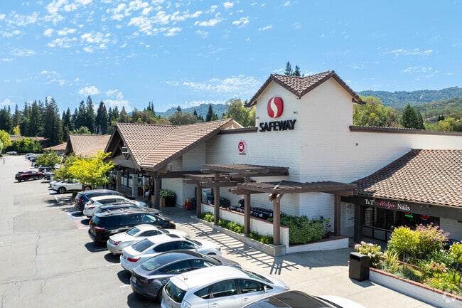
Regionalshoppingcenterormallwithanchorstore
Contra Costa
X
California
06013C0431F
0.92 AC
2025
Danville/Alamo
2025
East Bay/Oakland
345204
Oakland-Hayward-Berkeley, CA
39,216 SF
DEMOGRAPHICS near 200 Alamo Plz
1 Mile
3 Mile
5 Mile
2024 Total Population
4,592
42,917
121,903
2029 Population
4,546
42,661
121,041
Pop Growth 2024-2029
(1.00%)
(0.60%)
(0.71%)
Average Age
45
50
46
2024 Total Households
1,632
18,503
50,330
HH Growth 2024-2029
(1.04%)
(0.50%)
(0.57%)
Median Household Inc
$216,947
$136,386
$152,147
Avg Household Size
2.80
2.30
2.40
2024 Avg HH Vehicles
3.00
2.00
2.00
Median Home Value
$1,141,045
$1,089,480
$1,094,712
Median Year Built
1966
1972
1972
Nearby Places
Map Layers
Map Styles
 Street
 Aerial
- Restaurants
- Banks
- Shops
- Fitness
- Groceries
PUBLIC TRANSPORTATION
AIRPORT
Metro Oakland International
DRIVE
WALK
Distance
Metro Oakland International
38 min
27.4 mi
San Francisco International
DRIVE
WALK
Distance
San Francisco International
56 min
39.4 mi
Freight Ports
Port of Oakland
DRIVE
WALK
Distance
Port of Oakland
28 min
20.2 mi
SALE & LEASE HISTORY
LISTING DATE
SALE/LEASE

Sep 24, 2016
For Lease
Mar 30, 2017
For Lease
Jun 05, 2025
For Lease
Nearby Properties
Address
Land Use
TOTAL SIZE
Lot Size
Zoning
Address
Land Use
TOTAL SIZE
Lot Size
Zoning
157,729 SF
4.26 AC
Address
Land Use
TOTAL SIZE
Lot Size
Zoning
13,326 SF
6.84 AC
M-H
Address
Land Use
TOTAL SIZE
Lot Size
Zoning
34,900 SF
3.54 AC
Address
Land Use
TOTAL SIZE
Lot Size
Zoning
80,368 SF
5.89 AC
Address
Land Use
TOTAL SIZE
Lot Size
Zoning
39,831 SF
34.88 AC
R15
Address
Land Use
TOTAL SIZE
Lot Size
Zoning
134,240 SF
3.56 AC
Address
Land Use
TOTAL SIZE
Lot Size
Zoning
69,382 SF
2.77 AC
Address
Land Use
TOTAL SIZE
Lot Size
Zoning
96,478 SF
4.55 AC
Address
Land Use
TOTAL SIZE
Lot Size
Zoning
53,335 SF
4.67 AC
Address
Land Use
TOTAL SIZE
Lot Size
Zoning
61,104 SF
3.87 AC
Address
Land Use
TOTAL SIZE
Lot Size
Zoning
6.03 AC
Address
Land Use
TOTAL SIZE
Lot Size
Zoning
49,456 SF
3.49 AC
Address
Land Use
TOTAL SIZE
Lot Size
Zoning
67,914 SF
1.66 AC
Address
Land Use
TOTAL SIZE
Lot Size
Zoning
26,608 SF
2.39 AC
Address
Land Use
TOTAL SIZE
Lot Size
Zoning
105,484 SF
4.97 AC
Address
Land Use
TOTAL SIZE
Lot Size
Zoning
8,540 SF
1.87 AC
Address
Land Use
TOTAL SIZE
Lot Size
Zoning
13,128 SF
57.84 AC
Address
Land Use
TOTAL SIZE
Lot Size
Zoning
20,000 SF
50.61 AC
Address
Land Use
TOTAL SIZE
Lot Size
Zoning
46,868 SF
2.69 AC
Address
Land Use
TOTAL SIZE
Lot Size
Zoning
18,640 SF
5.55 AC
Address
Land Use
TOTAL SIZE
Lot Size
Zoning
38,951 SF
2.44 AC
Address
Land Use
TOTAL SIZE
Lot Size
Zoning
12,823 SF
1.85 AC
RB
Address
Land Use
TOTAL SIZE
Lot Size
Zoning
26,415 SF
0.62 AC
Address
Land Use
TOTAL SIZE
Lot Size
Zoning
16,687 SF
0.46 AC
Address
Land Use
TOTAL SIZE
Lot Size
Zoning
26,593 SF
1.19 AC
Address
Land Use
TOTAL SIZE
Lot Size
Zoning
2,580 SF
2.21 AC
Address
Land Use
TOTAL SIZE
Lot Size
Zoning
17,640 SF
0.41 AC
RB
Address
Land Use
TOTAL SIZE
Lot Size
Zoning
12,720 SF
0.22 AC
RB
Address
Land Use
TOTAL SIZE
Lot Size
Zoning
11,969 SF
0.16 AC
RB
The World's #1 Commercial Real Estate Marketplace
Connect with us
© 2025 CoStar Group
The information above has been obtained from sources believed reliable. While we do not doubt its accuracy we have not verified it and make no guarantee, warranty or representation about it. It is your responsibility to independently confirm its accuracy and completeness. Any projections, opinions, assumptions, or estimates used are for example only and do not represent the current or future performance of the property. The value of this transaction to you depends on tax and other factors which should be evaluated by your tax, financial, and legal advisors. You and your advisors should conduct a careful, independent investigation of the property to determine to your satisfaction the suitability of the property for your needs.