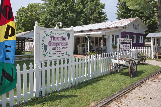
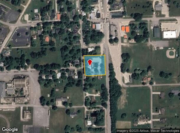
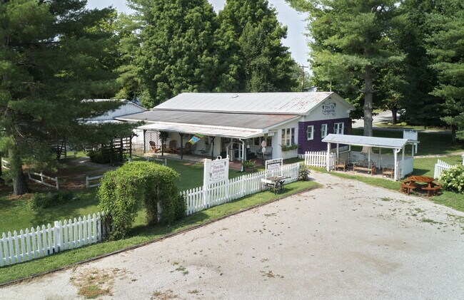
Property Record
200 Bell Ave, Glendale, KY 42740
NEARBY LISTINGS FOR SALE OR LEASE
-
-
View all Glendale listings for sale on LoopNet.com
Property Detail
200 Bell Ave
190-30-02-007
Hardin
Commercialnec
Kentucky
X
0.90 AC
21123C0100C
Kentucky West Area
2025
Other Market Areas
2025
Elizabethtown, KY
001603
DEMOGRAPHICS near 200 Bell Ave
1 Mile
3 Mile
5 Mile
2024 Total Population
438
2,275
8,090
2029 Population
440
2,288
8,209
Pop Growth 2024-2029
+ 0.46%
+ 0.57%
+ 1.47%
Average Age
42
41
40
2024 Total Households
164
855
2,908
HH Growth 2024-2029
+ 0.61%
+ 0.47%
+ 1.41%
Median Household Inc
$90,340
$86,479
$74,240
Avg Household Size
2.60
2.60
2.60
2024 Avg HH Vehicles
3.00
3.00
2.00
Median Home Value
$322,727
$299,999
$204,353
Median Year Built
1989
1989
1991
Nearby Places
Map Layers
Map Styles
 Street
 Aerial
- Restaurants
- Banks
- Shops
- Fitness
- Groceries
SALE & LEASE HISTORY
LISTING DATE
SALE/LEASE

Aug 03, 2020
For Sale
Nearby Properties
Address
Land Use
TOTAL SIZE
Lot Size
Zoning
Address
Land Use
TOTAL SIZE
Lot Size
Zoning
1,219 SF
1,503.41 AC
Address
Land Use
TOTAL SIZE
Lot Size
Zoning
Address
Land Use
TOTAL SIZE
Lot Size
Zoning
Address
Land Use
TOTAL SIZE
Lot Size
Zoning
Address
Land Use
TOTAL SIZE
Lot Size
Zoning
1,120 SF
12.74 AC
Address
Land Use
TOTAL SIZE
Lot Size
Zoning
Address
Land Use
TOTAL SIZE
Lot Size
Zoning
Address
Land Use
TOTAL SIZE
Lot Size
Zoning
3,660 SF
4.39 AC
Address
Land Use
TOTAL SIZE
Lot Size
Zoning
Address
Land Use
TOTAL SIZE
Lot Size
Zoning
Address
Land Use
TOTAL SIZE
Lot Size
Zoning
912 SF
0.37 AC
Address
Land Use
TOTAL SIZE
Lot Size
Zoning
Address
Land Use
TOTAL SIZE
Lot Size
Zoning
Address
Land Use
TOTAL SIZE
Lot Size
Zoning
1,176 SF
Address
Land Use
TOTAL SIZE
Lot Size
Zoning
43.12 AC
Address
Land Use
TOTAL SIZE
Lot Size
Zoning
Address
Land Use
TOTAL SIZE
Lot Size
Zoning
1,256 SF
4 AC
Address
Land Use
TOTAL SIZE
Lot Size
Zoning
Address
Land Use
TOTAL SIZE
Lot Size
Zoning
2,497 SF
25 AC
Address
Land Use
TOTAL SIZE
Lot Size
Zoning
Address
Land Use
TOTAL SIZE
Lot Size
Zoning
Address
Land Use
TOTAL SIZE
Lot Size
Zoning
13.52 AC
Address
Land Use
TOTAL SIZE
Lot Size
Zoning
4,930 SF
91 AC
Address
Land Use
TOTAL SIZE
Lot Size
Zoning
4,100 SF
31.51 AC
Address
Land Use
TOTAL SIZE
Lot Size
Zoning
1,734 SF
87.90 AC
Address
Land Use
TOTAL SIZE
Lot Size
Zoning
2,968 SF
321 AC
Address
Land Use
TOTAL SIZE
Lot Size
Zoning
1,872 SF
41.09 AC
Address
Land Use
TOTAL SIZE
Lot Size
Zoning
3,493 SF
22.40 AC
Address
Land Use
TOTAL SIZE
Lot Size
Zoning
1.61 AC
Address
Land Use
TOTAL SIZE
Lot Size
Zoning
3,023 SF
5 AC
The World's #1 Commercial Real Estate Marketplace
Connect with us
© 2026 CoStar Group
The information above has been obtained from sources believed reliable. While we do not doubt its accuracy we have not verified it and make no guarantee, warranty or representation about it. It is your responsibility to independently confirm its accuracy and completeness. Any projections, opinions, assumptions, or estimates used are for example only and do not represent the current or future performance of the property. The value of this transaction to you depends on tax and other factors which should be evaluated by your tax, financial, and legal advisors. You and your advisors should conduct a careful, independent investigation of the property to determine to your satisfaction the suitability of the property for your needs.