Property Record
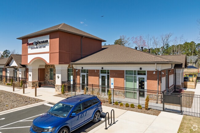
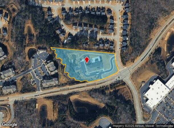
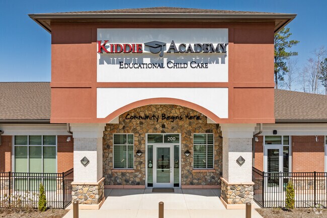
200 Bennet Knoll Pkwy, Holly Springs, NC 27540
NEARBY LISTINGS FOR SALE OR LEASE
Property Detail
200 Bennet Knoll Pkwy
Raleigh, NC
Holly Springs Towne Center
0649.01-47-8420-000
LOGR PT 17 HOLLY SPRINGS TOWNE CENTER PH
Daycare
Wake
X
North Carolina
3720064900K
17
2025
4.35 AC
2025
Southwest Wake County
053432
Raleigh/Durham
10,514 SF
DEMOGRAPHICS near 200 Bennet Knoll Pkwy
1 Mile
3 Mile
5 Mile
2024 Total Population
5,320
44,339
109,905
2029 Population
5,905
48,498
120,135
Pop Growth 2024-2029
+ 11.00%
+ 9.38%
+ 9.31%
Average Age
35
35
37
2024 Total Households
1,854
14,786
37,296
HH Growth 2024-2029
+ 10.95%
+ 9.33%
+ 9.25%
Median Household Inc
$111,053
$118,828
$124,377
Avg Household Size
2.90
3.00
2.90
2024 Avg HH Vehicles
2.00
2.00
2.00
Median Home Value
$378,365
$426,215
$438,204
Median Year Built
1997
1999
1998
Nearby Places
Map Layers
Map Styles
 Street
 Aerial
- Restaurants
- Banks
- Shops
- Fitness
- Groceries
PUBLIC TRANSPORTATION
AIRPORT
Raleigh-Durham International
DRIVE
WALK
Distance
Raleigh-Durham International
29 min
21.0 mi
Freight Ports
Port of Wilmington
DRIVE
WALK
Distance
Port of Wilmington
164 min
134.4 mi
Nearby Properties
Address
Land Use
TOTAL SIZE
Lot Size
Zoning
Address
Land Use
TOTAL SIZE
Lot Size
Zoning
898,348 SF
147.52 AC
BRT
Address
Land Use
TOTAL SIZE
Lot Size
Zoning
600,780 SF
157.91 AC
PUD
Address
Land Use
TOTAL SIZE
Lot Size
Zoning
553,292 SF
91.44 AC
RR
Address
Land Use
TOTAL SIZE
Lot Size
Zoning
295,615 SF
38.04 AC
SP
Address
Land Use
TOTAL SIZE
Lot Size
Zoning
402,468 SF
37.03 AC
HD MF
Address
Land Use
TOTAL SIZE
Lot Size
Zoning
362,567 SF
17.97 AC
NMX
Address
Land Use
TOTAL SIZE
Lot Size
Zoning
313,307 SF
21.58 AC
MXR
Address
Land Use
TOTAL SIZE
Lot Size
Zoning
301,882 SF
19.44 AC
MXR
Address
Land Use
TOTAL SIZE
Lot Size
Zoning
242,251 SF
35.55 AC
SR
Address
Land Use
TOTAL SIZE
Lot Size
Zoning
208,323 SF
36.14 AC
CB
Address
Land Use
TOTAL SIZE
Lot Size
Zoning
230,176 SF
16.83 AC
MXR
Address
Land Use
TOTAL SIZE
Lot Size
Zoning
213,912 SF
16.33 AC
MXR
Address
Land Use
TOTAL SIZE
Lot Size
Zoning
208,958 SF
14.34 AC
MXR
Address
Land Use
TOTAL SIZE
Lot Size
Zoning
361,582 SF
45.01 AC
LI
Address
Land Use
TOTAL SIZE
Lot Size
Zoning
221,860 SF
40.32 AC
PUD
Address
Land Use
TOTAL SIZE
Lot Size
Zoning
159,046 SF
6.47 AC
CB
Address
Land Use
TOTAL SIZE
Lot Size
Zoning
99,326 SF
12.66 AC
TF-CZ
Address
Land Use
TOTAL SIZE
Lot Size
Zoning
140,774 SF
8.56 AC
MXR
Address
Land Use
TOTAL SIZE
Lot Size
Zoning
95,819 SF
22.63 AC
NR
Address
Land Use
TOTAL SIZE
Lot Size
Zoning
83,117 SF
9.74 AC
NR
Address
Land Use
TOTAL SIZE
Lot Size
Zoning
145,707 SF
15.40 AC
PUD
Address
Land Use
TOTAL SIZE
Lot Size
Zoning
59,764 SF
8.36 AC
MXR
Address
Land Use
TOTAL SIZE
Lot Size
Zoning
180,595 SF
35.61 AC
CB
Address
Land Use
TOTAL SIZE
Lot Size
Zoning
72,096 SF
5.51 AC
NMX
Address
Land Use
TOTAL SIZE
Lot Size
Zoning
86,659 SF
10.08 AC
CB
Address
Land Use
TOTAL SIZE
Lot Size
Zoning
93,174 SF
9.07 AC
PUD
Address
Land Use
TOTAL SIZE
Lot Size
Zoning
104,908 SF
8.82 AC
BRT
Address
Land Use
TOTAL SIZE
Lot Size
Zoning
104,908 SF
9.68 AC
BRT
Address
Land Use
TOTAL SIZE
Lot Size
Zoning
81,948 SF
38.04 AC
SP
Address
Land Use
TOTAL SIZE
Lot Size
Zoning
65,569 SF
14.80 AC
CB
The World's #1 Commercial Real Estate Marketplace
Connect with us
© 2025 CoStar Group
The information above has been obtained from sources believed reliable. While we do not doubt its accuracy we have not verified it and make no guarantee, warranty or representation about it. It is your responsibility to independently confirm its accuracy and completeness. Any projections, opinions, assumptions, or estimates used are for example only and do not represent the current or future performance of the property. The value of this transaction to you depends on tax and other factors which should be evaluated by your tax, financial, and legal advisors. You and your advisors should conduct a careful, independent investigation of the property to determine to your satisfaction the suitability of the property for your needs.