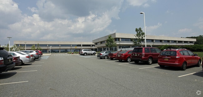
Property Record
200 Bmw Dr, Woodcliff Lake, NJ 07677


NEARBY LISTINGS FOR SALE OR LEASE
Property Detail
200 Bmw Dr
68-00802-0000-00001
65 AC
Commercialnec
Bergen
X
New Jersey
34003C0089H
1
2024
65 AC
2025
Upper Parkway
035200
Northern New Jersey
312 SF
New York-Jersey City-White Plains, NY-NJ
DEMOGRAPHICS near 200 Bmw Dr
1 Mile
3 Mile
5 Mile
2024 Total Population
4,687
67,088
215,114
2029 Population
4,679
67,294
215,109
Pop Growth 2024-2029
(0.17%)
+ 0.31%
0.00%
Average Age
44
43
42
2024 Total Households
1,623
23,560
73,936
HH Growth 2024-2029
(0.25%)
+ 0.32%
(0.05%)
Median Household Inc
$207,473
$158,153
$148,141
Avg Household Size
2.80
2.80
2.80
2024 Avg HH Vehicles
2.00
2.00
2.00
Median Home Value
$927,419
$743,575
$717,577
Median Year Built
1973
1964
1962
Nearby Places
Map Layers
Map Styles
 Street
 Aerial
- Restaurants
- Banks
- Shops
- Fitness
- Groceries
PUBLIC TRANSPORTATION
COMMUTER RAIL
Woodcliff Lake (Pascack Valley Line - NJ Transit Commuter Rail (NJ Transit))
DRIVE
WALK
Distance
Woodcliff Lake (Pascack Valley Line - NJ Transit Commuter Rail (NJ Transit))
6 min
2.3 mi
Park Ridge (Pascack Valley Line - NJ Transit Commuter Rail (NJ Transit))
DRIVE
WALK
Distance
Park Ridge (Pascack Valley Line - NJ Transit Commuter Rail (NJ Transit))
8 min
3.2 mi
AIRPORT
LaGuardia
DRIVE
WALK
Distance
LaGuardia
45 min
28.2 mi
Newark Liberty International
DRIVE
WALK
Distance
Newark Liberty International
37 min
28.5 mi
Westchester County
DRIVE
WALK
Distance
Westchester County
47 min
30.0 mi
Freight Ports
Port Newark Container Terminal
DRIVE
WALK
Distance
Port Newark Container Terminal
44 min
30.4 mi
Nearby Properties
Address
Land Use
TOTAL SIZE
Lot Size
Zoning
Address
Land Use
TOTAL SIZE
Lot Size
Zoning
Address
Land Use
TOTAL SIZE
Lot Size
Zoning
205,580 SF
21.18 AC
EO
Address
Land Use
TOTAL SIZE
Lot Size
Zoning
Address
Land Use
TOTAL SIZE
Lot Size
Zoning
7.04 AC
SED
Address
Land Use
TOTAL SIZE
Lot Size
Zoning
Address
Land Use
TOTAL SIZE
Lot Size
Zoning
Address
Land Use
TOTAL SIZE
Lot Size
Zoning
13 AC
EAO
Address
Land Use
TOTAL SIZE
Lot Size
Zoning
22.75 AC
Address
Land Use
TOTAL SIZE
Lot Size
Zoning
11.48 AC
OR-3
Address
Land Use
TOTAL SIZE
Lot Size
Zoning
21.74 AC
SC
Address
Land Use
TOTAL SIZE
Lot Size
Zoning
9.29 AC
SED
Address
Land Use
TOTAL SIZE
Lot Size
Zoning
17 AC
OR1
Address
Land Use
TOTAL SIZE
Lot Size
Zoning
36.49 AC
OR-2
Address
Land Use
TOTAL SIZE
Lot Size
Zoning
Address
Land Use
TOTAL SIZE
Lot Size
Zoning
31.79 AC
OR2
Address
Land Use
TOTAL SIZE
Lot Size
Zoning
3,165 SF
2.07 AC
VC2
Address
Land Use
TOTAL SIZE
Lot Size
Zoning
Address
Land Use
TOTAL SIZE
Lot Size
Zoning
10.64 AC
AAA
Address
Land Use
TOTAL SIZE
Lot Size
Zoning
2,374 SF
1.80 AC
SOII
Address
Land Use
TOTAL SIZE
Lot Size
Zoning
71,166 SF
7.26 AC
B3
Address
Land Use
TOTAL SIZE
Lot Size
Zoning
124,528 SF
8.87 AC
EM
Address
Land Use
TOTAL SIZE
Lot Size
Zoning
Address
Land Use
TOTAL SIZE
Lot Size
Zoning
99,832 SF
10.39 AC
E
Address
Land Use
TOTAL SIZE
Lot Size
Zoning
24.45 AC
R40
Address
Land Use
TOTAL SIZE
Lot Size
Zoning
74,278 SF
6.91 AC
C2
Address
Land Use
TOTAL SIZE
Lot Size
Zoning
107,584 SF
9.19 AC
EM
Address
Land Use
TOTAL SIZE
Lot Size
Zoning
10.94 AC
AA
Address
Land Use
TOTAL SIZE
Lot Size
Zoning
9.19 AC
OR2
Address
Land Use
TOTAL SIZE
Lot Size
Zoning
144,751 SF
22.87 AC
RA
The World's #1 Commercial Real Estate Marketplace
Connect with us
© 2025 CoStar Group
The information above has been obtained from sources believed reliable. While we do not doubt its accuracy we have not verified it and make no guarantee, warranty or representation about it. It is your responsibility to independently confirm its accuracy and completeness. Any projections, opinions, assumptions, or estimates used are for example only and do not represent the current or future performance of the property. The value of this transaction to you depends on tax and other factors which should be evaluated by your tax, financial, and legal advisors. You and your advisors should conduct a careful, independent investigation of the property to determine to your satisfaction the suitability of the property for your needs.