Property Record
200 Brandywine Dr, West Chester, PA 19382

NEARBY LISTINGS FOR SALE OR LEASE
Property Detail
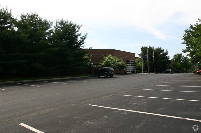
200 Brandywine Dr
52-003-0100.03G0
17.5 AC & IND BLDGS LOT 3
Officebuilding
Chester
X
Pennsylvania
42029C0210G
3
2024
17.50 AC
2025
Chester
302706
Philadelphia
170,524 SF
Philadelphia-Camden-Wilmington, PA-NJ-DE-MD
DEMOGRAPHICS near 200 Brandywine Dr
1 Mile
3 Mile
5 Mile
2024 Total Population
5,235
60,492
131,968
2029 Population
5,469
63,332
138,745
Pop Growth 2024-2029
+ 4.47%
+ 4.69%
+ 5.14%
Average Age
46
42
41
2024 Total Households
1,945
23,753
51,487
HH Growth 2024-2029
+ 4.73%
+ 4.85%
+ 5.29%
Median Household Inc
$131,126
$110,210
$113,211
Avg Household Size
2.60
2.40
2.40
2024 Avg HH Vehicles
2.00
2.00
2.00
Median Home Value
$474,465
$458,596
$472,139
Median Year Built
1992
1980
1980
Nearby Places
Map Layers
Map Styles
 Street
 Aerial
- Restaurants
- Banks
- Shops
- Fitness
- Groceries
PUBLIC TRANSPORTATION
COMMUTER RAIL
Exton (R5 - Southeastern Pennsylvania Transportation Authority Regional Rail (SEPTA Regional Rail))
DRIVE
WALK
Distance
Exton (R5 - Southeastern Pennsylvania Transportation Authority Regional Rail (SEPTA Regional Rail))
11 min
4.3 mi
Whitford (R5 - Southeastern Pennsylvania Transportation Authority Regional Rail (SEPTA Regional Rail))
DRIVE
WALK
Distance
Whitford (R5 - Southeastern Pennsylvania Transportation Authority Regional Rail (SEPTA Regional Rail))
13 min
5.0 mi
AIRPORT
Philadelphia International
DRIVE
WALK
Distance
Philadelphia International
45 min
24.1 mi
Freight Ports
Port of Wilmington, RI
DRIVE
WALK
Distance
Port of Wilmington, RI
45 min
23.3 mi
Nearby Properties
Address
Land Use
TOTAL SIZE
Lot Size
Zoning
Address
Land Use
TOTAL SIZE
Lot Size
Zoning
693,370 SF
18.30 AC
MSP
Address
Land Use
TOTAL SIZE
Lot Size
Zoning
691,907 SF
52.02 AC
I1
Address
Land Use
TOTAL SIZE
Lot Size
Zoning
356,084 SF
8.70 AC
NC1
Address
Land Use
TOTAL SIZE
Lot Size
Zoning
734,062 SF
150.80 AC
R1
Address
Land Use
TOTAL SIZE
Lot Size
Zoning
537,724 SF
38.20 AC
R3
Address
Land Use
TOTAL SIZE
Lot Size
Zoning
29.92 AC
I1
Address
Land Use
TOTAL SIZE
Lot Size
Zoning
289,368 SF
36.70 AC
I2
Address
Land Use
TOTAL SIZE
Lot Size
Zoning
297,424 SF
5.11 AC
C4
Address
Land Use
TOTAL SIZE
Lot Size
Zoning
370,879 SF
21.60 AC
R1
Address
Land Use
TOTAL SIZE
Lot Size
Zoning
276,662 SF
10.83 AC
R2
Address
Land Use
TOTAL SIZE
Lot Size
Zoning
477,007 SF
55 AC
I1
Address
Land Use
TOTAL SIZE
Lot Size
Zoning
289,504 SF
10.10 AC
NC2
Address
Land Use
TOTAL SIZE
Lot Size
Zoning
187,078 SF
21.99 AC
C1
Address
Land Use
TOTAL SIZE
Lot Size
Zoning
458,206 SF
30.80 AC
R5
Address
Land Use
TOTAL SIZE
Lot Size
Zoning
381,284 SF
8.53 AC
R2
Address
Land Use
TOTAL SIZE
Lot Size
Zoning
267,843 SF
18.35 AC
R1
Address
Land Use
TOTAL SIZE
Lot Size
Zoning
207,090 SF
11.25 AC
R4
Address
Land Use
TOTAL SIZE
Lot Size
Zoning
313,024 SF
35.97 AC
C2
Address
Land Use
TOTAL SIZE
Lot Size
Zoning
399,346 SF
27.40 AC
R3
Address
Land Use
TOTAL SIZE
Lot Size
Zoning
109,371 SF
10.30 AC
NC1
Address
Land Use
TOTAL SIZE
Lot Size
Zoning
419,639 SF
28.30 AC
C4
Address
Land Use
TOTAL SIZE
Lot Size
Zoning
356,747 SF
2.21 AC
TC
Address
Land Use
TOTAL SIZE
Lot Size
Zoning
140,834 SF
11.91 AC
TCM
Address
Land Use
TOTAL SIZE
Lot Size
Zoning
156,625 SF
2.89 AC
TCM
Address
Land Use
TOTAL SIZE
Lot Size
Zoning
350,697 SF
13.60 AC
NC2
Address
Land Use
TOTAL SIZE
Lot Size
Zoning
142,854 SF
23.10 AC
BP
Address
Land Use
TOTAL SIZE
Lot Size
Zoning
139,626 SF
8.35 AC
I1
Address
Land Use
TOTAL SIZE
Lot Size
Zoning
131,245 SF
10.10 AC
R3
Address
Land Use
TOTAL SIZE
Lot Size
Zoning
131,253 SF
8.60 AC
BP
Address
Land Use
TOTAL SIZE
Lot Size
Zoning
68,563 SF
33.70 AC
I1
The World's #1 Commercial Real Estate Marketplace
Connect with us
© 2026 CoStar Group
The information above has been obtained from sources believed reliable. While we do not doubt its accuracy we have not verified it and make no guarantee, warranty or representation about it. It is your responsibility to independently confirm its accuracy and completeness. Any projections, opinions, assumptions, or estimates used are for example only and do not represent the current or future performance of the property. The value of this transaction to you depends on tax and other factors which should be evaluated by your tax, financial, and legal advisors. You and your advisors should conduct a careful, independent investigation of the property to determine to your satisfaction the suitability of the property for your needs.