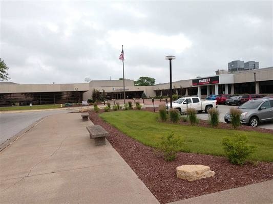
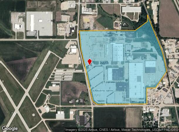
Property Record
200 E 90Th St, Davenport, IA 52806
NEARBY LISTINGS FOR SALE OR LEASE
-
-
View all Davenport listings for lease on LoopNet.com
Property Detail
200 E 90Th St
X2639-01A
Section 26
Officebuilding
SEC:26 TWP:79 RNG:03PT SW/4 SEC 25-79-3& PT SEC 26 DESC ASFOLLOWS:COM AT SECOR SD SEC 26;W 495'ALG S/L AS SEC 26 ,N 0D30' E
A
Scott
19163C0355H
Iowa
2025
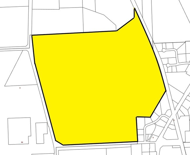
202 AC
2025
Outlying Scott County
010202
Davenport/Moline/Rock Island
4,804 SF
Davenport-Moline-Rock Island, IA-IL
DEMOGRAPHICS near 200 E 90Th St
1 Mile
3 Mile
5 Mile
2024 Total Population
266
17,561
65,270
2029 Population
263
17,445
64,813
Pop Growth 2024-2029
(1.13%)
(0.66%)
(0.70%)
Average Age
46
39
40
2024 Total Households
117
7,055
27,074
HH Growth 2024-2029
(0.85%)
(0.81%)
(0.79%)
Median Household Inc
$41,400
$63,348
$67,649
Avg Household Size
2.30
2.40
2.30
2024 Avg HH Vehicles
2.00
2.00
2.00
Median Home Value
$245,000
$214,423
$191,264
Median Year Built
1985
1990
1977
Nearby Places
Map Layers
Map Styles
 Street
 Aerial
- Restaurants
- Banks
- Shops
- Fitness
- Groceries
PUBLIC TRANSPORTATION
AIRPORT
Quad Cities International
DRIVE
WALK
Distance
Quad Cities International
33 min
17.2 mi
Freight Ports
Port Milwaukee
DRIVE
WALK
Distance
Port Milwaukee
240 min
212.5 mi
SALE & LEASE HISTORY
LISTING DATE
SALE/LEASE

Sep 25, 2016
For Lease
Mar 14, 2019
For Lease
Nearby Properties
Address
Land Use
TOTAL SIZE
Lot Size
Zoning
Address
Land Use
TOTAL SIZE
Lot Size
Zoning
2,615,134 SF
120.68 AC
Address
Land Use
TOTAL SIZE
Lot Size
Zoning
2,545,300 SF
159.73 AC
Address
Land Use
TOTAL SIZE
Lot Size
Zoning
92,431 SF
40.01 AC
Address
Land Use
TOTAL SIZE
Lot Size
Zoning
3,360 SF
42.55 AC
Address
Land Use
TOTAL SIZE
Lot Size
Zoning
300,100 SF
14.87 AC
Address
Land Use
TOTAL SIZE
Lot Size
Zoning
128,100 SF
14.65 AC
Address
Land Use
TOTAL SIZE
Lot Size
Zoning
45,602 SF
149.61 AC
Address
Land Use
TOTAL SIZE
Lot Size
Zoning
27,225 SF
40.34 AC
Address
Land Use
TOTAL SIZE
Lot Size
Zoning
688 SF
56.76 AC
Address
Land Use
TOTAL SIZE
Lot Size
Zoning
26,460 SF
42.72 AC
Address
Land Use
TOTAL SIZE
Lot Size
Zoning
12,500 SF
578.76 AC
Address
Land Use
TOTAL SIZE
Lot Size
Zoning
197,946 SF
18.64 AC
Address
Land Use
TOTAL SIZE
Lot Size
Zoning
4,800 SF
18.86 AC
Address
Land Use
TOTAL SIZE
Lot Size
Zoning
99,540 SF
10.95 AC
Address
Land Use
TOTAL SIZE
Lot Size
Zoning
111,452 SF
40 AC
Address
Land Use
TOTAL SIZE
Lot Size
Zoning
422,688 SF
16.44 AC
Address
Land Use
TOTAL SIZE
Lot Size
Zoning
348,893 SF
15.30 AC
Address
Land Use
TOTAL SIZE
Lot Size
Zoning
78,037 SF
17.06 AC
Address
Land Use
TOTAL SIZE
Lot Size
Zoning
387,408 SF
13.68 AC
Address
Land Use
TOTAL SIZE
Lot Size
Zoning
6,774 SF
8.20 AC
Address
Land Use
TOTAL SIZE
Lot Size
Zoning
98,297 SF
14.73 AC
Address
Land Use
TOTAL SIZE
Lot Size
Zoning
136,292 SF
30.02 AC
Address
Land Use
TOTAL SIZE
Lot Size
Zoning
10,980 SF
42.84 AC
Address
Land Use
TOTAL SIZE
Lot Size
Zoning
175,578 SF
17.19 AC
Address
Land Use
TOTAL SIZE
Lot Size
Zoning
119,808 SF
38.22 AC
Address
Land Use
TOTAL SIZE
Lot Size
Zoning
4,000 SF
8.81 AC
Address
Land Use
TOTAL SIZE
Lot Size
Zoning
113,921 SF
18.78 AC
Address
Land Use
TOTAL SIZE
Lot Size
Zoning
52,032 SF
11.37 AC
Address
Land Use
TOTAL SIZE
Lot Size
Zoning
57,084 SF
8.12 AC
The World's #1 Commercial Real Estate Marketplace
Connect with us
© 2025 CoStar Group
The information above has been obtained from sources believed reliable. While we do not doubt its accuracy we have not verified it and make no guarantee, warranty or representation about it. It is your responsibility to independently confirm its accuracy and completeness. Any projections, opinions, assumptions, or estimates used are for example only and do not represent the current or future performance of the property. The value of this transaction to you depends on tax and other factors which should be evaluated by your tax, financial, and legal advisors. You and your advisors should conduct a careful, independent investigation of the property to determine to your satisfaction the suitability of the property for your needs.