Property Record
200 E Azalea Ave E, Foley, AL 36535
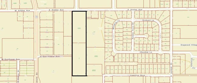

Property Detail
200 E Azalea Ave E
Daphne-Fairhope-Foley, AL
279' X 638'(S) FM THE NW COR SEC 33 RUN E 679' TH S 30' FOR THE POB, TH E 279', TH S 638'(S), TH W 281.7', TH N 638'(S) TO TH
54-08-33-2-000-005.001
BALDWIN
Rangelandgrazing
Alabama
B and X Area of moderate flood hazard, usually the area between the limits of the 100-year and 500-year floods.
4.21 AC
0
Baldwin County
2024
Mobile
011503
NEARBY LISTINGS FOR SALE OR LEASE
DEMOGRAPHICS near 200 E Azalea Ave E
1 mile
3 mile
5 mile
2025 Total Population
4,497
20,406
36,859
2030 Population
4,908
22,414
40,541
Pop Growth 2025-2030
+ 9.14%
+ 9.84%
+ 9.99%
Average Age
41
43
43
2025 Total Households
1,792
8,360
15,090
HH Growth 2025-2030
+ 9.15%
+ 9.84%
+ 10.02%
Median Household Inc
$68,293
$68,356
$68,992
Avg Household Size
2.40
2.30
2.40
2025 Avg HH Vehicles
2.00
2.00
2.00
Median Home Value
$238,185
$257,846
$266,153
Median Year Built
1997
2001
2002
Nearby Places
Map Layers
Map Styles
 Street
 Aerial
Transit
 Traffic
 Biking
Places
Listings with unknown addresses are not visible on the map
- Restaurants
- Banks
- Shops
- Fitness
- Groceries
PUBLIC TRANSPORTATION
AIRPORT
Pensacola International
Drive
Walk
Distance
Pensacola International
57 min
32.8 mi
Mobile International
Drive
Walk
Distance
Mobile International
59 min
41.4 mi
Freight Ports
Port of Mobile
Drive
Walk
Distance
Port of Mobile
54 min
38.1 mi
SALE & LEASE HISTORY
LISTING DATE
SALE/LEASE

Sep 24, 2016
For Sale
Nearby Properties
Address
Land Use
TOTAL SIZE
Lot Size
Zoning
Address
Land Use
TOTAL SIZE
Lot Size
Zoning
25,816 SF
55 AC
Address
Land Use
TOTAL SIZE
Lot Size
Zoning
12,629 SF
100 AC
Address
Land Use
TOTAL SIZE
Lot Size
Zoning
167,962 SF
11 AC
Address
Land Use
TOTAL SIZE
Lot Size
Zoning
1.84 AC
Address
Land Use
TOTAL SIZE
Lot Size
Zoning
96,427 SF
6.10 AC
Address
Land Use
TOTAL SIZE
Lot Size
Zoning
8,883 SF
11 AC
Address
Land Use
TOTAL SIZE
Lot Size
Zoning
30,085 SF
8.90 AC
Address
Land Use
TOTAL SIZE
Lot Size
Zoning
185,458 SF
24 AC
Address
Land Use
TOTAL SIZE
Lot Size
Zoning
49 SF
31 AC
Address
Land Use
TOTAL SIZE
Lot Size
Zoning
105,000 SF
81 AC
Address
Land Use
TOTAL SIZE
Lot Size
Zoning
69,845 SF
10 AC
Address
Land Use
TOTAL SIZE
Lot Size
Zoning
13,884 SF
9.10 AC
Address
Land Use
TOTAL SIZE
Lot Size
Zoning
57,473 SF
2.50 AC
Address
Land Use
TOTAL SIZE
Lot Size
Zoning
64,091 SF
13 AC
Address
Land Use
TOTAL SIZE
Lot Size
Zoning
136,126 SF
14 AC
Address
Land Use
TOTAL SIZE
Lot Size
Zoning
118,646 SF
15 AC
Address
Land Use
TOTAL SIZE
Lot Size
Zoning
91,911 SF
2.10 AC
Address
Land Use
TOTAL SIZE
Lot Size
Zoning
11,324 SF
5.50 AC
Address
Land Use
TOTAL SIZE
Lot Size
Zoning
50,893 SF
7 AC
Address
Land Use
TOTAL SIZE
Lot Size
Zoning
63,096 SF
7.20 AC
Address
Land Use
TOTAL SIZE
Lot Size
Zoning
1,125 SF
19 AC
Address
Land Use
TOTAL SIZE
Lot Size
Zoning
30,000 SF
6.20 AC
Address
Land Use
TOTAL SIZE
Lot Size
Zoning
32,268 SF
13 AC
Address
Land Use
TOTAL SIZE
Lot Size
Zoning
13,884 SF
11 AC
Address
Land Use
TOTAL SIZE
Lot Size
Zoning
36,083 SF
2.16 AC
Address
Land Use
TOTAL SIZE
Lot Size
Zoning
56,353 SF
5.50 AC
Address
Land Use
TOTAL SIZE
Lot Size
Zoning
45,404 SF
2.21 AC
Address
Land Use
TOTAL SIZE
Lot Size
Zoning
49,588 SF
2.25 AC
Address
Land Use
TOTAL SIZE
Lot Size
Zoning
57,431 SF
15 AC
Address
Land Use
TOTAL SIZE
Lot Size
Zoning
4,617 SF
20 AC
The World's #1 Commercial Real Estate Marketplace
Connect with us
© 2026 CoStar Group
The information above has been obtained from sources believed reliable. While we do not doubt its accuracy we have not verified it and make no guarantee, warranty or representation about it. It is your responsibility to independently confirm its accuracy and completeness. Any projections, opinions, assumptions, or estimates used are for example only and do not represent the current or future performance of the property. The value of this transaction to you depends on tax and other factors which should be evaluated by your tax, financial, and legal advisors. You and your advisors should conduct a careful, independent investigation of the property to determine to your satisfaction the suitability of the property for your needs.