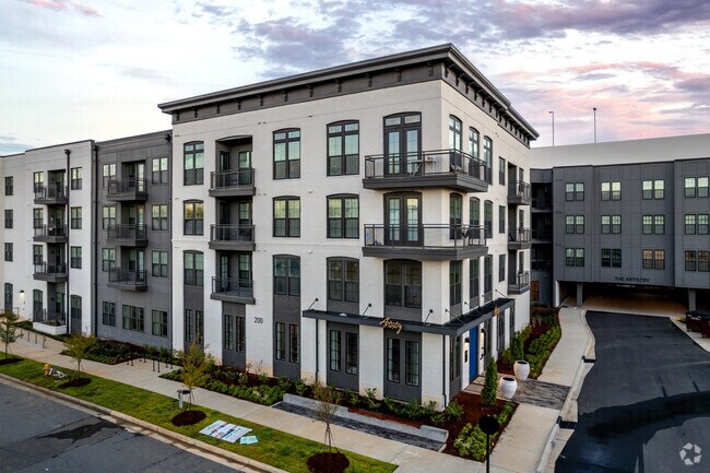
Property Record
200 E Cama St, Charlotte, NC 28217


Property Detail
200 E Cama St
149-024-05
L2A M65-227
Multifamilydwelling
Mecklenburg
I2
North Carolina
B and X Area of moderate flood hazard, usually the area between the limits of the 100-year and 500-year floods.
2a
2024
4.58 AC
2025
York Road
003802
Charlotte
434,803 SF
Charlotte-Concord-Gastonia, NC-SC
NEARBY LISTINGS FOR SALE OR LEASE
DEMOGRAPHICS near 200 E Cama St
1 mile
3 mile
5 mile
2025 Total Population
11,548
103,870
261,403
2030 Population
13,061
113,999
286,270
Pop Growth 2025-2030
+ 13.10%
+ 9.75%
+ 9.51%
Average Age
36
36
37
2025 Total Households
5,411
50,671
122,188
HH Growth 2025-2030
+ 12.46%
+ 9.88%
+ 9.69%
Median Household Inc
$92,235
$91,022
$89,160
Avg Household Size
2.10
2.00
2.10
2025 Avg HH Vehicles
2.00
2.00
2.00
Median Home Value
$633,293
$670,132
$620,389
Median Year Built
2002
2000
1996
Nearby Places
Map Layers
Map Styles
 Street
 Aerial
Layers
 Traffic
 Biking
Places
Listings with unknown addresses are not visible on the map
- Restaurants
- Banks
- Shops
- Fitness
- Groceries
PUBLIC TRANSPORTATION
TRANSIT/SUBWAY
Scaleybark (LYNX Blue Line - Charlotte Area Transit System (CATS))
Drive
Walk
Distance
Scaleybark (LYNX Blue Line - Charlotte Area Transit System (CATS))
2 min
9 min
0.4 mi
Woodlawn (LYNX Blue Line - Charlotte Area Transit System (CATS))
Drive
Walk
Distance
Woodlawn (LYNX Blue Line - Charlotte Area Transit System (CATS))
3 min
20 min
1.0 mi
COMMUTER RAIL
Drive
Walk
Distance
10 min
5.3 mi
AIRPORT
Charlotte/Douglas International
Drive
Walk
Distance
Charlotte/Douglas International
14 min
6.4 mi
Concord-Padgett Regional
Drive
Walk
Distance
Concord-Padgett Regional
30 min
20.1 mi
Nearby Properties
Address
Land Use
TOTAL SIZE
Lot Size
Zoning
Address
Land Use
TOTAL SIZE
Lot Size
Zoning
3,286,640 SF
55.70 AC
O6CD
Address
Land Use
TOTAL SIZE
Lot Size
Zoning
1,652,470 SF
10.96 AC
UMUD
Address
Land Use
TOTAL SIZE
Lot Size
Zoning
1,498,190 SF
2.09 AC
UMUD
Address
Land Use
TOTAL SIZE
Lot Size
Zoning
1,483,634 SF
1.49 AC
Address
Land Use
TOTAL SIZE
Lot Size
Zoning
1,266,700 SF
2.98 AC
Address
Land Use
TOTAL SIZE
Lot Size
Zoning
1,435,616 SF
33.78 AC
UMUD
Address
Land Use
TOTAL SIZE
Lot Size
Zoning
1,250,926 SF
4.89 AC
I2
Address
Land Use
TOTAL SIZE
Lot Size
Zoning
582,357 SF
1.13 AC
MUDD-O
Address
Land Use
TOTAL SIZE
Lot Size
Zoning
894,108 SF
4.52 AC
UMUDO
Address
Land Use
TOTAL SIZE
Lot Size
Zoning
696,527 SF
1.96 AC
UMUDO
Address
Land Use
TOTAL SIZE
Lot Size
Zoning
626,053 SF
2.77 AC
I2
Address
Land Use
TOTAL SIZE
Lot Size
Zoning
416,225 SF
0.64 AC
Address
Land Use
TOTAL SIZE
Lot Size
Zoning
645,212 SF
3.76 AC
UMUD
Address
Land Use
TOTAL SIZE
Lot Size
Zoning
680,348 SF
0.94 AC
Address
Land Use
TOTAL SIZE
Lot Size
Zoning
766,215 SF
1.17 AC
UMUD
Address
Land Use
TOTAL SIZE
Lot Size
Zoning
743,550 SF
4.69 AC
I2
Address
Land Use
TOTAL SIZE
Lot Size
Zoning
505,747 SF
3.87 AC
Address
Land Use
TOTAL SIZE
Lot Size
Zoning
639,406 SF
2.76 AC
TOD-UC
Address
Land Use
TOTAL SIZE
Lot Size
Zoning
689,165 SF
1.30 AC
Address
Land Use
TOTAL SIZE
Lot Size
Zoning
693,089 SF
1.81 AC
MUDDO
Address
Land Use
TOTAL SIZE
Lot Size
Zoning
838,508 SF
4.25 AC
UMUD
Address
Land Use
TOTAL SIZE
Lot Size
Zoning
187,366 SF
4.06 AC
TOD-UC
Address
Land Use
TOTAL SIZE
Lot Size
Zoning
581,470 SF
2.55 AC
I2
Address
Land Use
TOTAL SIZE
Lot Size
Zoning
490,957 SF
4.32 AC
I2
Address
Land Use
TOTAL SIZE
Lot Size
Zoning
412,104 SF
1.13 AC
UMUDO
Address
Land Use
TOTAL SIZE
Lot Size
Zoning
603,986 SF
1.47 AC
B1
Address
Land Use
TOTAL SIZE
Lot Size
Zoning
831,732 SF
24.50 AC
R3
Address
Land Use
TOTAL SIZE
Lot Size
Zoning
357,769 SF
4.93 AC
Address
Land Use
TOTAL SIZE
Lot Size
Zoning
565,754 SF
4.96 AC
MUDD
Address
Land Use
TOTAL SIZE
Lot Size
Zoning
410,964 SF
0.58 AC
UMUDO
The World's #1 Commercial Real Estate Marketplace
Connect with us
© 2026 CoStar Group
The information above has been obtained from sources believed reliable. While we do not doubt its accuracy we have not verified it and make no guarantee, warranty or representation about it. It is your responsibility to independently confirm its accuracy and completeness. Any projections, opinions, assumptions, or estimates used are for example only and do not represent the current or future performance of the property. The value of this transaction to you depends on tax and other factors which should be evaluated by your tax, financial, and legal advisors. You and your advisors should conduct a careful, independent investigation of the property to determine to your satisfaction the suitability of the property for your needs.