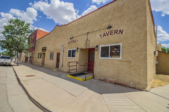
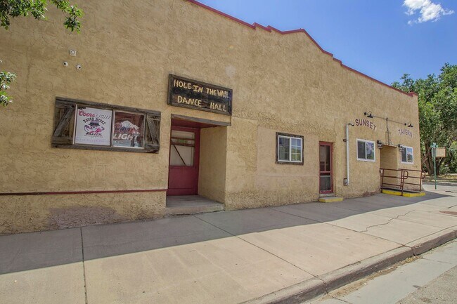
Property Record
200 E Main St, Trinidad, CO 81082
Property Detail
200 E Main St
13023000
AGUILAR BLK-6- LTS-8-9-
Commercialnec
Las Animas
B and X Area of moderate flood hazard, usually the area between the limits of the 100-year and 500-year floods.
Colorado
2024
8-9
2025
0.09 AC
000100
Colorado East Area
1,024 SF
Other Market Areas
NEARBY LISTINGS FOR SALE OR LEASE
DEMOGRAPHICS near 200 E Main St
1 mile
3 mile
5 mile
2024 Total Population
256
281
320
2029 Population
235
259
295
Pop Growth 2024-2029
(8.20%)
(7.83%)
(7.81%)
Average Age
51
51
51
2024 Total Households
127
140
159
HH Growth 2024-2029
(7.87%)
(7.86%)
(8.18%)
Median Household Inc
$32,500
$32,500
$32,261
Avg Household Size
2.00
2.00
2.00
2024 Avg HH Vehicles
2.00
2.00
2.00
Median Home Value
$165,789
$169,047
$170,833
Median Year Built
1981
1980
1980
Nearby Places
Map Layers
Map Styles
 Street
 Aerial
Transit
 Traffic
 Biking
Places
Listings with unknown addresses are not visible on the map
- Restaurants
- Banks
- Shops
- Fitness
- Groceries
PUBLIC TRANSPORTATION
COMMUTER RAIL
Trinidad Amtrak (Southwest Chief - Amtrak)
Drive
Walk
Distance
Trinidad Amtrak (Southwest Chief - Amtrak)
2 min
12 min
0.6 mi
Freight Ports
Tulsa Port Of Catoosa
Drive
Walk
Distance
Tulsa Port Of Catoosa
648 min
554.0 mi
SALE & LEASE HISTORY
LISTING DATE
SALE/LEASE

Jun 14, 2021
For Sale
Aug 15, 2022
For Sale
Apr 22, 2021
For Sale
Nearby Properties
Address
Land Use
TOTAL SIZE
Lot Size
Zoning
Address
Land Use
TOTAL SIZE
Lot Size
Zoning
1.74 AC
Address
Land Use
TOTAL SIZE
Lot Size
Zoning
22.44 AC
Address
Land Use
TOTAL SIZE
Lot Size
Zoning
49.55 AC
Address
Land Use
TOTAL SIZE
Lot Size
Zoning
0.52 AC
Address
Land Use
TOTAL SIZE
Lot Size
Zoning
3.27 AC
Address
Land Use
TOTAL SIZE
Lot Size
Zoning
39,979 SF
4.50 AC
Address
Land Use
TOTAL SIZE
Lot Size
Zoning
153,025 SF
20.82 AC
Address
Land Use
TOTAL SIZE
Lot Size
Zoning
22.68 AC
Address
Land Use
TOTAL SIZE
Lot Size
Zoning
57,000 SF
4.34 AC
Address
Land Use
TOTAL SIZE
Lot Size
Zoning
Address
Land Use
TOTAL SIZE
Lot Size
Zoning
6.39 AC
Address
Land Use
TOTAL SIZE
Lot Size
Zoning
2,020 SF
7.26 AC
Address
Land Use
TOTAL SIZE
Lot Size
Zoning
2,160 SF
0.35 AC
Address
Land Use
TOTAL SIZE
Lot Size
Zoning
5.57 AC
Address
Land Use
TOTAL SIZE
Lot Size
Zoning
Address
Land Use
TOTAL SIZE
Lot Size
Zoning
0.11 AC
Address
Land Use
TOTAL SIZE
Lot Size
Zoning
43,600 SF
4.50 AC
Address
Land Use
TOTAL SIZE
Lot Size
Zoning
2,990 SF
0.10 AC
Address
Land Use
TOTAL SIZE
Lot Size
Zoning
37,250 SF
4.60 AC
Address
Land Use
TOTAL SIZE
Lot Size
Zoning
Address
Land Use
TOTAL SIZE
Lot Size
Zoning
18,552 SF
0.38 AC
Address
Land Use
TOTAL SIZE
Lot Size
Zoning
14,768 SF
1.29 AC
Address
Land Use
TOTAL SIZE
Lot Size
Zoning
Address
Land Use
TOTAL SIZE
Lot Size
Zoning
Address
Land Use
TOTAL SIZE
Lot Size
Zoning
Address
Land Use
TOTAL SIZE
Lot Size
Zoning
3.51 AC
Address
Land Use
TOTAL SIZE
Lot Size
Zoning
36,500 SF
0.68 AC
Address
Land Use
TOTAL SIZE
Lot Size
Zoning
70,720 SF
6 AC
Address
Land Use
TOTAL SIZE
Lot Size
Zoning
33.50 AC
Address
Land Use
TOTAL SIZE
Lot Size
Zoning
60,014 SF
6.57 AC
The World's #1 Commercial Real Estate Marketplace
Connect with us
© 2026 CoStar Group
The information above has been obtained from sources believed reliable. While we do not doubt its accuracy we have not verified it and make no guarantee, warranty or representation about it. It is your responsibility to independently confirm its accuracy and completeness. Any projections, opinions, assumptions, or estimates used are for example only and do not represent the current or future performance of the property. The value of this transaction to you depends on tax and other factors which should be evaluated by your tax, financial, and legal advisors. You and your advisors should conduct a careful, independent investigation of the property to determine to your satisfaction the suitability of the property for your needs.