Property Record
200 Fallon Rd, Stoneham, MA 02180


Property Detail
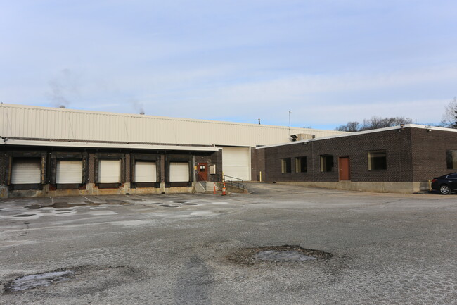
200 Fallon Rd
STON-000026-000000-000002
Middlesex
Warehouse
Massachusetts
C
2
B and X Area of moderate flood hazard, usually the area between the limits of the 100-year and 500-year floods.
5 AC
2025
Wilmington/Winchester
2025
Boston
337300
Boston-Cambridge-Newton, MA-NH
88,722 SF
NEARBY LISTINGS FOR SALE OR LEASE
DEMOGRAPHICS near 200 Fallon Rd
1 mile
3 mile
5 mile
2025 Total Population
10,059
120,645
408,719
2030 Population
10,411
124,945
420,712
Pop Growth 2025-2030
+ 3.50%
+ 3.56%
+ 2.93%
Average Age
42
42
41
2025 Total Households
4,074
47,868
162,877
HH Growth 2025-2030
+ 3.63%
+ 3.70%
+ 3.10%
Median Household Inc
$124,613
$126,673
$119,727
Avg Household Size
2.40
2.40
2.40
2025 Avg HH Vehicles
2.00
2.00
2.00
Median Home Value
$786,170
$779,797
$778,107
Median Year Built
1957
1954
1953
Nearby Places
Map Layers
Map Styles
 Street
 Aerial
Transit
 Traffic
 Biking
Places
Listings with unknown addresses are not visible on the map
- Restaurants
- Banks
- Shops
- Fitness
- Groceries
PUBLIC TRANSPORTATION
COMMUTER RAIL
Winchester Center (Lowell Line - Massachusetts Bay Transportation Authority Commuter Rail (Purple Line))
Drive
Walk
Distance
Winchester Center (Lowell Line - Massachusetts Bay Transportation Authority Commuter Rail (Purple Line))
8 min
3.1 mi
Wedgemere (Lowell Line - Massachusetts Bay Transportation Authority Commuter Rail (Purple Line))
Drive
Walk
Distance
Wedgemere (Lowell Line - Massachusetts Bay Transportation Authority Commuter Rail (Purple Line))
10 min
3.8 mi
AIRPORT
General Edward Lawrence Logan International
Drive
Walk
Distance
General Edward Lawrence Logan International
20 min
11.7 mi
Freight Ports
Port of Boston
Drive
Walk
Distance
Port of Boston
21 min
11.4 mi
SALE & LEASE HISTORY
LISTING DATE
SALE/LEASE

Sep 25, 2016
For Lease
Mar 30, 2017
For Lease
Jan 20, 2022
For Lease
Nearby Properties
Address
Land Use
TOTAL SIZE
Lot Size
Zoning
Address
Land Use
TOTAL SIZE
Lot Size
Zoning
530,113 SF
29.43 AC
Address
Land Use
TOTAL SIZE
Lot Size
Zoning
169 AC
OS
Address
Land Use
TOTAL SIZE
Lot Size
Zoning
14.97 AC
C
Address
Land Use
TOTAL SIZE
Lot Size
Zoning
153,732 SF
12.50 AC
SCI
Address
Land Use
TOTAL SIZE
Lot Size
Zoning
476,332 SF
5.37 AC
Address
Land Use
TOTAL SIZE
Lot Size
Zoning
0.47 AC
M
Address
Land Use
TOTAL SIZE
Lot Size
Zoning
11.72 AC
Address
Land Use
TOTAL SIZE
Lot Size
Zoning
720 SF
632 AC
SA8
Address
Land Use
TOTAL SIZE
Lot Size
Zoning
31.56 AC
HB
Address
Land Use
TOTAL SIZE
Lot Size
Zoning
191,050 SF
3.15 AC
Address
Land Use
TOTAL SIZE
Lot Size
Zoning
4.58 AC
HB
Address
Land Use
TOTAL SIZE
Lot Size
Zoning
9.01 AC
S-I
Address
Land Use
TOTAL SIZE
Lot Size
Zoning
9.50 AC
SCI
Address
Land Use
TOTAL SIZE
Lot Size
Zoning
127.30 AC
R-1
Address
Land Use
TOTAL SIZE
Lot Size
Zoning
157,305 SF
10.69 AC
RDB
Address
Land Use
TOTAL SIZE
Lot Size
Zoning
172,056 SF
I
Address
Land Use
TOTAL SIZE
Lot Size
Zoning
17.65 AC
B-I
Address
Land Use
TOTAL SIZE
Lot Size
Zoning
5.63 AC
C
Address
Land Use
TOTAL SIZE
Lot Size
Zoning
8.17 AC
RB
Address
Land Use
TOTAL SIZE
Lot Size
Zoning
6.28 AC
RB
Address
Land Use
TOTAL SIZE
Lot Size
Zoning
9 AC
C/R
Address
Land Use
TOTAL SIZE
Lot Size
Zoning
14,760 SF
1 AC
SR
Address
Land Use
TOTAL SIZE
Lot Size
Zoning
53,415 SF
11.02 AC
SCI
Address
Land Use
TOTAL SIZE
Lot Size
Zoning
62,853 SF
17.32 AC
R-2
Address
Land Use
TOTAL SIZE
Lot Size
Zoning
1,815 SF
2.99 AC
RDA
Address
Land Use
TOTAL SIZE
Lot Size
Zoning
107,759 SF
22.42 AC
R-1
Address
Land Use
TOTAL SIZE
Lot Size
Zoning
11.06 AC
RB
Address
Land Use
TOTAL SIZE
Lot Size
Zoning
155,686 SF
2.88 AC
I
Address
Land Use
TOTAL SIZE
Lot Size
Zoning
48.16 AC
R-1
Address
Land Use
TOTAL SIZE
Lot Size
Zoning
1,142 SF
38.68 AC
OS
The World's #1 Commercial Real Estate Marketplace
Connect with us
© 2026 CoStar Group
The information above has been obtained from sources believed reliable. While we do not doubt its accuracy we have not verified it and make no guarantee, warranty or representation about it. It is your responsibility to independently confirm its accuracy and completeness. Any projections, opinions, assumptions, or estimates used are for example only and do not represent the current or future performance of the property. The value of this transaction to you depends on tax and other factors which should be evaluated by your tax, financial, and legal advisors. You and your advisors should conduct a careful, independent investigation of the property to determine to your satisfaction the suitability of the property for your needs.