Property Record
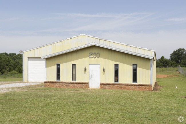
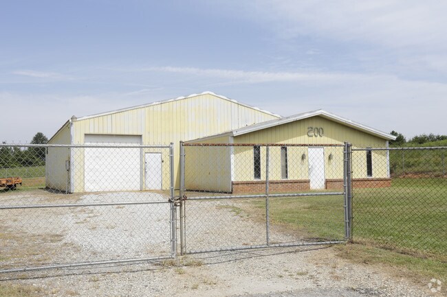
200 Gary Armstrong Rd, Greer, SC 29651
NEARBY LISTINGS FOR SALE OR LEASE
Property Detail
200 Gary Armstrong Rd
5-14-00-097.00
Of Gap Creek
Commercialnec
N SIDE GARY ARMSTRONG RD W OF GAP CREEK RD PB 152-42
ARE
Spartanburg
45045C0358E
South Carolina
2024
4.25 AC
2025
Upper Spartanburg Cty
023201
Greenville/Spartanburg
600 SF
Spartanburg, SC
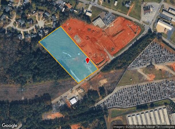
DEMOGRAPHICS near 200 Gary Armstrong Rd
1 Mile
3 Mile
5 Mile
2024 Total Population
2,105
26,464
62,317
2029 Population
2,384
30,071
70,135
Pop Growth 2024-2029
+ 13.25%
+ 13.63%
+ 12.55%
Average Age
38
38
39
2024 Total Households
780
10,100
24,339
HH Growth 2024-2029
+ 13.59%
+ 13.83%
+ 12.65%
Median Household Inc
$62,282
$57,734
$58,969
Avg Household Size
2.70
2.60
2.50
2024 Avg HH Vehicles
2.00
2.00
2.00
Median Home Value
$193,345
$185,046
$197,183
Median Year Built
1996
1993
1992
Nearby Places
Map Layers
Map Styles
 Street
 Aerial
- Restaurants
- Banks
- Shops
- Fitness
- Groceries
PUBLIC TRANSPORTATION
AIRPORT
Greenville Spartanburg International
DRIVE
WALK
Distance
Greenville Spartanburg International
8 min
5.2 mi
SALE & LEASE HISTORY
LISTING DATE
SALE/LEASE

Oct 11, 2017
For Sale
Aug 09, 2017
For Sale
Nearby Properties
Address
Land Use
TOTAL SIZE
Lot Size
Zoning
Address
Land Use
TOTAL SIZE
Lot Size
Zoning
227,627 SF
21.37 AC
Address
Land Use
TOTAL SIZE
Lot Size
Zoning
241,696 SF
15.12 AC
Address
Land Use
TOTAL SIZE
Lot Size
Zoning
1,320,000 SF
130.98 AC
Address
Land Use
TOTAL SIZE
Lot Size
Zoning
Address
Land Use
TOTAL SIZE
Lot Size
Zoning
111.08 AC
Address
Land Use
TOTAL SIZE
Lot Size
Zoning
66.99 AC
Address
Land Use
TOTAL SIZE
Lot Size
Zoning
710,705 SF
34.03 AC
Address
Land Use
TOTAL SIZE
Lot Size
Zoning
91,927 SF
21.14 AC
Address
Land Use
TOTAL SIZE
Lot Size
Zoning
5.73 AC
C1
Address
Land Use
TOTAL SIZE
Lot Size
Zoning
34.30 AC
UNZONED
Address
Land Use
TOTAL SIZE
Lot Size
Zoning
42.27 AC
Address
Land Use
TOTAL SIZE
Lot Size
Zoning
2,497 SF
12.36 AC
Address
Land Use
TOTAL SIZE
Lot Size
Zoning
1,111,000 SF
Address
Land Use
TOTAL SIZE
Lot Size
Zoning
2,088 SF
40.12 AC
Address
Land Use
TOTAL SIZE
Lot Size
Zoning
1,798 SF
9.63 AC
Address
Land Use
TOTAL SIZE
Lot Size
Zoning
28.26 AC
Address
Land Use
TOTAL SIZE
Lot Size
Zoning
67,938 SF
8.02 AC
Address
Land Use
TOTAL SIZE
Lot Size
Zoning
1.40 AC
C2
Address
Land Use
TOTAL SIZE
Lot Size
Zoning
13,344 SF
125 AC
Address
Land Use
TOTAL SIZE
Lot Size
Zoning
274,050 SF
Address
Land Use
TOTAL SIZE
Lot Size
Zoning
234,220 SF
Address
Land Use
TOTAL SIZE
Lot Size
Zoning
217,788 SF
23.50 AC
Address
Land Use
TOTAL SIZE
Lot Size
Zoning
20,621 SF
8.01 AC
Address
Land Use
TOTAL SIZE
Lot Size
Zoning
7,002 SF
6.66 AC
Address
Land Use
TOTAL SIZE
Lot Size
Zoning
0.43 AC
C2
Address
Land Use
TOTAL SIZE
Lot Size
Zoning
189,624 SF
30.64 AC
Address
Land Use
TOTAL SIZE
Lot Size
Zoning
21,402 SF
9.01 AC
Address
Land Use
TOTAL SIZE
Lot Size
Zoning
11,289 SF
10.30 AC
Address
Land Use
TOTAL SIZE
Lot Size
Zoning
3,921 SF
5.35 AC
Address
Land Use
TOTAL SIZE
Lot Size
Zoning
35,285 SF
4.16 AC
The World's #1 Commercial Real Estate Marketplace
Connect with us
© 2026 CoStar Group
The information above has been obtained from sources believed reliable. While we do not doubt its accuracy we have not verified it and make no guarantee, warranty or representation about it. It is your responsibility to independently confirm its accuracy and completeness. Any projections, opinions, assumptions, or estimates used are for example only and do not represent the current or future performance of the property. The value of this transaction to you depends on tax and other factors which should be evaluated by your tax, financial, and legal advisors. You and your advisors should conduct a careful, independent investigation of the property to determine to your satisfaction the suitability of the property for your needs.