Property Record
Highway 57, Collierville, TN 38017


Current Lease Availabilities
NEARBY LISTINGS FOR SALE OR LEASE
Property Detail
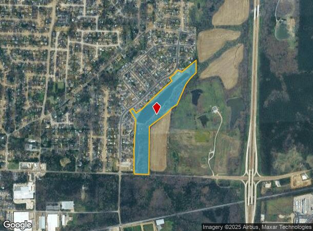
Highway 57
Memphis, TN-MS-AR
Steeple Chase Park
C0-245-0-0318
NS US HWY 57 MAP 203 I
Vacantlandnec
Shelby
AE
Tennessee
47157C0495G
26.87 AC
0
385 Corridor
2025
Memphis
021611
DEMOGRAPHICS near Highway 57
1 Mile
3 Mile
5 Mile
2024 Total Population
4,344
23,602
48,235
2029 Population
4,218
23,296
47,641
Pop Growth 2024-2029
(2.90%)
(1.30%)
(1.23%)
Average Age
40
40
40
2024 Total Households
1,509
8,233
17,082
HH Growth 2024-2029
(2.98%)
(1.25%)
(1.27%)
Median Household Inc
$114,679
$114,915
$124,232
Avg Household Size
2.90
2.80
2.80
2024 Avg HH Vehicles
2.00
2.00
2.00
Median Home Value
$321,037
$345,283
$385,455
Median Year Built
1990
1989
1995
Nearby Places
- Restaurants
- Banks
- Shops
- Fitness
- Groceries
PUBLIC TRANSPORTATION
AIRPORT
Memphis International
DRIVE
WALK
Distance
Memphis International
35 min
23.5 mi
Freight Ports
Port of Shreveport
DRIVE
WALK
Distance
Port of Shreveport
437 min
397.2 mi
Nearby Properties
Address
Land Use
TOTAL SIZE
Lot Size
Zoning
Address
Land Use
TOTAL SIZE
Lot Size
Zoning
241,626 SF
19.59 AC
Address
Land Use
TOTAL SIZE
Lot Size
Zoning
98,107 SF
10.09 AC
RI
Address
Land Use
TOTAL SIZE
Lot Size
Zoning
167,121 SF
13.56 AC
AG
Address
Land Use
TOTAL SIZE
Lot Size
Zoning
223,103 SF
19.25 AC
SCC
Address
Land Use
TOTAL SIZE
Lot Size
Zoning
916,949 SF
100.43 AC
GI
Address
Land Use
TOTAL SIZE
Lot Size
Zoning
108,234 SF
13.48 AC
SCC
Address
Land Use
TOTAL SIZE
Lot Size
Zoning
397,593 SF
61.46 AC
R-1
Address
Land Use
TOTAL SIZE
Lot Size
Zoning
75,975 SF
13.09 AC
SCC
Address
Land Use
TOTAL SIZE
Lot Size
Zoning
256,456 SF
51.05 AC
M2
Address
Land Use
TOTAL SIZE
Lot Size
Zoning
197,121 SF
22.07 AC
SCC
Address
Land Use
TOTAL SIZE
Lot Size
Zoning
61,542 SF
6.65 AC
AG
Address
Land Use
TOTAL SIZE
Lot Size
Zoning
36,800 SF
18.50 AC
Address
Land Use
TOTAL SIZE
Lot Size
Zoning
155.29 AC
CA
Address
Land Use
TOTAL SIZE
Lot Size
Zoning
62,710 SF
11.97 AC
SCC
Address
Land Use
TOTAL SIZE
Lot Size
Zoning
111,730 SF
11.30 AC
RI
Address
Land Use
TOTAL SIZE
Lot Size
Zoning
85,290 SF
11.58 AC
SCC
Address
Land Use
TOTAL SIZE
Lot Size
Zoning
49,377 SF
17.50 AC
Address
Land Use
TOTAL SIZE
Lot Size
Zoning
125,993 SF
9.08 AC
RI
Address
Land Use
TOTAL SIZE
Lot Size
Zoning
34,356 SF
6.23 AC
GC
Address
Land Use
TOTAL SIZE
Lot Size
Zoning
160,180 SF
12.88 AC
GI
Address
Land Use
TOTAL SIZE
Lot Size
Zoning
125,846 SF
10.02 AC
M1
Address
Land Use
TOTAL SIZE
Lot Size
Zoning
180,755 SF
15.39 AC
SCC
Address
Land Use
TOTAL SIZE
Lot Size
Zoning
56,730 SF
7.21 AC
GC
Address
Land Use
TOTAL SIZE
Lot Size
Zoning
46,628 SF
10.62 AC
GI
Address
Land Use
TOTAL SIZE
Lot Size
Zoning
59,602 SF
6.57 AC
R-1
Address
Land Use
TOTAL SIZE
Lot Size
Zoning
130,000 SF
11.98 AC
RI
Address
Land Use
TOTAL SIZE
Lot Size
Zoning
107,500 SF
12.06 AC
SCC
Address
Land Use
TOTAL SIZE
Lot Size
Zoning
124,829 SF
14.03 AC
SCC
Address
Land Use
TOTAL SIZE
Lot Size
Zoning
68.10 AC
R-2
Address
Land Use
TOTAL SIZE
Lot Size
Zoning
27,642 SF
5.38 AC
The World's #1 Commercial Real Estate Marketplace
Connect with us
© 2025 CoStar Group
The information above has been obtained from sources believed reliable. While we do not doubt its accuracy we have not verified it and make no guarantee, warranty or representation about it. It is your responsibility to independently confirm its accuracy and completeness. Any projections, opinions, assumptions, or estimates used are for example only and do not represent the current or future performance of the property. The value of this transaction to you depends on tax and other factors which should be evaluated by your tax, financial, and legal advisors. You and your advisors should conduct a careful, independent investigation of the property to determine to your satisfaction the suitability of the property for your needs.