Property Record
200 Greenridge Dr, Lake Oswego, OR 97035
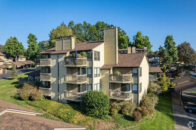

Property Detail
200 Greenridge Dr
00208652
1795 MOUNTAIN PARK #9 PT BLK 8 1283 MOUNTAIN PARK #5 PT BLK 4
Multifamilydwelling
Clackamas
R-0
Oregon
B and X Area of moderate flood hazard, usually the area between the limits of the 100-year and 500-year floods.
9 AC
2025
Mt Park
2025
Portland
020101
Portland-Vancouver-Hillsboro, OR-WA
NEARBY LISTINGS FOR SALE OR LEASE
DEMOGRAPHICS near 200 Greenridge Dr
1 mile
3 mile
5 mile
2025 Total Population
12,855
90,326
274,334
2030 Population
12,922
90,309
274,759
Pop Growth 2025-2030
+ 0.52%
(0.02%)
+ 0.15%
Average Age
45
43
43
2025 Total Households
5,470
36,789
115,982
HH Growth 2025-2030
+ 0.44%
(0.09%)
+ 0.14%
Median Household Inc
$123,832
$125,404
$106,477
Avg Household Size
2.30
2.40
2.30
2025 Avg HH Vehicles
2.00
2.00
2.00
Median Home Value
$795,918
$789,749
$714,133
Median Year Built
1980
1978
1977
Nearby Places
Map Layers
Map Styles
 Street
 Aerial
Transit
 Traffic
 Biking
Places
Listings with unknown addresses are not visible on the map
- Restaurants
- Banks
- Shops
- Fitness
- Groceries
PUBLIC TRANSPORTATION
COMMUTER RAIL
Tigard Transit Center (Westside Express Service - Tri-County Metropolitan Transportation District of Oregon Rail (TriMet Rail))
Drive
Walk
Distance
Tigard Transit Center (Westside Express Service - Tri-County Metropolitan Transportation District of Oregon Rail (TriMet Rail))
10 min
4.6 mi
Tualatin (Westside Express Service - Tri-County Metropolitan Transportation District of Oregon Rail (TriMet Rail))
Drive
Walk
Distance
Tualatin (Westside Express Service - Tri-County Metropolitan Transportation District of Oregon Rail (TriMet Rail))
10 min
4.6 mi
AIRPORT
Portland International
Drive
Walk
Distance
Portland International
32 min
19.1 mi
Freight Ports
Port of Portland
Drive
Walk
Distance
Port of Portland
19 min
10.4 mi
Nearby Properties
Address
Land Use
TOTAL SIZE
Lot Size
Zoning
Address
Land Use
TOTAL SIZE
Lot Size
Zoning
931,749 SF
85.50 AC
CI1
Address
Land Use
TOTAL SIZE
Lot Size
Zoning
828,566 SF
54.77 AC
CI2
Address
Land Use
TOTAL SIZE
Lot Size
Zoning
1 SF
16 AC
R-5
Address
Land Use
TOTAL SIZE
Lot Size
Zoning
175,880 SF
36.43 AC
OS
Address
Land Use
TOTAL SIZE
Lot Size
Zoning
Address
Land Use
TOTAL SIZE
Lot Size
Zoning
138,295 SF
29.79 AC
CI1
Address
Land Use
TOTAL SIZE
Lot Size
Zoning
14.77 AC
MUE
Address
Land Use
TOTAL SIZE
Lot Size
Zoning
28.30 AC
EC/R-0
Address
Land Use
TOTAL SIZE
Lot Size
Zoning
20.82 AC
R-5
Address
Land Use
TOTAL SIZE
Lot Size
Zoning
6 AC
MC
Address
Land Use
TOTAL SIZE
Lot Size
Zoning
Address
Land Use
TOTAL SIZE
Lot Size
Zoning
1 SF
1 AC
PF
Address
Land Use
TOTAL SIZE
Lot Size
Zoning
5,724 SF
13.95 AC
NC/R-0
Address
Land Use
TOTAL SIZE
Lot Size
Zoning
262,880 SF
0.95 AC
CX
Address
Land Use
TOTAL SIZE
Lot Size
Zoning
1 SF
0.14 AC
EC
Address
Land Use
TOTAL SIZE
Lot Size
Zoning
Address
Land Use
TOTAL SIZE
Lot Size
Zoning
10.35 AC
PF
Address
Land Use
TOTAL SIZE
Lot Size
Zoning
3 AC
CR&D
Address
Land Use
TOTAL SIZE
Lot Size
Zoning
Address
Land Use
TOTAL SIZE
Lot Size
Zoning
5.12 AC
CR&D
Address
Land Use
TOTAL SIZE
Lot Size
Zoning
62,048 SF
8.58 AC
R20
Address
Land Use
TOTAL SIZE
Lot Size
Zoning
5 AC
CR&D
Address
Land Use
TOTAL SIZE
Lot Size
Zoning
35.26 AC
PNA
Address
Land Use
TOTAL SIZE
Lot Size
Zoning
Address
Land Use
TOTAL SIZE
Lot Size
Zoning
3,162 SF
4 AC
CR&D
Address
Land Use
TOTAL SIZE
Lot Size
Zoning
11.10 AC
HDR
Address
Land Use
TOTAL SIZE
Lot Size
Zoning
3.31 AC
MC
Address
Land Use
TOTAL SIZE
Lot Size
Zoning
3,732 SF
0.95 AC
TMU
Address
Land Use
TOTAL SIZE
Lot Size
Zoning
Address
Land Use
TOTAL SIZE
Lot Size
Zoning
113,676 SF
1.12 AC
CE
The World's #1 Commercial Real Estate Marketplace
Connect with us
© 2026 CoStar Group
The information above has been obtained from sources believed reliable. While we do not doubt its accuracy we have not verified it and make no guarantee, warranty or representation about it. It is your responsibility to independently confirm its accuracy and completeness. Any projections, opinions, assumptions, or estimates used are for example only and do not represent the current or future performance of the property. The value of this transaction to you depends on tax and other factors which should be evaluated by your tax, financial, and legal advisors. You and your advisors should conduct a careful, independent investigation of the property to determine to your satisfaction the suitability of the property for your needs.