Property Record
200 Kellie Dr, Smithfield, NC 27577


Property Detail
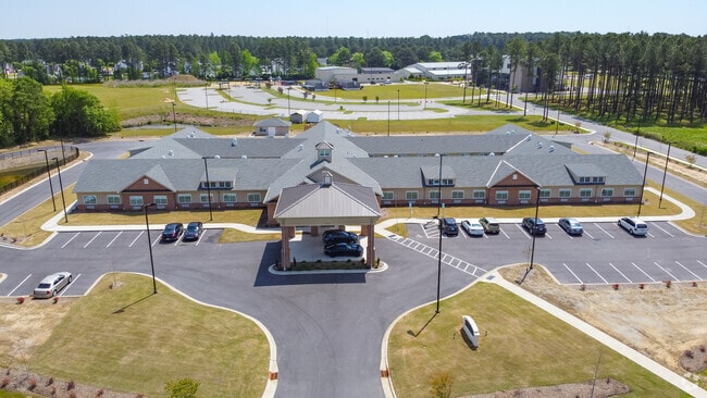
200 Kellie Dr
14075021W
OUT PARCEL 1 WOLFPACK INVESTORS 85/397
Continuumofcareseniorsfacility
Johnston
OFF
North Carolina
B and X Area of moderate flood hazard, usually the area between the limits of the 100-year and 500-year floods.
5 AC
2025
Johnston County
2025
Raleigh/Durham
040700
Raleigh-Cary, NC
30,368 SF
NEARBY LISTINGS FOR SALE OR LEASE
-
-
View all Smithfield listings for sale on LoopNet.com
DEMOGRAPHICS near 200 Kellie Dr
1 mile
3 mile
5 mile
2025 Total Population
2,189
19,497
35,713
2030 Population
2,476
21,892
40,033
Pop Growth 2025-2030
+ 13.11%
+ 12.28%
+ 12.10%
Average Age
43
40
40
2025 Total Households
882
7,478
13,392
HH Growth 2025-2030
+ 13.27%
+ 12.46%
+ 12.25%
Median Household Inc
$44,839
$42,366
$54,145
Avg Household Size
2.30
2.50
2.50
2025 Avg HH Vehicles
2.00
2.00
2.00
Median Home Value
$247,859
$207,390
$240,081
Median Year Built
1992
1978
1984
Nearby Places
Map Layers
Map Styles
 Street
 Aerial
Transit
 Traffic
 Biking
Places
Listings with unknown addresses are not visible on the map
- Restaurants
- Banks
- Shops
- Fitness
- Groceries
PUBLIC TRANSPORTATION
COMMUTER RAIL
Selma (Carolinian - Amtrak, Palmetto - Amtrak)
Drive
Walk
Distance
Selma (Carolinian - Amtrak, Palmetto - Amtrak)
7 min
3.7 mi
Freight Ports
Port of Wilmington
Drive
Walk
Distance
Port of Wilmington
138 min
110.9 mi
Nearby Properties
Address
Land Use
TOTAL SIZE
Lot Size
Zoning
Address
Land Use
TOTAL SIZE
Lot Size
Zoning
59,114 SF
100.50 AC
OFF
Address
Land Use
TOTAL SIZE
Lot Size
Zoning
202,660 SF
90.41 AC
IND
Address
Land Use
TOTAL SIZE
Lot Size
Zoning
16.84 AC
OFF
Address
Land Use
TOTAL SIZE
Lot Size
Zoning
118,710 SF
34.77 AC
OFF
Address
Land Use
TOTAL SIZE
Lot Size
Zoning
158,778 SF
35.88 AC
OFF
Address
Land Use
TOTAL SIZE
Lot Size
Zoning
85,041 SF
35.02 AC
SUP
Address
Land Use
TOTAL SIZE
Lot Size
Zoning
45,000 SF
99.14 AC
IND
Address
Land Use
TOTAL SIZE
Lot Size
Zoning
71,860 SF
1.28 AC
OFF
Address
Land Use
TOTAL SIZE
Lot Size
Zoning
697,252 SF
114.71 AC
IND
Address
Land Use
TOTAL SIZE
Lot Size
Zoning
6,440 SF
16.82 AC
RES
Address
Land Use
TOTAL SIZE
Lot Size
Zoning
95,952 SF
0.34 AC
OFF
Address
Land Use
TOTAL SIZE
Lot Size
Zoning
197,722 SF
25.55 AC
COM
Address
Land Use
TOTAL SIZE
Lot Size
Zoning
79,034 SF
30 AC
OFF
Address
Land Use
TOTAL SIZE
Lot Size
Zoning
57,014 SF
15.03 AC
COM
Address
Land Use
TOTAL SIZE
Lot Size
Zoning
75,657 SF
15.30 AC
OFF
Address
Land Use
TOTAL SIZE
Lot Size
Zoning
24,830 SF
28.89 AC
OFF
Address
Land Use
TOTAL SIZE
Lot Size
Zoning
39,191 SF
7.46 AC
COM
Address
Land Use
TOTAL SIZE
Lot Size
Zoning
72,165 SF
24.21 AC
COM
Address
Land Use
TOTAL SIZE
Lot Size
Zoning
78,588 SF
7.99 AC
SUP
Address
Land Use
TOTAL SIZE
Lot Size
Zoning
102,276 SF
35 AC
RES
Address
Land Use
TOTAL SIZE
Lot Size
Zoning
64,134 SF
3.03 AC
COM
Address
Land Use
TOTAL SIZE
Lot Size
Zoning
120,872 SF
13.57 AC
COM
Address
Land Use
TOTAL SIZE
Lot Size
Zoning
26,980 SF
42.14 AC
OFF
Address
Land Use
TOTAL SIZE
Lot Size
Zoning
42,806 SF
1.99 AC
COM
Address
Land Use
TOTAL SIZE
Lot Size
Zoning
63,415 SF
5.45 AC
COM
Address
Land Use
TOTAL SIZE
Lot Size
Zoning
112,276 SF
10.57 AC
COM
Address
Land Use
TOTAL SIZE
Lot Size
Zoning
31,195 SF
10 AC
OFF
Address
Land Use
TOTAL SIZE
Lot Size
Zoning
50,350 SF
2.05 AC
COM
Address
Land Use
TOTAL SIZE
Lot Size
Zoning
30,370 SF
8.43 AC
COM
The World's #1 Commercial Real Estate Marketplace
Connect with us
© 2026 CoStar Group
The information above has been obtained from sources believed reliable. While we do not doubt its accuracy we have not verified it and make no guarantee, warranty or representation about it. It is your responsibility to independently confirm its accuracy and completeness. Any projections, opinions, assumptions, or estimates used are for example only and do not represent the current or future performance of the property. The value of this transaction to you depends on tax and other factors which should be evaluated by your tax, financial, and legal advisors. You and your advisors should conduct a careful, independent investigation of the property to determine to your satisfaction the suitability of the property for your needs.