Property Record
200 Kentuck Rd, Danville, VA 24540
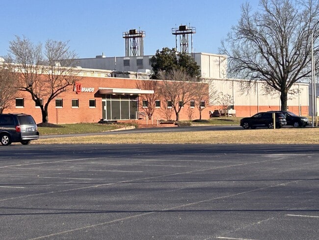
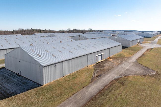
Property Detail
200 Kentuck Rd
73503
.337 AC NO 3 KENTUCK RD
Realpropertynec
Danville City
MANUFACTUR
Virginia
B and X Area of moderate flood hazard, usually the area between the limits of the 100-year and 500-year floods.
135.71 AC
2025
Virginia South Central
2025
Other Market Areas
000100
Danville, VA
485,973 SF
NEARBY LISTINGS FOR SALE OR LEASE
DEMOGRAPHICS near 200 Kentuck Rd
1 mile
3 mile
5 mile
2025 Total Population
712
9,689
36,423
2030 Population
688
9,689
36,290
Pop Growth 2025-2030
(3.37%)
0.00%
(0.37%)
Average Age
44
42
43
2025 Total Households
358
4,175
16,113
HH Growth 2025-2030
(3.63%)
(0.10%)
(0.38%)
Median Household Inc
$39,166
$34,053
$41,750
Avg Household Size
2.00
2.20
2.10
2025 Avg HH Vehicles
2.00
2.00
2.00
Median Home Value
$115,625
$84,706
$118,768
Median Year Built
1973
1964
1964
Nearby Places
Map Layers
Map Styles
 Street
 Aerial
Layers
 Traffic
 Biking
Places
Listings with unknown addresses are not visible on the map
- Restaurants
- Banks
- Shops
- Fitness
- Groceries
PUBLIC TRANSPORTATION
COMMUTER RAIL
Danville Amtrak Station (Crescent - Amtrak)
Drive
Walk
Distance
Danville Amtrak Station (Crescent - Amtrak)
8 min
4.8 mi
Freight Ports
Virginia Port Authority - Richmond
Drive
Walk
Distance
Virginia Port Authority - Richmond
182 min
139.4 mi
SALE & LEASE HISTORY
LISTING DATE
SALE/LEASE

May 21, 2024
For Sale
Jan 08, 2025
For Sale
Nearby Properties
Address
Land Use
TOTAL SIZE
Lot Size
Zoning
Address
Land Use
TOTAL SIZE
Lot Size
Zoning
87.04 AC
M-1
Address
Land Use
TOTAL SIZE
Lot Size
Zoning
23.16 AC
M-1
Address
Land Use
TOTAL SIZE
Lot Size
Zoning
1,440 SF
75.14 AC
LIGHT ECON
Address
Land Use
TOTAL SIZE
Lot Size
Zoning
66,846 SF
22.99 AC
CYBER PARK
Address
Land Use
TOTAL SIZE
Lot Size
Zoning
23.30 AC
M-1
Address
Land Use
TOTAL SIZE
Lot Size
Zoning
7,554 SF
961.50 AC
LIGHT ECON
Address
Land Use
TOTAL SIZE
Lot Size
Zoning
2,421 SF
14.29 AC
LIGHT ECON
Address
Land Use
TOTAL SIZE
Lot Size
Zoning
833,039 SF
66.18 AC
MANUFACTUR
Address
Land Use
TOTAL SIZE
Lot Size
Zoning
205,652 SF
7.13 AC
LIGHT ECON
Address
Land Use
TOTAL SIZE
Lot Size
Zoning
312,528 SF
23.32 AC
M-1
Address
Land Use
TOTAL SIZE
Lot Size
Zoning
93,442 SF
11.94 AC
CYBER PARK
Address
Land Use
TOTAL SIZE
Lot Size
Zoning
241,200 SF
55.54 AC
M-1
Address
Land Use
TOTAL SIZE
Lot Size
Zoning
66,954 SF
17.70 AC
TOBACCO WA
Address
Land Use
TOTAL SIZE
Lot Size
Zoning
420 SF
40.78 AC
LIGHT ECON
Address
Land Use
TOTAL SIZE
Lot Size
Zoning
51.53 AC
M-1
Address
Land Use
TOTAL SIZE
Lot Size
Zoning
6,664 SF
102.20 AC
MANUFACTUR
Address
Land Use
TOTAL SIZE
Lot Size
Zoning
162 SF
87 AC
HIGHWAY RE
Address
Land Use
TOTAL SIZE
Lot Size
Zoning
25.05 AC
M-2
Address
Land Use
TOTAL SIZE
Lot Size
Zoning
77,004 SF
22.58 AC
THRESHOLD
Address
Land Use
TOTAL SIZE
Lot Size
Zoning
42,244 SF
6.10 AC
MULTI-FAMI
Address
Land Use
TOTAL SIZE
Lot Size
Zoning
62,336 SF
16.65 AC
CYBER PARK
Address
Land Use
TOTAL SIZE
Lot Size
Zoning
85,041 SF
10 AC
CYBER PARK
Address
Land Use
TOTAL SIZE
Lot Size
Zoning
301,800 SF
41.47 AC
LIGHT ECON
Address
Land Use
TOTAL SIZE
Lot Size
Zoning
150,000 SF
23.41 AC
M-1
Address
Land Use
TOTAL SIZE
Lot Size
Zoning
123.22 AC
M-2
Address
Land Use
TOTAL SIZE
Lot Size
Zoning
92,090 SF
3.13 AC
HIGHWAY RE
Address
Land Use
TOTAL SIZE
Lot Size
Zoning
50,652 SF
9.76 AC
LIGHT ECON
Address
Land Use
TOTAL SIZE
Lot Size
Zoning
67,940 SF
20.53 AC
M-1
The World's #1 Commercial Real Estate Marketplace
Connect with us
© 2026 CoStar Group
The information above has been obtained from sources believed reliable. While we do not doubt its accuracy we have not verified it and make no guarantee, warranty or representation about it. It is your responsibility to independently confirm its accuracy and completeness. Any projections, opinions, assumptions, or estimates used are for example only and do not represent the current or future performance of the property. The value of this transaction to you depends on tax and other factors which should be evaluated by your tax, financial, and legal advisors. You and your advisors should conduct a careful, independent investigation of the property to determine to your satisfaction the suitability of the property for your needs.