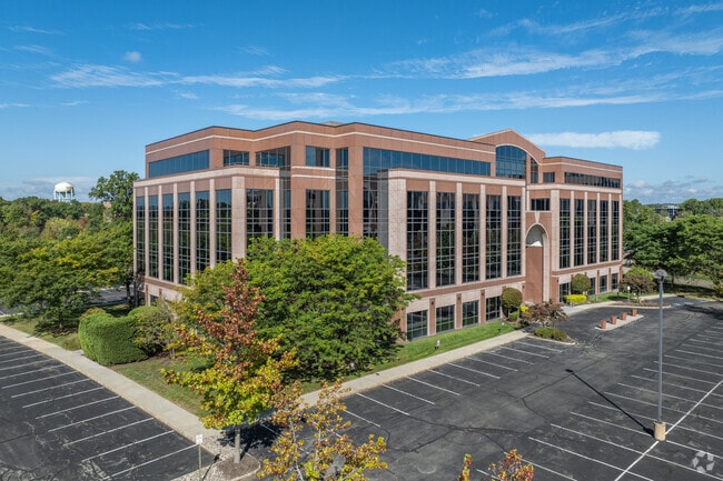
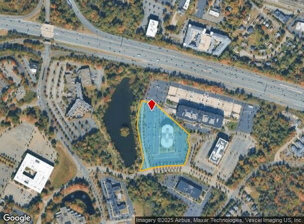
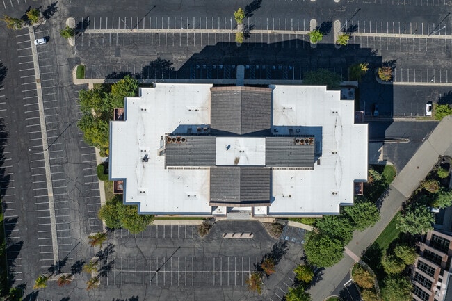
Property Record
200 Kimball Dr, Parsippany, NJ 07054
NEARBY LISTINGS FOR SALE OR LEASE
Property Detail
200 Kimball Dr
Northern New Jersey
Mazdabrook Farms Sec 2
Newark, NJ-PA
INCL BLK 735 LOTS 1-04 1-06 & BLK 735-02 LOT 4
29-00735-0000-00001-04
Morris
Commercialnec
New Jersey
2024
1.4
2025
8.20 AC
041803
Parsippany
DEMOGRAPHICS near 200 Kimball Dr
1 Mile
3 Mile
5 Mile
2024 Total Population
13,348
57,183
140,126
2029 Population
13,564
57,217
140,436
Pop Growth 2024-2029
+ 1.62%
+ 0.06%
+ 0.22%
Average Age
40
42
43
2024 Total Households
5,676
21,419
52,803
HH Growth 2024-2029
+ 1.90%
+ 0.10%
+ 0.27%
Median Household Inc
$99,540
$110,983
$122,518
Avg Household Size
2.30
2.60
2.60
2024 Avg HH Vehicles
2.00
2.00
2.00
Median Home Value
$635,262
$539,394
$576,636
Median Year Built
1974
1967
1969
Nearby Places
Map Layers
Map Styles
 Street
 Aerial
- Restaurants
- Banks
- Shops
- Fitness
- Groceries
PUBLIC TRANSPORTATION
COMMUTER RAIL
Mountain Lakes (Montclair-Boonton Line - NJ Transit Commuter Rail (NJ Transit))
DRIVE
WALK
Distance
Mountain Lakes (Montclair-Boonton Line - NJ Transit Commuter Rail (NJ Transit))
8 min
3.2 mi
Boonton (Montclair-Boonton Line - NJ Transit Commuter Rail (NJ Transit))
DRIVE
WALK
Distance
Boonton (Montclair-Boonton Line - NJ Transit Commuter Rail (NJ Transit))
7 min
4.1 mi
AIRPORT
Newark Liberty International
DRIVE
WALK
Distance
Newark Liberty International
34 min
25.5 mi
LaGuardia
DRIVE
WALK
Distance
LaGuardia
53 min
39.2 mi
Freight Ports
Maher Terminal
DRIVE
WALK
Distance
Maher Terminal
36 min
26.0 mi
SALE & LEASE HISTORY
LISTING DATE
SALE/LEASE

Sep 25, 2016
For Lease
Mar 12, 2024
For Sale
Dec 30, 2022
For Sale
Nearby Properties
Address
Land Use
TOTAL SIZE
Lot Size
Zoning
Address
Land Use
TOTAL SIZE
Lot Size
Zoning
48.76 AC
OBRL
Address
Land Use
TOTAL SIZE
Lot Size
Zoning
577,851 SF
35.90 AC
SD5A
Address
Land Use
TOTAL SIZE
Lot Size
Zoning
11,353 SF
9.29 AC
COD
Address
Land Use
TOTAL SIZE
Lot Size
Zoning
46.46 AC
B-3
Address
Land Use
TOTAL SIZE
Lot Size
Zoning
114,267 SF
27.26 AC
SED5
Address
Land Use
TOTAL SIZE
Lot Size
Zoning
257,220 SF
30.83 AC
SED5
Address
Land Use
TOTAL SIZE
Lot Size
Zoning
4.94 AC
OLV
Address
Land Use
TOTAL SIZE
Lot Size
Zoning
3.86 AC
O-3
Address
Land Use
TOTAL SIZE
Lot Size
Zoning
32.61 AC
R-5
Address
Land Use
TOTAL SIZE
Lot Size
Zoning
377,114 SF
40.64 AC
SD10
Address
Land Use
TOTAL SIZE
Lot Size
Zoning
58.20 AC
I
Address
Land Use
TOTAL SIZE
Lot Size
Zoning
Address
Land Use
TOTAL SIZE
Lot Size
Zoning
203,590 SF
24.98 AC
SD10
Address
Land Use
TOTAL SIZE
Lot Size
Zoning
11.80 AC
I/B
Address
Land Use
TOTAL SIZE
Lot Size
Zoning
13.45 AC
IP
Address
Land Use
TOTAL SIZE
Lot Size
Zoning
201,648 SF
19.35 AC
B-1
Address
Land Use
TOTAL SIZE
Lot Size
Zoning
16.01 AC
R-C
Address
Land Use
TOTAL SIZE
Lot Size
Zoning
197,023 SF
22.08 AC
AHMU
Address
Land Use
TOTAL SIZE
Lot Size
Zoning
23.15 AC
SD10
Address
Land Use
TOTAL SIZE
Lot Size
Zoning
91,872 SF
31.16 AC
B-1
Address
Land Use
TOTAL SIZE
Lot Size
Zoning
1,440 SF
38.80 AC
I-2
Address
Land Use
TOTAL SIZE
Lot Size
Zoning
28.84 AC
OBDS
Address
Land Use
TOTAL SIZE
Lot Size
Zoning
333,991 SF
15.76 AC
SD10
Address
Land Use
TOTAL SIZE
Lot Size
Zoning
756 SF
16.46 AC
I
Address
Land Use
TOTAL SIZE
Lot Size
Zoning
374,691 SF
40.71 AC
SD10
Address
Land Use
TOTAL SIZE
Lot Size
Zoning
310,954 SF
22.99 AC
SED5
Address
Land Use
TOTAL SIZE
Lot Size
Zoning
23.01 AC
SD10
Address
Land Use
TOTAL SIZE
Lot Size
Zoning
217,502 SF
25 AC
SED5
Address
Land Use
TOTAL SIZE
Lot Size
Zoning
Address
Land Use
TOTAL SIZE
Lot Size
Zoning
26.65 AC
AHD7
The World's #1 Commercial Real Estate Marketplace
Connect with us
© 2025 CoStar Group
The information above has been obtained from sources believed reliable. While we do not doubt its accuracy we have not verified it and make no guarantee, warranty or representation about it. It is your responsibility to independently confirm its accuracy and completeness. Any projections, opinions, assumptions, or estimates used are for example only and do not represent the current or future performance of the property. The value of this transaction to you depends on tax and other factors which should be evaluated by your tax, financial, and legal advisors. You and your advisors should conduct a careful, independent investigation of the property to determine to your satisfaction the suitability of the property for your needs.