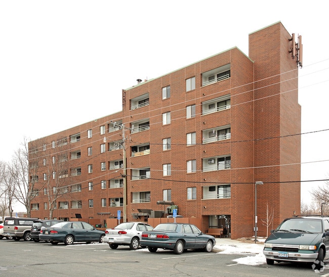
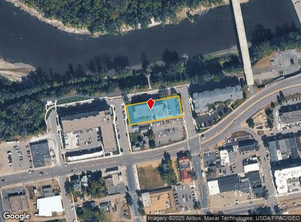
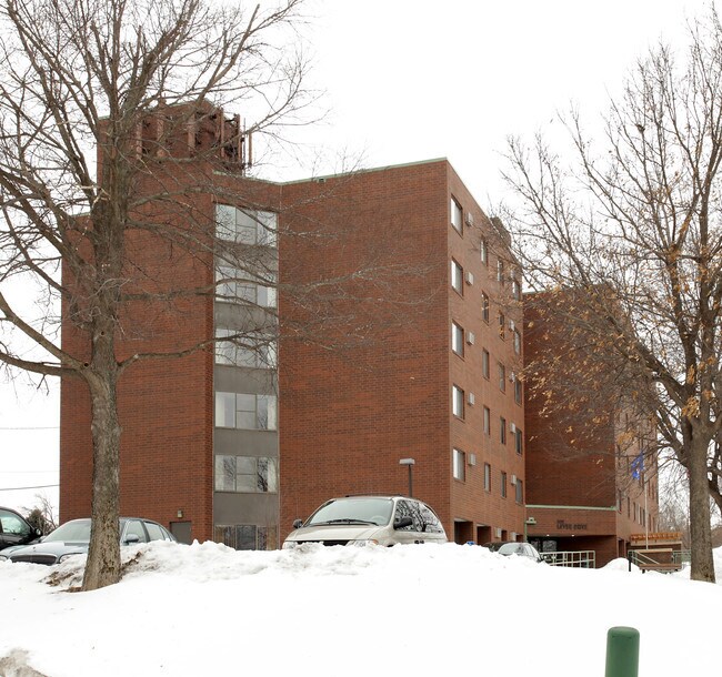
Property Record
200 Levee Dr W, Shakopee, MN 55379
NEARBY LISTINGS FOR SALE OR LEASE
-
-
View all Shakopee listings for sale on LoopNet.com
Property Detail
200 Levee Dr W
Minneapolis/St Paul
City Of Shakopee
Minneapolis-St. Paul-Bloomington, MN-WI
CITY OF SHAKOPEE LOT 006 BLOCK 006 & LOTS 7-10 EX N 30'
27-001-075-0
Scott
Welfaresocialservicelowincomehousingexempt
Minnesota
2025
6
2025
0.77 AC
080500
Scott Far Western Suburbs
27,779 SF
DEMOGRAPHICS near 200 Levee Dr W
1 Mile
3 Mile
5 Mile
2024 Total Population
6,380
45,830
100,963
2029 Population
6,817
48,845
106,691
Pop Growth 2024-2029
+ 6.85%
+ 6.58%
+ 5.67%
Average Age
41
38
39
2024 Total Households
2,424
16,170
36,668
HH Growth 2024-2029
+ 7.51%
+ 6.94%
+ 5.89%
Median Household Inc
$57,418
$92,756
$100,942
Avg Household Size
2.30
2.70
2.70
2024 Avg HH Vehicles
2.00
2.00
2.00
Median Home Value
$257,061
$317,802
$370,334
Median Year Built
1977
1995
1994
Nearby Places
Map Layers
Map Styles
 Street
 Aerial
- Restaurants
- Banks
- Shops
- Fitness
- Groceries
PUBLIC TRANSPORTATION
AIRPORT
Minneapolis-St Paul International/Wold-Chamberlain
DRIVE
WALK
Distance
Minneapolis-St Paul International/Wold-Chamberlain
32 min
21.5 mi
Nearby Properties
Address
Land Use
TOTAL SIZE
Lot Size
Zoning
Address
Land Use
TOTAL SIZE
Lot Size
Zoning
625,426 SF
40.47 AC
Address
Land Use
TOTAL SIZE
Lot Size
Zoning
66.08 AC
Address
Land Use
TOTAL SIZE
Lot Size
Zoning
475,471 SF
12.90 AC
Address
Land Use
TOTAL SIZE
Lot Size
Zoning
10.02 AC
Address
Land Use
TOTAL SIZE
Lot Size
Zoning
151,074 SF
17.27 AC
Address
Land Use
TOTAL SIZE
Lot Size
Zoning
33.02 AC
Address
Land Use
TOTAL SIZE
Lot Size
Zoning
Address
Land Use
TOTAL SIZE
Lot Size
Zoning
600,000 SF
31.21 AC
Address
Land Use
TOTAL SIZE
Lot Size
Zoning
397,347 SF
28.62 AC
Address
Land Use
TOTAL SIZE
Lot Size
Zoning
374,700 SF
24.09 AC
Address
Land Use
TOTAL SIZE
Lot Size
Zoning
16.08 AC
Address
Land Use
TOTAL SIZE
Lot Size
Zoning
Address
Land Use
TOTAL SIZE
Lot Size
Zoning
51,272 SF
2.11 AC
Address
Land Use
TOTAL SIZE
Lot Size
Zoning
1.80 AC
Address
Land Use
TOTAL SIZE
Lot Size
Zoning
164,809 SF
7.28 AC
Address
Land Use
TOTAL SIZE
Lot Size
Zoning
198,754 SF
27.50 AC
Address
Land Use
TOTAL SIZE
Lot Size
Zoning
52,280 SF
12.15 AC
Address
Land Use
TOTAL SIZE
Lot Size
Zoning
302,500 SF
23.79 AC
Address
Land Use
TOTAL SIZE
Lot Size
Zoning
Address
Land Use
TOTAL SIZE
Lot Size
Zoning
26.05 AC
Address
Land Use
TOTAL SIZE
Lot Size
Zoning
191,395 SF
5.16 AC
Address
Land Use
TOTAL SIZE
Lot Size
Zoning
73,937 SF
23.89 AC
Address
Land Use
TOTAL SIZE
Lot Size
Zoning
109,720 SF
10.65 AC
Address
Land Use
TOTAL SIZE
Lot Size
Zoning
242,004 SF
16.54 AC
Address
Land Use
TOTAL SIZE
Lot Size
Zoning
231,842 SF
21.61 AC
Address
Land Use
TOTAL SIZE
Lot Size
Zoning
138,865 SF
12.55 AC
Address
Land Use
TOTAL SIZE
Lot Size
Zoning
131,154 SF
21.76 AC
Address
Land Use
TOTAL SIZE
Lot Size
Zoning
39.80 AC
Address
Land Use
TOTAL SIZE
Lot Size
Zoning
176,648 SF
12.97 AC
Address
Land Use
TOTAL SIZE
Lot Size
Zoning
79,582 SF
4.86 AC
The World's #1 Commercial Real Estate Marketplace
Connect with us
© 2025 CoStar Group
The information above has been obtained from sources believed reliable. While we do not doubt its accuracy we have not verified it and make no guarantee, warranty or representation about it. It is your responsibility to independently confirm its accuracy and completeness. Any projections, opinions, assumptions, or estimates used are for example only and do not represent the current or future performance of the property. The value of this transaction to you depends on tax and other factors which should be evaluated by your tax, financial, and legal advisors. You and your advisors should conduct a careful, independent investigation of the property to determine to your satisfaction the suitability of the property for your needs.