Property Record
200 Macarthur Blvd, Grand Prairie, TX 75050
NEARBY LISTINGS FOR SALE OR LEASE
Property Detail
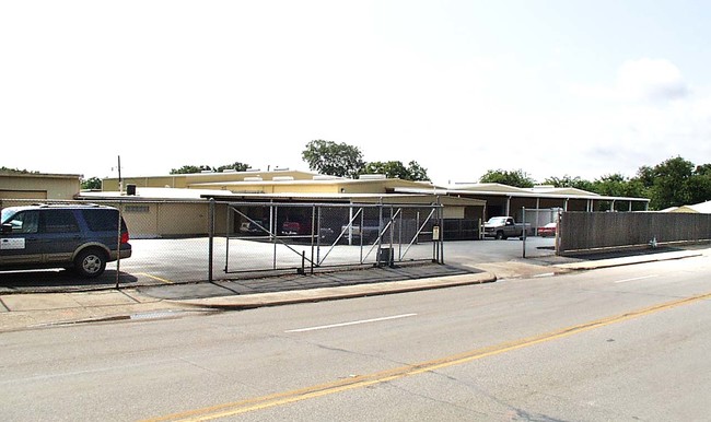
200 Macarthur Blvd
Dallas-Fort Worth-Arlington, TX
Burbank Gardens Rep
280155000314RHS00
BURBANK GARDENS REP LOT 314R ACS 1.6632 INT201400062731 DD03172014 CO-DC 0155000314R00 5CP01550003
Commercialnec
Dallas
X
Texas
48113C0315L
314r
2024
0.37 AC
2025
Western Lonestar/Tpke
021200
Dallas/Ft Worth
4,649 SF
DEMOGRAPHICS near 200 Macarthur Blvd
1 Mile
3 Mile
5 Mile
2024 Total Population
4,527
40,925
195,814
2029 Population
4,473
40,142
193,808
Pop Growth 2024-2029
(1.19%)
(1.91%)
(1.02%)
Average Age
35
34
35
2024 Total Households
1,154
12,079
59,867
HH Growth 2024-2029
(1.39%)
(2.24%)
(1.24%)
Median Household Inc
$56,174
$52,158
$55,413
Avg Household Size
3.50
3.30
3.20
2024 Avg HH Vehicles
2.00
2.00
2.00
Median Home Value
$167,164
$169,865
$178,192
Median Year Built
1956
1970
1973
Nearby Places
Map Layers
Map Styles
 Street
 Aerial
- Restaurants
- Banks
- Shops
- Fitness
- Groceries
PUBLIC TRANSPORTATION
COMMUTER RAIL
Downtown Irving/Heritage Crossing Station (TRINITY RAILWAY - Dallas Area Rapid Transit (DART), Trinity Railway Express - Dallas Area Rapid Transit (DART))
DRIVE
WALK
Distance
Downtown Irving/Heritage Crossing Station (TRINITY RAILWAY - Dallas Area Rapid Transit (DART), Trinity Railway Express - Dallas Area Rapid Transit (DART))
11 min
5.1 mi
West Irving (TRINITY RAILWAY - Dallas Area Rapid Transit (DART), Trinity Railway Express - Dallas Area Rapid Transit (DART))
DRIVE
WALK
Distance
West Irving (TRINITY RAILWAY - Dallas Area Rapid Transit (DART), Trinity Railway Express - Dallas Area Rapid Transit (DART))
14 min
7.7 mi
AIRPORT
Dallas Love Field
DRIVE
WALK
Distance
Dallas Love Field
24 min
12.7 mi
Dallas-Fort Worth International
DRIVE
WALK
Distance
Dallas-Fort Worth International
23 min
16.3 mi
Freight Ports
Port of Shreveport
DRIVE
WALK
Distance
Port of Shreveport
224 min
206.8 mi
Nearby Properties
Address
Land Use
TOTAL SIZE
Lot Size
Zoning
Address
Land Use
TOTAL SIZE
Lot Size
Zoning
2,395,314 SF
152.04 AC
Address
Land Use
TOTAL SIZE
Lot Size
Zoning
459,985 SF
179.23 AC
Z06
Address
Land Use
TOTAL SIZE
Lot Size
Zoning
1,080,000 SF
51.04 AC
Z123
Address
Land Use
TOTAL SIZE
Lot Size
Zoning
703,500 SF
47.38 AC
Z236
Address
Land Use
TOTAL SIZE
Lot Size
Zoning
496,283 SF
246.29 AC
Z236
Address
Land Use
TOTAL SIZE
Lot Size
Zoning
680,900 SF
32.25 AC
Z236
Address
Land Use
TOTAL SIZE
Lot Size
Zoning
334,057 SF
20.05 AC
Z312
Address
Land Use
TOTAL SIZE
Lot Size
Zoning
755,355 SF
40.84 AC
Z123
Address
Land Use
TOTAL SIZE
Lot Size
Zoning
531,072 SF
26.50 AC
Z236
Address
Land Use
TOTAL SIZE
Lot Size
Zoning
264,010 SF
34.50 AC
Z190
Address
Land Use
TOTAL SIZE
Lot Size
Zoning
641,780 SF
34.38 AC
Z236
Address
Land Use
TOTAL SIZE
Lot Size
Zoning
197,000 SF
25.51 AC
Z236
Address
Land Use
TOTAL SIZE
Lot Size
Zoning
602,000 SF
72.59 AC
Z123
Address
Land Use
TOTAL SIZE
Lot Size
Zoning
324,320 SF
17.30 AC
Z164
Address
Land Use
TOTAL SIZE
Lot Size
Zoning
392,220 SF
24.55 AC
Z102
Address
Land Use
TOTAL SIZE
Lot Size
Zoning
239,304 SF
16.27 AC
Z164
Address
Land Use
TOTAL SIZE
Lot Size
Zoning
315,000 SF
16.30 AC
Z236
Address
Land Use
TOTAL SIZE
Lot Size
Zoning
310,047 SF
16.40 AC
Z236
Address
Land Use
TOTAL SIZE
Lot Size
Zoning
344,400 SF
17.35 AC
Z236
Address
Land Use
TOTAL SIZE
Lot Size
Zoning
119,174 SF
11.72 AC
Address
Land Use
TOTAL SIZE
Lot Size
Zoning
322,215 SF
19.77 AC
Z236
Address
Land Use
TOTAL SIZE
Lot Size
Zoning
245,800 SF
12.59 AC
Address
Land Use
TOTAL SIZE
Lot Size
Zoning
299,500 SF
15.08 AC
Z236
Address
Land Use
TOTAL SIZE
Lot Size
Zoning
233,740 SF
11.82 AC
Z190
Address
Land Use
TOTAL SIZE
Lot Size
Zoning
194,878 SF
13 AC
Z298
Address
Land Use
TOTAL SIZE
Lot Size
Zoning
263,748 SF
14.71 AC
Z164
Address
Land Use
TOTAL SIZE
Lot Size
Zoning
205,440 SF
12.88 AC
Z236
Address
Land Use
TOTAL SIZE
Lot Size
Zoning
284,144 SF
14.96 AC
Z123
Address
Land Use
TOTAL SIZE
Lot Size
Zoning
123,744 SF
7.40 AC
Z97
Address
Land Use
TOTAL SIZE
Lot Size
Zoning
189,690 SF
11.18 AC
Z236
The World's #1 Commercial Real Estate Marketplace
Connect with us
© 2025 CoStar Group
The information above has been obtained from sources believed reliable. While we do not doubt its accuracy we have not verified it and make no guarantee, warranty or representation about it. It is your responsibility to independently confirm its accuracy and completeness. Any projections, opinions, assumptions, or estimates used are for example only and do not represent the current or future performance of the property. The value of this transaction to you depends on tax and other factors which should be evaluated by your tax, financial, and legal advisors. You and your advisors should conduct a careful, independent investigation of the property to determine to your satisfaction the suitability of the property for your needs.