Property Record
200 Main St, Menasha, WI 54952
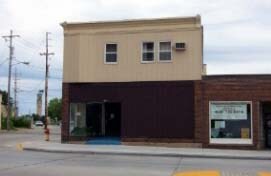

Property Detail
200 Main St
10-0442-0000
PLAT OF NORTH NEENAH LOT 1 BLK 3
Commercialnec
Winnebago
C1
Wisconsin
B and X Area of moderate flood hazard, usually the area between the limits of the 100-year and 500-year floods.
1
0
0.08 AC
2025
Appleton/Oshkosh
002900
Other Market Areas
8,200 SF
Oshkosh-Neenah, WI
NEARBY LISTINGS FOR SALE OR LEASE
DEMOGRAPHICS near 200 Main St
1 mile
3 mile
5 mile
2025 Total Population
9,391
46,904
83,078
2030 Population
9,523
47,308
84,072
Pop Growth 2025-2030
+ 1.41%
+ 0.86%
+ 1.20%
Average Age
39
40
40
2025 Total Households
4,112
20,006
35,250
HH Growth 2025-2030
+ 1.26%
+ 0.82%
+ 1.13%
Median Household Inc
$66,156
$71,467
$74,414
Avg Household Size
2.20
2.30
2.30
2025 Avg HH Vehicles
2.00
2.00
2.00
Median Home Value
$159,596
$196,720
$233,370
Median Year Built
1951
1968
1975
Nearby Places
Map Layers
Map Styles
 Street
 Aerial
Layers
 Traffic
 Biking
Places
Listings with unknown addresses are not visible on the map
- Restaurants
- Banks
- Shops
- Fitness
- Groceries
PUBLIC TRANSPORTATION
AIRPORT
Appleton International
Drive
Walk
Distance
Appleton International
14 min
7.6 mi
Green Bay/Austin Straubel International
Drive
Walk
Distance
Green Bay/Austin Straubel International
42 min
32.6 mi
Freight Ports
Port Milwaukee
Drive
Walk
Distance
Port Milwaukee
121 min
103.1 mi
Nearby Properties
Address
Land Use
TOTAL SIZE
Lot Size
Zoning
Address
Land Use
TOTAL SIZE
Lot Size
Zoning
120.73 AC
M2
Address
Land Use
TOTAL SIZE
Lot Size
Zoning
8.61 AC
R5
Address
Land Use
TOTAL SIZE
Lot Size
Zoning
11.99 AC
Address
Land Use
TOTAL SIZE
Lot Size
Zoning
11.22 AC
Address
Land Use
TOTAL SIZE
Lot Size
Zoning
9.40 AC
Address
Land Use
TOTAL SIZE
Lot Size
Zoning
11,340 SF
0.92 AC
C2
Address
Land Use
TOTAL SIZE
Lot Size
Zoning
178,750 SF
C2
Address
Land Use
TOTAL SIZE
Lot Size
Zoning
59,584 SF
12.11 AC
C1
Address
Land Use
TOTAL SIZE
Lot Size
Zoning
103,427 SF
PDD
Address
Land Use
TOTAL SIZE
Lot Size
Zoning
89,042 SF
2.83 AC
C2
Address
Land Use
TOTAL SIZE
Lot Size
Zoning
89,576 SF
1.03 AC
C2
Address
Land Use
TOTAL SIZE
Lot Size
Zoning
105,852 SF
0.39 AC
PDD
Address
Land Use
TOTAL SIZE
Lot Size
Zoning
15.73 AC
B5
Address
Land Use
TOTAL SIZE
Lot Size
Zoning
67.41 AC
I2
Address
Land Use
TOTAL SIZE
Lot Size
Zoning
86,455 SF
PDD
Address
Land Use
TOTAL SIZE
Lot Size
Zoning
4.33 AC
Address
Land Use
TOTAL SIZE
Lot Size
Zoning
210,214 SF
16.44 AC
I1
Address
Land Use
TOTAL SIZE
Lot Size
Zoning
361,899 SF
18.54 AC
I2
Address
Land Use
TOTAL SIZE
Lot Size
Zoning
20.92 AC
R5
Address
Land Use
TOTAL SIZE
Lot Size
Zoning
25.62 AC
I2
Address
Land Use
TOTAL SIZE
Lot Size
Zoning
20,874 SF
11.57 AC
R4
Address
Land Use
TOTAL SIZE
Lot Size
Zoning
7.29 AC
Address
Land Use
TOTAL SIZE
Lot Size
Zoning
115,151 SF
11.71 AC
PDD
Address
Land Use
TOTAL SIZE
Lot Size
Zoning
139,871 SF
11.14 AC
C1
Address
Land Use
TOTAL SIZE
Lot Size
Zoning
74,603 SF
4.96 AC
I1
Address
Land Use
TOTAL SIZE
Lot Size
Zoning
78,268 SF
7.80 AC
C3
Address
Land Use
TOTAL SIZE
Lot Size
Zoning
145,322 SF
11.20 AC
PDD
Address
Land Use
TOTAL SIZE
Lot Size
Zoning
18.18 AC
I1
Address
Land Use
TOTAL SIZE
Lot Size
Zoning
10.13 AC
M2
Address
Land Use
TOTAL SIZE
Lot Size
Zoning
11.77 AC
R5
The World's #1 Commercial Real Estate Marketplace
Connect with us
© 2026 CoStar Group
The information above has been obtained from sources believed reliable. While we do not doubt its accuracy we have not verified it and make no guarantee, warranty or representation about it. It is your responsibility to independently confirm its accuracy and completeness. Any projections, opinions, assumptions, or estimates used are for example only and do not represent the current or future performance of the property. The value of this transaction to you depends on tax and other factors which should be evaluated by your tax, financial, and legal advisors. You and your advisors should conduct a careful, independent investigation of the property to determine to your satisfaction the suitability of the property for your needs.