Property Record
200 Maple Ave, Metuchen, NJ 08840


Save to a Folder
{{folder.Name}}
{{folder.ListingIds.length}} Properties
{{folder.ListingIds.length}} Property
Create a New Folder
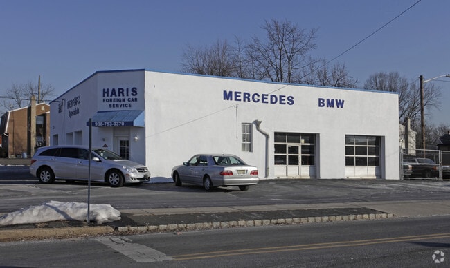
Property Detail
200 Maple Ave
Lakewood-New Brunswick, NJ
50X130EL
22-00265-0000-00019
Middlesex
Commercialnec
New Jersey
HDD
19
B and X Area of moderate flood hazard, usually the area between the limits of the 100-year and 500-year floods.
0.15 AC
2025
Route 287 East
2026
Northern New Jersey
000902
NEARBY LISTINGS FOR SALE OR LEASE
DEMOGRAPHICS near 200 Maple Ave
1 mile
3 mile
5 mile
2025 Total Population
12,554
137,747
337,622
2030 Population
13,025
143,434
351,556
Pop Growth 2025-2030
+ 3.75%
+ 4.13%
+ 4.13%
Average Age
42
39
40
2025 Total Households
4,214
43,984
110,329
HH Growth 2025-2030
+ 3.89%
+ 4.32%
+ 4.34%
Median Household Inc
$120,249
$108,787
$119,426
Avg Household Size
2.90
3.00
2.90
2025 Avg HH Vehicles
2.00
2.00
2.00
Median Home Value
$463,223
$474,618
$497,049
Median Year Built
1959
1964
1965
Nearby Places
Map Layers
Map Styles
 Street
 Aerial
Layers
 Traffic
 Biking
Places
Listings with unknown addresses are not visible on the map
- Restaurants
- Banks
- Shops
- Fitness
- Groceries
PUBLIC TRANSPORTATION
COMMUTER RAIL
Metuchen (Northeast Corridor - NJ TRANSIT RAIL)
Drive
Walk
Distance
Metuchen (Northeast Corridor - NJ TRANSIT RAIL)
1 min
11 min
0.6 mi
Metropark Amtrak Station (Acela - Amtrak, Crescent - Amtrak, Keystone Service - Amtrak, Palmetto - Amtrak, Vermonter - Amtrak)
Drive
Walk
Distance
Metropark Amtrak Station (Acela - Amtrak, Crescent - Amtrak, Keystone Service - Amtrak, Palmetto - Amtrak, Vermonter - Amtrak)
6 min
2.6 mi
AIRPORT
Newark Liberty International
Drive
Walk
Distance
Newark Liberty International
27 min
20.1 mi
Freight Ports
New York Container Terminal
Drive
Walk
Distance
New York Container Terminal
26 min
15.3 mi
SALE & LEASE HISTORY
LISTING DATE
SALE/LEASE

Oct 26, 2022
For Sale
Jul 03, 2023
For Lease
Nearby Properties
Address
Land Use
TOTAL SIZE
Lot Size
Zoning
Address
Land Use
TOTAL SIZE
Lot Size
Zoning
37.46 AC
EI
Address
Land Use
TOTAL SIZE
Lot Size
Zoning
65.84 AC
PB
Address
Land Use
TOTAL SIZE
Lot Size
Zoning
165.43 AC
EI
Address
Land Use
TOTAL SIZE
Lot Size
Zoning
80,000 SF
23.37 AC
R50
Address
Land Use
TOTAL SIZE
Lot Size
Zoning
147.45 AC
RRRD
Address
Land Use
TOTAL SIZE
Lot Size
Zoning
137.89 AC
RAA
Address
Land Use
TOTAL SIZE
Lot Size
Zoning
49.83 AC
LI
Address
Land Use
TOTAL SIZE
Lot Size
Zoning
55.57 AC
LI
Address
Land Use
TOTAL SIZE
Lot Size
Zoning
40.78 AC
RRRD
Address
Land Use
TOTAL SIZE
Lot Size
Zoning
96.22 AC
RA
Address
Land Use
TOTAL SIZE
Lot Size
Zoning
Address
Land Use
TOTAL SIZE
Lot Size
Zoning
30.84 AC
LR
Address
Land Use
TOTAL SIZE
Lot Size
Zoning
35.98 AC
LI
Address
Land Use
TOTAL SIZE
Lot Size
Zoning
34.14 AC
LR
Address
Land Use
TOTAL SIZE
Lot Size
Zoning
191.81 AC
R75
Address
Land Use
TOTAL SIZE
Lot Size
Zoning
3.18 AC
Address
Land Use
TOTAL SIZE
Lot Size
Zoning
162.66 AC
LI
Address
Land Use
TOTAL SIZE
Lot Size
Zoning
53.95 AC
RRRD
Address
Land Use
TOTAL SIZE
Lot Size
Zoning
164.79 AC
LI
Address
Land Use
TOTAL SIZE
Lot Size
Zoning
23.32 AC
RBTH
Address
Land Use
TOTAL SIZE
Lot Size
Zoning
43.63 AC
MF
Address
Land Use
TOTAL SIZE
Lot Size
Zoning
5.83 AC
RO
Address
Land Use
TOTAL SIZE
Lot Size
Zoning
25 AC
LR
Address
Land Use
TOTAL SIZE
Lot Size
Zoning
26.07 AC
LR
Address
Land Use
TOTAL SIZE
Lot Size
Zoning
19.50 AC
LR
Address
Land Use
TOTAL SIZE
Lot Size
Zoning
50 AC
LI
Address
Land Use
TOTAL SIZE
Lot Size
Zoning
6.10 AC
RO
Address
Land Use
TOTAL SIZE
Lot Size
Zoning
22.50 AC
LR
Address
Land Use
TOTAL SIZE
Lot Size
Zoning
44.51 AC
M3
Address
Land Use
TOTAL SIZE
Lot Size
Zoning
26.50 AC
LR
The World's #1 Commercial Real Estate Marketplace
Connect with us
© 2026 CoStar Group
The information above has been obtained from sources believed reliable. While we do not doubt its accuracy we have not verified it and make no guarantee, warranty or representation about it. It is your responsibility to independently confirm its accuracy and completeness. Any projections, opinions, assumptions, or estimates used are for example only and do not represent the current or future performance of the property. The value of this transaction to you depends on tax and other factors which should be evaluated by your tax, financial, and legal advisors. You and your advisors should conduct a careful, independent investigation of the property to determine to your satisfaction the suitability of the property for your needs.