Property Record
200 Mason St, Onalaska, WI 54650
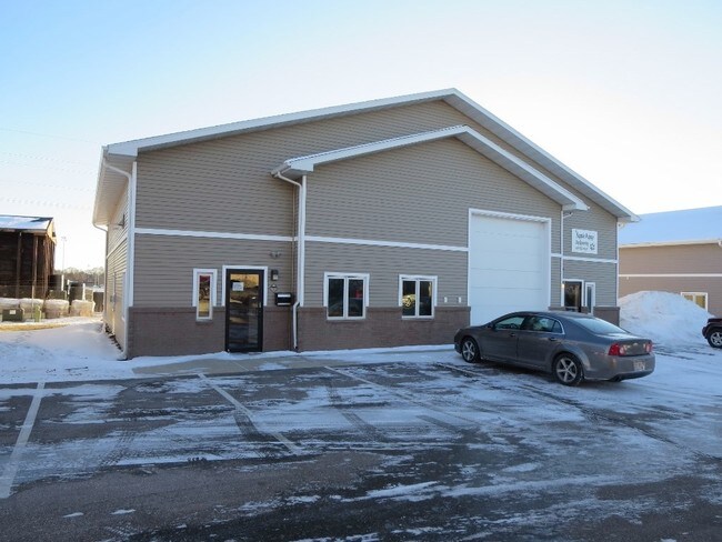
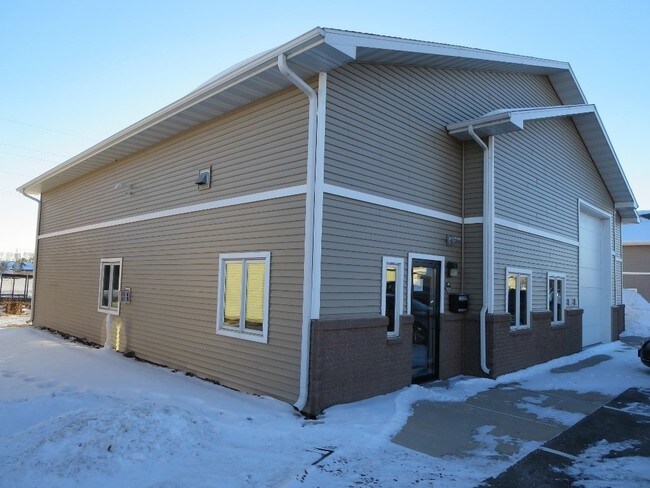
Property Detail
200 Mason St
018-006188-000
FIRST ADDENDUM TO EAGLE BUSINESS CONDOMINIUMS ONALASKA UNIT 5
Commercialnec
La Crosse
MZA
Wisconsin
B and X Area of moderate flood hazard, usually the area between the limits of the 100-year and 500-year floods.
0.11 AC
2025
Other Market Areas
2025
La Crosse-Onalaska, WI-MN
010404
NEARBY LISTINGS FOR SALE OR LEASE
-
-
View all Onalaska listings for sale on LoopNet.com
DEMOGRAPHICS near 200 Mason St
1 mile
3 mile
5 mile
2025 Total Population
5,847
24,369
47,134
2030 Population
6,045
24,603
47,259
Pop Growth 2025-2030
+ 3.39%
+ 0.96%
+ 0.27%
Average Age
42
41
41
2025 Total Households
2,414
9,970
19,410
HH Growth 2025-2030
+ 3.23%
+ 0.73%
+ 0.01%
Median Household Inc
$94,864
$84,569
$76,185
Avg Household Size
2.40
2.40
2.40
2025 Avg HH Vehicles
2.00
2.00
2.00
Median Home Value
$332,769
$310,971
$291,808
Median Year Built
1996
1991
1985
Nearby Places
Map Layers
Map Styles
 Street
 Aerial
Layers
 Traffic
 Biking
Places
Listings with unknown addresses are not visible on the map
- Restaurants
- Banks
- Shops
- Fitness
- Groceries
PUBLIC TRANSPORTATION
COMMUTER RAIL
Drive
Walk
Distance
17 min
6.2 mi
AIRPORT
La Crosse Regional
Drive
Walk
Distance
La Crosse Regional
16 min
6.2 mi
SALE & LEASE HISTORY
LISTING DATE
SALE/LEASE

Dec 07, 2016
For Sale
Nearby Properties
Address
Land Use
TOTAL SIZE
Lot Size
Zoning
Address
Land Use
TOTAL SIZE
Lot Size
Zoning
2.52 AC
Address
Land Use
TOTAL SIZE
Lot Size
Zoning
15.41 AC
MZA
Address
Land Use
TOTAL SIZE
Lot Size
Zoning
4.40 AC
Address
Land Use
TOTAL SIZE
Lot Size
Zoning
19.98 AC
Address
Land Use
TOTAL SIZE
Lot Size
Zoning
3.75 AC
Address
Land Use
TOTAL SIZE
Lot Size
Zoning
4.31 AC
Address
Land Use
TOTAL SIZE
Lot Size
Zoning
6.19 AC
Address
Land Use
TOTAL SIZE
Lot Size
Zoning
1.96 AC
Address
Land Use
TOTAL SIZE
Lot Size
Zoning
9.25 AC
Address
Land Use
TOTAL SIZE
Lot Size
Zoning
12.61 AC
Address
Land Use
TOTAL SIZE
Lot Size
Zoning
3.72 AC
MZA
Address
Land Use
TOTAL SIZE
Lot Size
Zoning
2.27 AC
Address
Land Use
TOTAL SIZE
Lot Size
Zoning
24.16 AC
COND USE
Address
Land Use
TOTAL SIZE
Lot Size
Zoning
1.98 AC
Address
Land Use
TOTAL SIZE
Lot Size
Zoning
2.07 AC
Address
Land Use
TOTAL SIZE
Lot Size
Zoning
1.98 AC
MZA
Address
Land Use
TOTAL SIZE
Lot Size
Zoning
2.16 AC
Address
Land Use
TOTAL SIZE
Lot Size
Zoning
2.76 AC
Address
Land Use
TOTAL SIZE
Lot Size
Zoning
20.59 AC
MZA
Address
Land Use
TOTAL SIZE
Lot Size
Zoning
6.03 AC
MZA
Address
Land Use
TOTAL SIZE
Lot Size
Zoning
2.30 AC
MZA
Address
Land Use
TOTAL SIZE
Lot Size
Zoning
2.41 AC
MZA
Address
Land Use
TOTAL SIZE
Lot Size
Zoning
3.85 AC
MZA
Address
Land Use
TOTAL SIZE
Lot Size
Zoning
14.76 AC
MZA
Address
Land Use
TOTAL SIZE
Lot Size
Zoning
5.77 AC
MZA
Address
Land Use
TOTAL SIZE
Lot Size
Zoning
6.37 AC
MZA
Address
Land Use
TOTAL SIZE
Lot Size
Zoning
2.60 AC
Address
Land Use
TOTAL SIZE
Lot Size
Zoning
125.97 AC
MZA
Address
Land Use
TOTAL SIZE
Lot Size
Zoning
1.95 AC
MZA
Address
Land Use
TOTAL SIZE
Lot Size
Zoning
3.47 AC
AA
The World's #1 Commercial Real Estate Marketplace
Connect with us
© 2026 CoStar Group
The information above has been obtained from sources believed reliable. While we do not doubt its accuracy we have not verified it and make no guarantee, warranty or representation about it. It is your responsibility to independently confirm its accuracy and completeness. Any projections, opinions, assumptions, or estimates used are for example only and do not represent the current or future performance of the property. The value of this transaction to you depends on tax and other factors which should be evaluated by your tax, financial, and legal advisors. You and your advisors should conduct a careful, independent investigation of the property to determine to your satisfaction the suitability of the property for your needs.