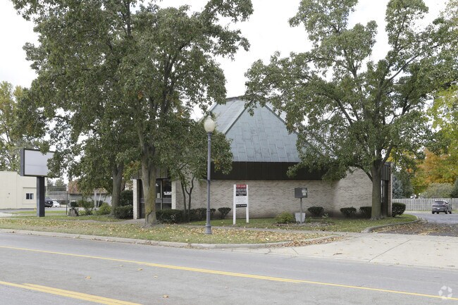
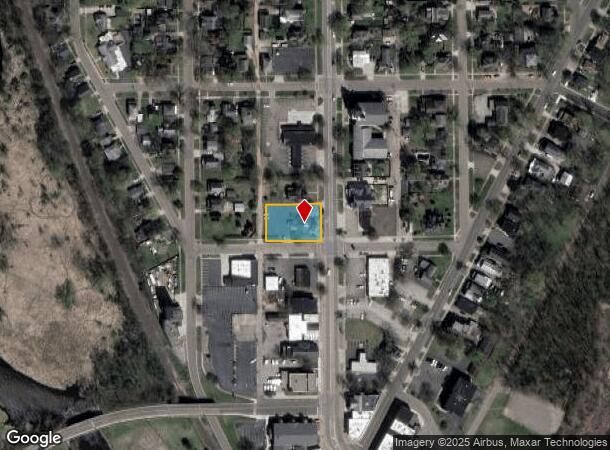
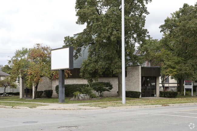
Property Record
200 N Main St, Three Rivers, MI 49093
NEARBY LISTINGS FOR SALE OR LEASE
Property Detail
200 N Main St
Sturgis, MI
City Of Three Rivers
051-145-026-00
PART OF LOTS 9 & 10 BLK 2 ORIG PLAT CITY OF THREE RIVERS DESC AS: BEG AT SW COR OF LOT 10 TH E 160 FT TO SE COR SD LOT 10 TH
Commercialnec
St. Joseph
X
Michigan
26149C0159D
9-10
2025
0.36 AC
2025
Michigan Southwest Area
040100
Other Market Areas
2,261 SF
DEMOGRAPHICS near 200 N Main St
1 mile
3 mile
5 mile
2024 Total Population
6,230
11,786
15,484
2029 Population
6,192
11,740
15,475
Pop Growth 2024-2029
(0.61%)
(0.39%)
(0.06%)
Average Age
38
39
40
2024 Total Households
2,481
4,616
6,132
HH Growth 2024-2029
(0.77%)
(0.52%)
(0.11%)
Median Household Inc
$48,808
$53,784
$57,243
Avg Household Size
2.40
2.50
2.50
2024 Avg HH Vehicles
2.00
2.00
2.00
Median Home Value
$115,273
$131,283
$149,379
Median Year Built
1962
1967
1968
Nearby Places
Map Layers
Map Styles
 Street
 Aerial
Transit
 Traffic
 Biking
Places
Listings with unknown addresses are not visible on the map
- Restaurants
- Banks
- Shops
- Fitness
- Groceries
PUBLIC TRANSPORTATION
AIRPORT
Kalamazoo/Battle Creek International
Drive
Walk
Distance
Kalamazoo/Battle Creek International
36 min
25.8 mi
SALE & LEASE HISTORY
LISTING DATE
SALE/LEASE

Oct 26, 2018
For Lease
Nearby Properties
Address
Land Use
TOTAL SIZE
Lot Size
Zoning
Address
Land Use
TOTAL SIZE
Lot Size
Zoning
2,160 SF
128.90 AC
I-2
Address
Land Use
TOTAL SIZE
Lot Size
Zoning
312,414 SF
58.17 AC
Address
Land Use
TOTAL SIZE
Lot Size
Zoning
140,468 SF
12.99 AC
Address
Land Use
TOTAL SIZE
Lot Size
Zoning
194,305 SF
29.62 AC
B-2
Address
Land Use
TOTAL SIZE
Lot Size
Zoning
Address
Land Use
TOTAL SIZE
Lot Size
Zoning
156,459 SF
10.03 AC
R-5
Address
Land Use
TOTAL SIZE
Lot Size
Zoning
183,162 SF
35.60 AC
B-2
Address
Land Use
TOTAL SIZE
Lot Size
Zoning
219,083 SF
8.90 AC
I-2
Address
Land Use
TOTAL SIZE
Lot Size
Zoning
123,612 SF
10 AC
B-2
Address
Land Use
TOTAL SIZE
Lot Size
Zoning
239,049 SF
21.30 AC
I-2
Address
Land Use
TOTAL SIZE
Lot Size
Zoning
138,328 SF
10.25 AC
R-5
Address
Land Use
TOTAL SIZE
Lot Size
Zoning
41,325 SF
24.80 AC
I-2
Address
Land Use
TOTAL SIZE
Lot Size
Zoning
16,962 SF
3.77 AC
B3
Address
Land Use
TOTAL SIZE
Lot Size
Zoning
109,816 SF
7.14 AC
I-2
Address
Land Use
TOTAL SIZE
Lot Size
Zoning
255,000 SF
6.69 AC
I-2
Address
Land Use
TOTAL SIZE
Lot Size
Zoning
123,555 SF
10.67 AC
I-2
Address
Land Use
TOTAL SIZE
Lot Size
Zoning
91,200 SF
11.80 AC
B-2
Address
Land Use
TOTAL SIZE
Lot Size
Zoning
110,068 SF
10.87 AC
I-2
Address
Land Use
TOTAL SIZE
Lot Size
Zoning
26,218 SF
2.35 AC
R
Address
Land Use
TOTAL SIZE
Lot Size
Zoning
127,184 SF
12.68 AC
Address
Land Use
TOTAL SIZE
Lot Size
Zoning
80,772 SF
10.36 AC
I-2
Address
Land Use
TOTAL SIZE
Lot Size
Zoning
12,883 SF
2 AC
Address
Land Use
TOTAL SIZE
Lot Size
Zoning
40,440 SF
6.70 AC
B-2
Address
Land Use
TOTAL SIZE
Lot Size
Zoning
50,583 SF
6.21 AC
I-1
Address
Land Use
TOTAL SIZE
Lot Size
Zoning
47,264 SF
7.30 AC
B-2
Address
Land Use
TOTAL SIZE
Lot Size
Zoning
50,058 SF
2.07 AC
R
Address
Land Use
TOTAL SIZE
Lot Size
Zoning
100,585 SF
8.25 AC
I-2
Address
Land Use
TOTAL SIZE
Lot Size
Zoning
19,448 SF
2.71 AC
Address
Land Use
TOTAL SIZE
Lot Size
Zoning
52,707 SF
5.83 AC
B-2
Address
Land Use
TOTAL SIZE
Lot Size
Zoning
21,656 SF
4.99 AC
The World's #1 Commercial Real Estate Marketplace
Connect with us
© 2026 CoStar Group
The information above has been obtained from sources believed reliable. While we do not doubt its accuracy we have not verified it and make no guarantee, warranty or representation about it. It is your responsibility to independently confirm its accuracy and completeness. Any projections, opinions, assumptions, or estimates used are for example only and do not represent the current or future performance of the property. The value of this transaction to you depends on tax and other factors which should be evaluated by your tax, financial, and legal advisors. You and your advisors should conduct a careful, independent investigation of the property to determine to your satisfaction the suitability of the property for your needs.