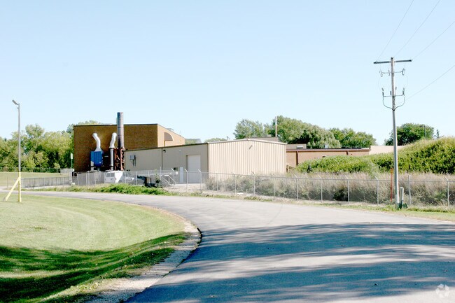
Property Record
200 Paoli St, Verona, WI 53593


NEARBY LISTINGS FOR SALE OR LEASE
Property Detail
200 Paoli St
Madison, WI
Certified Surv Map 10579
0608-223-8625-2
LOT 1 CSM 10579 CS62/316&318-11/1/2002 F/K/A LOTS 1 & 2 CSM 2821 CS11/148&149 F/ K/A PRT LOT 2 CSM 762 & ALSO INCL & DESCR AS SEC 21-6-8 PRT NE1/4SE1/4 & SEC 22- 6-8 PRT NW1/4SW1/4 (6.323 ACRES EXCL R/W)
Industrialgeneral
Dane
AE
Wisconsin
55025C0556G
1,2
2024
6.32 AC
2024
Outlying Dane West
013700
Milwaukee/Madison
DEMOGRAPHICS near 200 Paoli St
1 Mile
3 Mile
5 Mile
2024 Total Population
6,359
20,908
61,016
2029 Population
6,665
21,864
63,381
Pop Growth 2024-2029
+ 4.81%
+ 4.57%
+ 3.88%
Average Age
37
38
37
2024 Total Households
2,505
8,352
25,153
HH Growth 2024-2029
+ 4.99%
+ 4.74%
+ 4.00%
Median Household Inc
$89,686
$106,397
$98,968
Avg Household Size
2.50
2.40
2.40
2024 Avg HH Vehicles
2.00
2.00
2.00
Median Home Value
$372,705
$364,205
$351,853
Median Year Built
2001
2001
1997
Nearby Places
Map Layers
Map Styles
 Street
 Aerial
- Restaurants
- Banks
- Shops
- Fitness
- Groceries
PUBLIC TRANSPORTATION
AIRPORT
Dane County Regional/Truax Field
DRIVE
WALK
Distance
Dane County Regional/Truax Field
32 min
17.6 mi
Freight Ports
Port Milwaukee
DRIVE
WALK
Distance
Port Milwaukee
113 min
94.3 mi
Nearby Properties
Address
Land Use
TOTAL SIZE
Lot Size
Zoning
Address
Land Use
TOTAL SIZE
Lot Size
Zoning
13.06 AC
Address
Land Use
TOTAL SIZE
Lot Size
Zoning
77,296 SF
4.84 AC
TR-U1
Address
Land Use
TOTAL SIZE
Lot Size
Zoning
18,242 SF
4.45 AC
TR-U1
Address
Land Use
TOTAL SIZE
Lot Size
Zoning
Address
Land Use
TOTAL SIZE
Lot Size
Zoning
3.35 AC
Address
Land Use
TOTAL SIZE
Lot Size
Zoning
2.76 AC
Address
Land Use
TOTAL SIZE
Lot Size
Zoning
236,626 SF
5.63 AC
PD
Address
Land Use
TOTAL SIZE
Lot Size
Zoning
5.58 AC
Address
Land Use
TOTAL SIZE
Lot Size
Zoning
3.56 AC
Address
Land Use
TOTAL SIZE
Lot Size
Zoning
3.96 AC
Address
Land Use
TOTAL SIZE
Lot Size
Zoning
17.81 AC
Address
Land Use
TOTAL SIZE
Lot Size
Zoning
3.71 AC
Address
Land Use
TOTAL SIZE
Lot Size
Zoning
6.66 AC
Address
Land Use
TOTAL SIZE
Lot Size
Zoning
5.23 AC
Address
Land Use
TOTAL SIZE
Lot Size
Zoning
20,787 SF
4.56 AC
TR-U1
Address
Land Use
TOTAL SIZE
Lot Size
Zoning
3.62 AC
Address
Land Use
TOTAL SIZE
Lot Size
Zoning
7.77 AC
Address
Land Use
TOTAL SIZE
Lot Size
Zoning
3.12 AC
Address
Land Use
TOTAL SIZE
Lot Size
Zoning
13.43 AC
Address
Land Use
TOTAL SIZE
Lot Size
Zoning
5.77 AC
Address
Land Use
TOTAL SIZE
Lot Size
Zoning
5.17 AC
Address
Land Use
TOTAL SIZE
Lot Size
Zoning
Address
Land Use
TOTAL SIZE
Lot Size
Zoning
56,146 SF
1.33 AC
PD
Address
Land Use
TOTAL SIZE
Lot Size
Zoning
79,759 SF
1.15 AC
PD
Address
Land Use
TOTAL SIZE
Lot Size
Zoning
1.10 AC
Address
Land Use
TOTAL SIZE
Lot Size
Zoning
1.08 AC
Address
Land Use
TOTAL SIZE
Lot Size
Zoning
2.16 AC
Address
Land Use
TOTAL SIZE
Lot Size
Zoning
11.41 AC
Address
Land Use
TOTAL SIZE
Lot Size
Zoning
1.90 AC
The World's #1 Commercial Real Estate Marketplace
Connect with us
© 2026 CoStar Group
The information above has been obtained from sources believed reliable. While we do not doubt its accuracy we have not verified it and make no guarantee, warranty or representation about it. It is your responsibility to independently confirm its accuracy and completeness. Any projections, opinions, assumptions, or estimates used are for example only and do not represent the current or future performance of the property. The value of this transaction to you depends on tax and other factors which should be evaluated by your tax, financial, and legal advisors. You and your advisors should conduct a careful, independent investigation of the property to determine to your satisfaction the suitability of the property for your needs.