Property Record
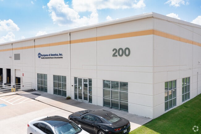
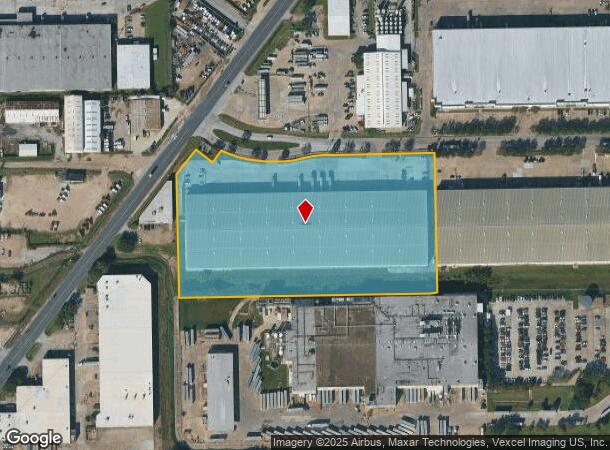
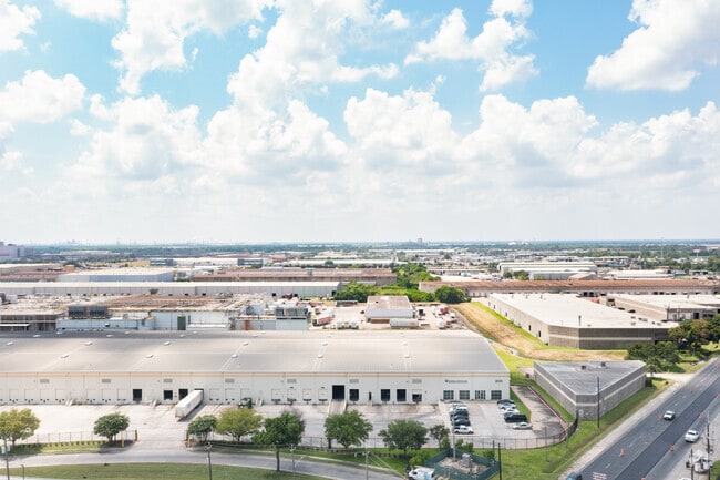
200 Portwall St, Houston, TX 77029
NEARBY LISTINGS FOR SALE OR LEASE
Property Detail
200 Portwall St
0151290010033
Glendale
Warehouse
RES A1 BLK 1 GLENDALE
X
Harris
48201C0695M
Texas
2024
9.49 AC
2025
Northeast Inner Loop
212400
Houston
205,000 SF
Houston-The Woodlands-Sugar Land, TX
DEMOGRAPHICS near 200 Portwall St
1 Mile
3 Mile
5 Mile
2024 Total Population
2,212
56,287
243,708
2029 Population
2,271
58,045
251,569
Pop Growth 2024-2029
+ 2.67%
+ 3.12%
+ 3.23%
Average Age
39
38
37
2024 Total Households
710
19,225
81,609
HH Growth 2024-2029
+ 2.54%
+ 3.13%
+ 3.42%
Median Household Inc
$42,844
$34,949
$38,166
Avg Household Size
3.00
2.90
2.80
2024 Avg HH Vehicles
2.00
2.00
2.00
Median Home Value
$132,353
$100,497
$130,243
Median Year Built
1952
1957
1962
Nearby Places
Map Layers
Map Styles
 Street
 Aerial
- Restaurants
- Banks
- Shops
- Fitness
- Groceries
PUBLIC TRANSPORTATION
COMMUTER RAIL
DRIVE
WALK
Distance
11 min
6.4 mi
AIRPORT
William P Hobby
DRIVE
WALK
Distance
William P Hobby
26 min
13.7 mi
George Bush Intcntl/Houston
DRIVE
WALK
Distance
George Bush Intcntl/Houston
27 min
19.7 mi
Freight Ports
Port of Houston
DRIVE
WALK
Distance
Port of Houston
13 min
5.7 mi
SALE & LEASE HISTORY
LISTING DATE
SALE/LEASE

Sep 25, 2016
For Lease
Aug 26, 2019
For Lease
Nearby Properties
Address
Land Use
TOTAL SIZE
Lot Size
Zoning
Address
Land Use
TOTAL SIZE
Lot Size
Zoning
100.26 AC
Address
Land Use
TOTAL SIZE
Lot Size
Zoning
12,206,592 SF
212.18 AC
Address
Land Use
TOTAL SIZE
Lot Size
Zoning
1,392,720 SF
83.75 AC
Address
Land Use
TOTAL SIZE
Lot Size
Zoning
793,077 SF
49.76 AC
Address
Land Use
TOTAL SIZE
Lot Size
Zoning
663,147 SF
40.63 AC
Address
Land Use
TOTAL SIZE
Lot Size
Zoning
Address
Land Use
TOTAL SIZE
Lot Size
Zoning
357,510 SF
29.15 AC
Address
Land Use
TOTAL SIZE
Lot Size
Zoning
343,265 SF
41.52 AC
Address
Land Use
TOTAL SIZE
Lot Size
Zoning
438,196 SF
89.88 AC
Address
Land Use
TOTAL SIZE
Lot Size
Zoning
Address
Land Use
TOTAL SIZE
Lot Size
Zoning
240,968 SF
12.45 AC
Address
Land Use
TOTAL SIZE
Lot Size
Zoning
190,512 SF
8.81 AC
Address
Land Use
TOTAL SIZE
Lot Size
Zoning
225,393 SF
20.59 AC
Address
Land Use
TOTAL SIZE
Lot Size
Zoning
433,639 SF
19.89 AC
Address
Land Use
TOTAL SIZE
Lot Size
Zoning
264,866 SF
10.46 AC
Address
Land Use
TOTAL SIZE
Lot Size
Zoning
163,807 SF
8.58 AC
Address
Land Use
TOTAL SIZE
Lot Size
Zoning
175,172 SF
8.81 AC
Address
Land Use
TOTAL SIZE
Lot Size
Zoning
304,925 SF
10.91 AC
Address
Land Use
TOTAL SIZE
Lot Size
Zoning
265,232 SF
13.31 AC
Address
Land Use
TOTAL SIZE
Lot Size
Zoning
250,929 SF
13.17 AC
Address
Land Use
TOTAL SIZE
Lot Size
Zoning
76,842 SF
49.76 AC
Address
Land Use
TOTAL SIZE
Lot Size
Zoning
149,052 SF
7.48 AC
Address
Land Use
TOTAL SIZE
Lot Size
Zoning
210,220 SF
15.38 AC
Address
Land Use
TOTAL SIZE
Lot Size
Zoning
254,904 SF
9.27 AC
Address
Land Use
TOTAL SIZE
Lot Size
Zoning
229,465 SF
9.80 AC
Address
Land Use
TOTAL SIZE
Lot Size
Zoning
346,320 SF
12.55 AC
Address
Land Use
TOTAL SIZE
Lot Size
Zoning
223,514 SF
9.23 AC
Address
Land Use
TOTAL SIZE
Lot Size
Zoning
177,720 SF
14.96 AC
Address
Land Use
TOTAL SIZE
Lot Size
Zoning
323,250 SF
14.20 AC
Address
Land Use
TOTAL SIZE
Lot Size
Zoning
199,340 SF
13.27 AC
The World's #1 Commercial Real Estate Marketplace
Connect with us
© 2025 CoStar Group
The information above has been obtained from sources believed reliable. While we do not doubt its accuracy we have not verified it and make no guarantee, warranty or representation about it. It is your responsibility to independently confirm its accuracy and completeness. Any projections, opinions, assumptions, or estimates used are for example only and do not represent the current or future performance of the property. The value of this transaction to you depends on tax and other factors which should be evaluated by your tax, financial, and legal advisors. You and your advisors should conduct a careful, independent investigation of the property to determine to your satisfaction the suitability of the property for your needs.