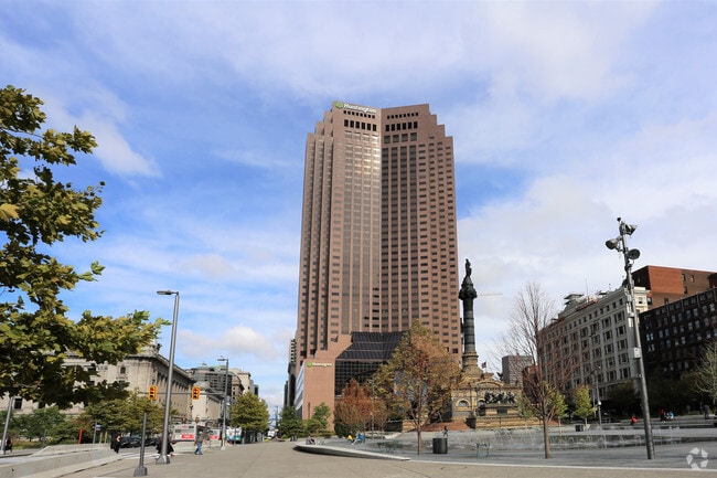
Property Record
200 Public Sq, Cleveland, OH 44114

NEARBY LISTINGS FOR SALE OR LEASE
Property Detail
200 Public Sq
Cleveland-Elyria, OH
J M Gasser Estate Subdivision
101-26-001
10126001
Officebuilding
Cuyahoga
X
Ohio
39035C0177F
1.66 AC
0
CBD
2024
Cleveland
1,547,111 SF
DEMOGRAPHICS near 200 Public Sq
1 Mile
3 Mile
5 Mile
2024 Total Population
17,273
78,708
235,326
2029 Population
17,492
77,570
230,607
Pop Growth 2024-2029
+ 1.27%
(1.45%)
(2.01%)
Average Age
34
36
38
2024 Total Households
10,031
38,346
108,571
HH Growth 2024-2029
+ 2.16%
(1.05%)
(1.86%)
Median Household Inc
$61,671
$38,958
$35,370
Avg Household Size
1.40
1.90
2.00
2024 Avg HH Vehicles
1.00
1.00
1.00
Median Home Value
$379,604
$176,147
$95,972
Median Year Built
1974
1948
1947
Nearby Places
Map Layers
Map Styles
 Street
 Aerial
- Restaurants
- Banks
- Shops
- Fitness
- Groceries
PUBLIC TRANSPORTATION
TRANSIT/SUBWAY
Tower City - Public Square (Blue Line - Greater Cleveland Regional Transit Authority Rapid Transit (The Rapid), Green Line - Greater Cleveland Regional Transit Authority Rapid Transit (The Rapid), Red Line - Greater Cleveland Regional Transit Authority Rapid Transit (The Rapid))
DRIVE
WALK
Distance
Tower City - Public Square (Blue Line - Greater Cleveland Regional Transit Authority Rapid Transit (The Rapid), Green Line - Greater Cleveland Regional Transit Authority Rapid Transit (The Rapid), Red Line - Greater Cleveland Regional Transit Authority Rapid Transit (The Rapid))
2 min
3 min
0.2 mi
Tower City Station Track 13 (Blue/Green) (Blue/Green/Waterfront Lines - Greater Cleveland Regional Transit Authority)
DRIVE
WALK
Distance
Tower City Station Track 13 (Blue/Green) (Blue/Green/Waterfront Lines - Greater Cleveland Regional Transit Authority)
2 min
5 min
0.3 mi
Tower City Station Track 10 West (Red Line - Greater Cleveland Regional Transit Authority)
DRIVE
WALK
Distance
Tower City Station Track 10 West (Red Line - Greater Cleveland Regional Transit Authority)
2 min
5 min
0.3 mi
W 3Rd St Station (Blue/Green/Waterfront Lines - Greater Cleveland Regional Transit Authority)
DRIVE
WALK
Distance
W 3Rd St Station (Blue/Green/Waterfront Lines - Greater Cleveland Regional Transit Authority)
2 min
12 min
0.7 mi
North Coast Station (Blue/Green/Waterfront Lines - Greater Cleveland Regional Transit Authority)
DRIVE
WALK
Distance
North Coast Station (Blue/Green/Waterfront Lines - Greater Cleveland Regional Transit Authority)
6 min
16 min
0.9 mi
COMMUTER RAIL
Cleveland Lakefront Station (Blue Line - Greater Cleveland Regional Transit Authority Rapid Transit (The Rapid), Green Line - Greater Cleveland Regional Transit Authority Rapid Transit (The Rapid))
DRIVE
WALK
Distance
Cleveland Lakefront Station (Blue Line - Greater Cleveland Regional Transit Authority Rapid Transit (The Rapid), Green Line - Greater Cleveland Regional Transit Authority Rapid Transit (The Rapid))
7 min
17 min
0.9 mi
Rockside (National Park Scenic Railway - Cuyahoga Valley Scenic Railroad)
DRIVE
WALK
Distance
Rockside (National Park Scenic Railway - Cuyahoga Valley Scenic Railroad)
18 min
9.7 mi
AIRPORT
Cleveland-Hopkins International
DRIVE
WALK
Distance
Cleveland-Hopkins International
23 min
13.8 mi
Freight Ports
Port of Toledo
DRIVE
WALK
Distance
Port of Toledo
137 min
114.2 mi
SALE & LEASE HISTORY
LISTING DATE
SALE/LEASE

Sep 14, 2023
For Sale
Nov 06, 2024
For Lease
May 25, 2017
For Lease
Jul 21, 2023
For Lease
Jul 12, 2018
For Sale
Jan 25, 2024
For Lease
Jan 25, 2024
For Lease
Feb 22, 2021
For Lease
Aug 29, 2018
For Lease
Apr 04, 2024
For Lease
Nearby Properties
Address
Land Use
TOTAL SIZE
Lot Size
Zoning
Address
Land Use
TOTAL SIZE
Lot Size
Zoning
3,491,901 SF
34.32 AC
Address
Land Use
TOTAL SIZE
Lot Size
Zoning
753,970 SF
9.31 AC
GR
Address
Land Use
TOTAL SIZE
Lot Size
Zoning
1,570,958 SF
1.33 AC
GR
Address
Land Use
TOTAL SIZE
Lot Size
Zoning
17.45 AC
GI
Address
Land Use
TOTAL SIZE
Lot Size
Zoning
16.78 AC
SI
Address
Land Use
TOTAL SIZE
Lot Size
Zoning
710,780 SF
4.33 AC
GR
Address
Land Use
TOTAL SIZE
Lot Size
Zoning
765,607 SF
12.15 AC
GR
Address
Land Use
TOTAL SIZE
Lot Size
Zoning
788,580 SF
4.85 AC
GR
Address
Land Use
TOTAL SIZE
Lot Size
Zoning
434,475 SF
0.53 AC
Address
Land Use
TOTAL SIZE
Lot Size
Zoning
1,191,268 SF
3.94 AC
SI
Address
Land Use
TOTAL SIZE
Lot Size
Zoning
6.98 AC
SI
Address
Land Use
TOTAL SIZE
Lot Size
Zoning
148,486 SF
489.21 AC
GI
Address
Land Use
TOTAL SIZE
Lot Size
Zoning
5,100 SF
9.41 AC
GI
Address
Land Use
TOTAL SIZE
Lot Size
Zoning
652,455 SF
2.04 AC
GR
Address
Land Use
TOTAL SIZE
Lot Size
Zoning
263,723 SF
7.48 AC
GI
Address
Land Use
TOTAL SIZE
Lot Size
Zoning
1,130,924 SF
4.02 AC
SI
Address
Land Use
TOTAL SIZE
Lot Size
Zoning
299,515 SF
1.30 AC
GR
Address
Land Use
TOTAL SIZE
Lot Size
Zoning
1,181,536 SF
27.82 AC
RO
Address
Land Use
TOTAL SIZE
Lot Size
Zoning
228,154 SF
0.48 AC
GR
Address
Land Use
TOTAL SIZE
Lot Size
Zoning
3.23 AC
LLR
Address
Land Use
TOTAL SIZE
Lot Size
Zoning
2.74 AC
Address
Land Use
TOTAL SIZE
Lot Size
Zoning
1,003,787 SF
2.12 AC
GR
Address
Land Use
TOTAL SIZE
Lot Size
Zoning
758,394 SF
2.25 AC
GR
Address
Land Use
TOTAL SIZE
Lot Size
Zoning
493,911 SF
1.88 AC
LLR
Address
Land Use
TOTAL SIZE
Lot Size
Zoning
257,857 SF
8.03 AC
GR
Address
Land Use
TOTAL SIZE
Lot Size
Zoning
1.53 AC
LLR
Address
Land Use
TOTAL SIZE
Lot Size
Zoning
299,507 SF
2.14 AC
LR
Address
Land Use
TOTAL SIZE
Lot Size
Zoning
194,478 SF
9.61 AC
SI
Address
Land Use
TOTAL SIZE
Lot Size
Zoning
2.83 AC
LLR
The World's #1 Commercial Real Estate Marketplace
Connect with us
© 2026 CoStar Group
The information above has been obtained from sources believed reliable. While we do not doubt its accuracy we have not verified it and make no guarantee, warranty or representation about it. It is your responsibility to independently confirm its accuracy and completeness. Any projections, opinions, assumptions, or estimates used are for example only and do not represent the current or future performance of the property. The value of this transaction to you depends on tax and other factors which should be evaluated by your tax, financial, and legal advisors. You and your advisors should conduct a careful, independent investigation of the property to determine to your satisfaction the suitability of the property for your needs.