Property Record
200 Rike Dr, Millstone Township, NJ 08535


NEARBY LISTINGS FOR SALE OR LEASE
Property Detail
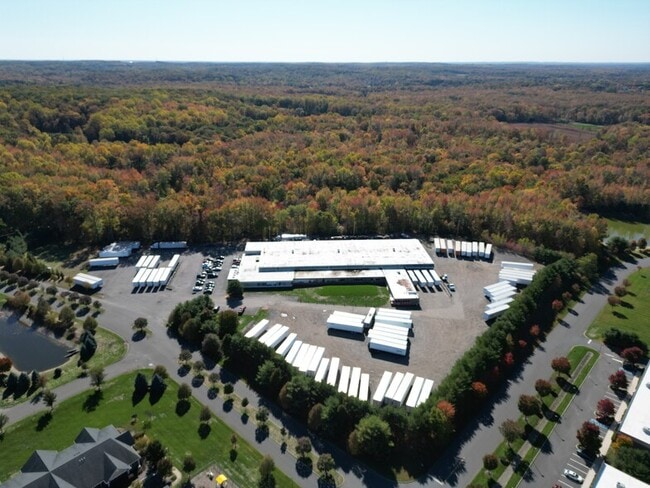
200 Rike Dr
Northern New Jersey
ADDITIONAL LOTS: 62016SF
New York-Jersey City-White Plains, NY-NJ
Monmouth
33-00016-0000-00009-12
New Jersey
Industrialgeneral
9.12
2024
10.04 AC
2025
Western Monmouth
812502
DEMOGRAPHICS near 200 Rike Dr
1 Mile
3 Mile
5 Mile
2024 Total Population
582
15,162
56,802
2029 Population
576
15,126
56,451
Pop Growth 2024-2029
(1.03%)
(0.24%)
(0.62%)
Average Age
41
40
45
2024 Total Households
176
4,990
21,507
HH Growth 2024-2029
(1.14%)
(0.40%)
(1.06%)
Median Household Inc
$193,292
$143,911
$114,978
Avg Household Size
3.10
2.90
2.60
2024 Avg HH Vehicles
3.00
2.00
2.00
Median Home Value
$644,144
$544,138
$441,562
Median Year Built
1992
1992
1988
Nearby Places
Map Layers
Map Styles
 Street
 Aerial
- Restaurants
- Banks
- Shops
- Fitness
- Groceries
PUBLIC TRANSPORTATION
AIRPORT
Trenton Mercer
DRIVE
WALK
Distance
Trenton Mercer
42 min
27.1 mi
Freight Ports
New York Container Terminal
DRIVE
WALK
Distance
New York Container Terminal
53 min
40.6 mi
Nearby Properties
Address
Land Use
TOTAL SIZE
Lot Size
Zoning
Address
Land Use
TOTAL SIZE
Lot Size
Zoning
3,060 SF
114.66 AC
PCD
Address
Land Use
TOTAL SIZE
Lot Size
Zoning
220,000 SF
25.42 AC
PCD
Address
Land Use
TOTAL SIZE
Lot Size
Zoning
12.27 AC
PCD
Address
Land Use
TOTAL SIZE
Lot Size
Zoning
15 AC
PUD
Address
Land Use
TOTAL SIZE
Lot Size
Zoning
63.69 AC
HD
Address
Land Use
TOTAL SIZE
Lot Size
Zoning
136 AC
R-40
Address
Land Use
TOTAL SIZE
Lot Size
Zoning
56.30 AC
Address
Land Use
TOTAL SIZE
Lot Size
Zoning
2,611 SF
5.23 AC
HDRA
Address
Land Use
TOTAL SIZE
Lot Size
Zoning
9.63 AC
SED2W
Address
Land Use
TOTAL SIZE
Lot Size
Zoning
1,150,128 SF
8.44 AC
PUD
Address
Land Use
TOTAL SIZE
Lot Size
Zoning
1,914 SF
12 AC
HD
Address
Land Use
TOTAL SIZE
Lot Size
Zoning
46,930 SF
12.39 AC
HC
Address
Land Use
TOTAL SIZE
Lot Size
Zoning
11.78 AC
HD
Address
Land Use
TOTAL SIZE
Lot Size
Zoning
113,700 SF
7.15 AC
HD
Address
Land Use
TOTAL SIZE
Lot Size
Zoning
52,557 SF
7.98 AC
PUD
Address
Land Use
TOTAL SIZE
Lot Size
Zoning
9.56 AC
SED/
Address
Land Use
TOTAL SIZE
Lot Size
Zoning
80 AC
FHC
Address
Land Use
TOTAL SIZE
Lot Size
Zoning
34,260 SF
3.40 AC
PCD
Address
Land Use
TOTAL SIZE
Lot Size
Zoning
1.93 AC
HD
Address
Land Use
TOTAL SIZE
Lot Size
Zoning
7.91 AC
BP
Address
Land Use
TOTAL SIZE
Lot Size
Zoning
5 AC
SED2W
Address
Land Use
TOTAL SIZE
Lot Size
Zoning
2,354 SF
29.10 AC
SF80
Address
Land Use
TOTAL SIZE
Lot Size
Zoning
Address
Land Use
TOTAL SIZE
Lot Size
Zoning
2,744 SF
43.38 AC
PCD
Address
Land Use
TOTAL SIZE
Lot Size
Zoning
21,074 SF
15.63 AC
R-40
Address
Land Use
TOTAL SIZE
Lot Size
Zoning
54.15 AC
SF80
Address
Land Use
TOTAL SIZE
Lot Size
Zoning
9,180 SF
11.96 AC
PDAH
Address
Land Use
TOTAL SIZE
Lot Size
Zoning
5.11 AC
I10
Address
Land Use
TOTAL SIZE
Lot Size
Zoning
3 AC
SED5
The World's #1 Commercial Real Estate Marketplace
Connect with us
© 2025 CoStar Group
The information above has been obtained from sources believed reliable. While we do not doubt its accuracy we have not verified it and make no guarantee, warranty or representation about it. It is your responsibility to independently confirm its accuracy and completeness. Any projections, opinions, assumptions, or estimates used are for example only and do not represent the current or future performance of the property. The value of this transaction to you depends on tax and other factors which should be evaluated by your tax, financial, and legal advisors. You and your advisors should conduct a careful, independent investigation of the property to determine to your satisfaction the suitability of the property for your needs.