Property Record
200 Roebuck Dr, Birmingham, AL 35215


NEARBY LISTINGS FOR SALE OR LEASE
Property Detail
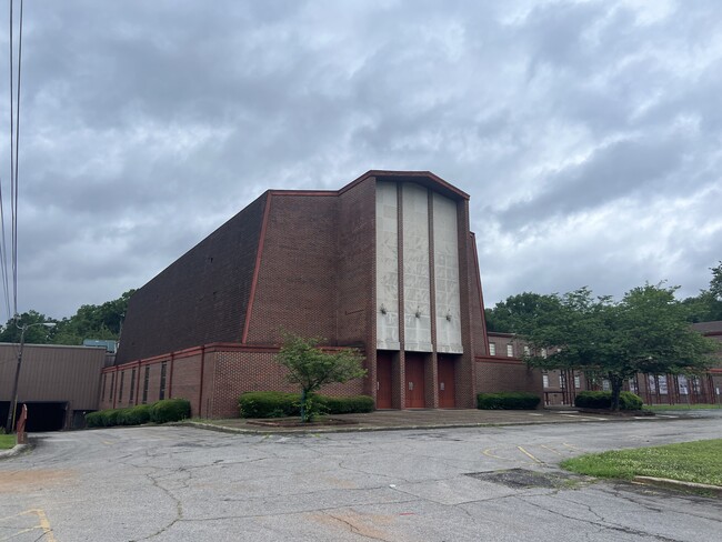
200 Roebuck Dr
Birmingham, AL
Roebuck Pk Bapt Ch Res #2
13-00-35-1-001-073.002
LOT 1-B ROEBUCK PARK BAPTIST CHURCH RES NO 2 PB 195 PG 32
Religious
Jefferson
X
Alabama
01073C0402H
1-b
0
3.88 AC
2024
Center Point
011803
Birmingham
115,490 SF
DEMOGRAPHICS near 200 Roebuck Dr
1 Mile
3 Mile
5 Mile
2024 Total Population
4,634
44,791
105,655
2029 Population
4,543
44,399
104,740
Pop Growth 2024-2029
(1.96%)
(0.88%)
(0.87%)
Average Age
38
39
38
2024 Total Households
1,735
17,187
41,502
HH Growth 2024-2029
(2.07%)
(0.94%)
(0.96%)
Median Household Inc
$50,413
$42,199
$43,692
Avg Household Size
2.60
2.50
2.40
2024 Avg HH Vehicles
2.00
2.00
2.00
Median Home Value
$124,448
$127,264
$142,249
Median Year Built
1962
1967
1970
Nearby Places
Map Layers
Map Styles
 Street
 Aerial
- Restaurants
- Banks
- Shops
- Fitness
- Groceries
PUBLIC TRANSPORTATION
COMMUTER RAIL
Birmingham (Crescent - Amtrak)
DRIVE
WALK
Distance
Birmingham (Crescent - Amtrak)
15 min
8.8 mi
AIRPORT
Birmingham-Shuttlesworth International
DRIVE
WALK
Distance
Birmingham-Shuttlesworth International
12 min
5.9 mi
Freight Ports
Port of Mobile
DRIVE
WALK
Distance
Port of Mobile
294 min
265.0 mi
SALE & LEASE HISTORY
LISTING DATE
SALE/LEASE

May 17, 2024
For Sale
Nearby Properties
Address
Land Use
TOTAL SIZE
Lot Size
Zoning
Address
Land Use
TOTAL SIZE
Lot Size
Zoning
152,664 SF
12.44 AC
CO&I
Address
Land Use
TOTAL SIZE
Lot Size
Zoning
725,840 SF
89 AC
CM2
Address
Land Use
TOTAL SIZE
Lot Size
Zoning
128,233 SF
CO&I
Address
Land Use
TOTAL SIZE
Lot Size
Zoning
150,160 SF
12 AC
INST
Address
Land Use
TOTAL SIZE
Lot Size
Zoning
284,402 SF
22.50 AC
I4
Address
Land Use
TOTAL SIZE
Lot Size
Zoning
1 SF
7.08 AC
CB2
Address
Land Use
TOTAL SIZE
Lot Size
Zoning
58,509 SF
CO&I
Address
Land Use
TOTAL SIZE
Lot Size
Zoning
207,383 SF
17 AC
CR5
Address
Land Use
TOTAL SIZE
Lot Size
Zoning
39,890 SF
7.10 AC
R8
Address
Land Use
TOTAL SIZE
Lot Size
Zoning
57,296 SF
CO&I
Address
Land Use
TOTAL SIZE
Lot Size
Zoning
218,922 SF
21 AC
CR5
Address
Land Use
TOTAL SIZE
Lot Size
Zoning
112,806 SF
2.04 AC
R2
Address
Land Use
TOTAL SIZE
Lot Size
Zoning
222,082 SF
46 AC
R3
Address
Land Use
TOTAL SIZE
Lot Size
Zoning
166,144 SF
12.95 AC
CB2
Address
Land Use
TOTAL SIZE
Lot Size
Zoning
412,320 SF
16.50 AC
I2
Address
Land Use
TOTAL SIZE
Lot Size
Zoning
178,988 SF
8.29 AC
CR5
Address
Land Use
TOTAL SIZE
Lot Size
Zoning
205,872 SF
12.53 AC
CB2
Address
Land Use
TOTAL SIZE
Lot Size
Zoning
118,522 SF
7.80 AC
I4
Address
Land Use
TOTAL SIZE
Lot Size
Zoning
92,560 SF
15.36 AC
I4
Address
Land Use
TOTAL SIZE
Lot Size
Zoning
148,245 SF
9.30 AC
CR5
Address
Land Use
TOTAL SIZE
Lot Size
Zoning
149,773 SF
7.30 AC
CR5
Address
Land Use
TOTAL SIZE
Lot Size
Zoning
95,172 SF
6.40 AC
R2
Address
Land Use
TOTAL SIZE
Lot Size
Zoning
71,028 SF
9.90 AC
O-I
Address
Land Use
TOTAL SIZE
Lot Size
Zoning
125,252 SF
8.07 AC
R4
Address
Land Use
TOTAL SIZE
Lot Size
Zoning
116,759 SF
6.10 AC
CR5
Address
Land Use
TOTAL SIZE
Lot Size
Zoning
163,790 SF
18 AC
I-4
Address
Land Use
TOTAL SIZE
Lot Size
Zoning
179,464 SF
17.70 AC
M3
Address
Land Use
TOTAL SIZE
Lot Size
Zoning
102 AC
R2
Address
Land Use
TOTAL SIZE
Lot Size
Zoning
86,434 SF
8.20 AC
QM1
The World's #1 Commercial Real Estate Marketplace
Connect with us
© 2026 CoStar Group
The information above has been obtained from sources believed reliable. While we do not doubt its accuracy we have not verified it and make no guarantee, warranty or representation about it. It is your responsibility to independently confirm its accuracy and completeness. Any projections, opinions, assumptions, or estimates used are for example only and do not represent the current or future performance of the property. The value of this transaction to you depends on tax and other factors which should be evaluated by your tax, financial, and legal advisors. You and your advisors should conduct a careful, independent investigation of the property to determine to your satisfaction the suitability of the property for your needs.