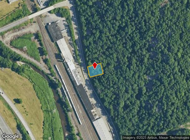
Property Record
200 Rt 59, Hillburn, NY 10931
Current Lease Availabilities
NEARBY LISTINGS FOR SALE OR LEASE
Property Detail
200 Rt 59
392601-047-019-0002-005-000-0000
Rockland
Residentialacreage
New York
X
5.0
34003C0056H
0.29 AC
2023
Ramapo
2024
Northern New Jersey
011800
New York-Jersey City-White Plains, NY-NJ
DEMOGRAPHICS near 200 Rt 59
1 Mile
3 Mile
5 Mile
2024 Total Population
3,672
32,040
102,800
2029 Population
3,733
33,187
106,502
Pop Growth 2024-2029
+ 1.66%
+ 3.58%
+ 3.60%
Average Age
40
42
38
2024 Total Households
1,486
12,037
32,992
HH Growth 2024-2029
+ 1.75%
+ 3.64%
+ 3.74%
Median Household Inc
$98,180
$113,347
$112,144
Avg Household Size
2.40
2.60
2.90
2024 Avg HH Vehicles
2.00
2.00
2.00
Median Home Value
$430,357
$489,449
$653,292
Median Year Built
1962
1971
1976
Nearby Places
Map Layers
Map Styles
 Street
 Aerial
- Restaurants
- Banks
- Shops
- Fitness
- Groceries
PUBLIC TRANSPORTATION
TRANSIT/SUBWAY
Suffern (Bergen County/Port Jervis Line - NJ Transit Commuter Rail (NJ Transit), Main/Port Jervis Line - NJ Transit Commuter Rail (NJ Transit))
DRIVE
WALK
Distance
Suffern (Bergen County/Port Jervis Line - NJ Transit Commuter Rail (NJ Transit), Main/Port Jervis Line - NJ Transit Commuter Rail (NJ Transit))
2 min
19 min
1.0 mi
COMMUTER RAIL
Suffern (Bergen County/Port Jervis Line - NJ Transit Commuter Rail (NJ Transit), Main/Port Jervis Line - NJ Transit Commuter Rail (NJ Transit))
DRIVE
WALK
Distance
Suffern (Bergen County/Port Jervis Line - NJ Transit Commuter Rail (NJ Transit), Main/Port Jervis Line - NJ Transit Commuter Rail (NJ Transit))
2 min
17 min
0.9 mi
Mahwah (Bergen County/Port Jervis Line - NJ Transit Commuter Rail (NJ Transit), Main/Port Jervis Line - NJ Transit Commuter Rail (NJ Transit))
DRIVE
WALK
Distance
Mahwah (Bergen County/Port Jervis Line - NJ Transit Commuter Rail (NJ Transit), Main/Port Jervis Line - NJ Transit Commuter Rail (NJ Transit))
4 min
2.3 mi
AIRPORT
Westchester County
DRIVE
WALK
Distance
Westchester County
44 min
31.4 mi
New York Stewart International
DRIVE
WALK
Distance
New York Stewart International
45 min
34.4 mi
LaGuardia
DRIVE
WALK
Distance
LaGuardia
57 min
34.7 mi
Freight Ports
Maher Terminal
DRIVE
WALK
Distance
Maher Terminal
58 min
37.1 mi
Nearby Properties
Address
Land Use
TOTAL SIZE
Lot Size
Zoning
Address
Land Use
TOTAL SIZE
Lot Size
Zoning
284 AC
P40
Address
Land Use
TOTAL SIZE
Lot Size
Zoning
46.89 AC
IP120
Address
Land Use
TOTAL SIZE
Lot Size
Zoning
1,056 SF
99.35 AC
OP200
Address
Land Use
TOTAL SIZE
Lot Size
Zoning
61.37 AC
PED
Address
Land Use
TOTAL SIZE
Lot Size
Zoning
23.32 AC
Address
Land Use
TOTAL SIZE
Lot Size
Zoning
14.09 AC
B200
Address
Land Use
TOTAL SIZE
Lot Size
Zoning
Address
Land Use
TOTAL SIZE
Lot Size
Zoning
68.78 AC
OP20
Address
Land Use
TOTAL SIZE
Lot Size
Zoning
19.60 AC
OP200
Address
Land Use
TOTAL SIZE
Lot Size
Zoning
33.78 AC
CEDR40
Address
Land Use
TOTAL SIZE
Lot Size
Zoning
539,911 SF
38.80 AC
05
Address
Land Use
TOTAL SIZE
Lot Size
Zoning
33.50 AC
GI80
Address
Land Use
TOTAL SIZE
Lot Size
Zoning
219,765 SF
29.88 AC
07
Address
Land Use
TOTAL SIZE
Lot Size
Zoning
10.08 AC
IP120
Address
Land Use
TOTAL SIZE
Lot Size
Zoning
12.77 AC
GI80
Address
Land Use
TOTAL SIZE
Lot Size
Zoning
0.44 AC
OP20
Address
Land Use
TOTAL SIZE
Lot Size
Zoning
9 AC
B40
Address
Land Use
TOTAL SIZE
Lot Size
Zoning
5.31 AC
GA200
Address
Land Use
TOTAL SIZE
Lot Size
Zoning
11.09 AC
IP120
Address
Land Use
TOTAL SIZE
Lot Size
Zoning
3.65 AC
Address
Land Use
TOTAL SIZE
Lot Size
Zoning
2.96 AC
I200
Address
Land Use
TOTAL SIZE
Lot Size
Zoning
928 AC
POS
Address
Land Use
TOTAL SIZE
Lot Size
Zoning
2.43 AC
B40
Address
Land Use
TOTAL SIZE
Lot Size
Zoning
5.46 AC
1200
Address
Land Use
TOTAL SIZE
Lot Size
Zoning
12.53 AC
IP120
Address
Land Use
TOTAL SIZE
Lot Size
Zoning
8.50 AC
IP120
Address
Land Use
TOTAL SIZE
Lot Size
Zoning
8.14 AC
IP120
Address
Land Use
TOTAL SIZE
Lot Size
Zoning
8.56 AC
IP120
Address
Land Use
TOTAL SIZE
Lot Size
Zoning
11.43 AC
GI80
Address
Land Use
TOTAL SIZE
Lot Size
Zoning
58,473 SF
0.70 AC
HCS
The World's #1 Commercial Real Estate Marketplace
Connect with us
© 2026 CoStar Group
The information above has been obtained from sources believed reliable. While we do not doubt its accuracy we have not verified it and make no guarantee, warranty or representation about it. It is your responsibility to independently confirm its accuracy and completeness. Any projections, opinions, assumptions, or estimates used are for example only and do not represent the current or future performance of the property. The value of this transaction to you depends on tax and other factors which should be evaluated by your tax, financial, and legal advisors. You and your advisors should conduct a careful, independent investigation of the property to determine to your satisfaction the suitability of the property for your needs.