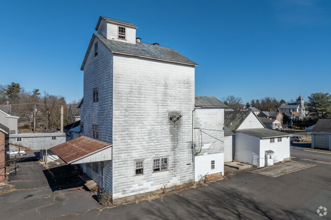
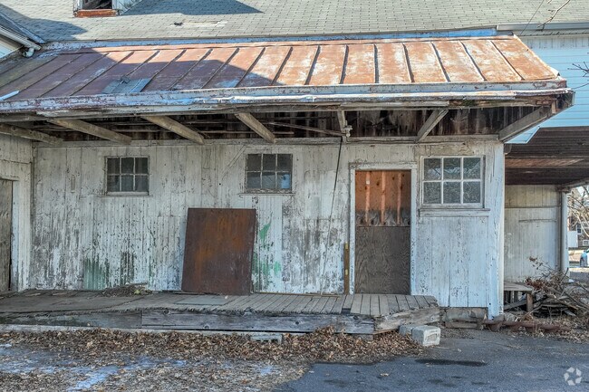
Property Record
446 E Walnut St, Perkasie, PA 18944

NEARBY LISTINGS FOR SALE OR LEASE
Property Detail
446 E Walnut St
Philadelphia-Camden-Wilmington, PA-NJ-DE-MD
Third Ward
33-010-020-001
1.353 AC NS MAIN ST 167 W WALNUT ST
Commercialnec
Bucks
2024
Pennsylvania
2025
1.35 AC
102500
Bucks
13,514 SF
Philadelphia
DEMOGRAPHICS near 446 E Walnut St
1 Mile
3 Mile
5 Mile
2024 Total Population
9,934
30,408
69,566
2029 Population
9,903
30,255
69,781
Pop Growth 2024-2029
(0.31%)
(0.50%)
+ 0.31%
Average Age
41
42
42
2024 Total Households
3,805
11,555
26,788
HH Growth 2024-2029
(0.32%)
(0.51%)
+ 0.31%
Median Household Inc
$100,778
$103,230
$97,528
Avg Household Size
2.60
2.60
2.50
2024 Avg HH Vehicles
2.00
2.00
2.00
Median Home Value
$320,546
$348,969
$346,425
Median Year Built
1979
1979
1976
Nearby Places
Map Layers
Map Styles
 Street
 Aerial
- Restaurants
- Banks
- Shops
- Fitness
- Groceries
PUBLIC TRANSPORTATION
COMMUTER RAIL
Chalfont (R5 - Southeastern Pennsylvania Transportation Authority Regional Rail (SEPTA Regional Rail))
DRIVE
WALK
Distance
Chalfont (R5 - Southeastern Pennsylvania Transportation Authority Regional Rail (SEPTA Regional Rail))
14 min
7.5 mi
Link Belt (R5 - Southeastern Pennsylvania Transportation Authority Regional Rail (SEPTA Regional Rail))
DRIVE
WALK
Distance
Link Belt (R5 - Southeastern Pennsylvania Transportation Authority Regional Rail (SEPTA Regional Rail))
16 min
8.9 mi
AIRPORT
Lehigh Valley International
DRIVE
WALK
Distance
Lehigh Valley International
45 min
25.1 mi
Trenton Mercer
DRIVE
WALK
Distance
Trenton Mercer
58 min
32.2 mi
Philadelphia International
DRIVE
WALK
Distance
Philadelphia International
71 min
46.9 mi
Freight Ports
Port of Philadelphia
DRIVE
WALK
Distance
Port of Philadelphia
57 min
33.4 mi
SALE & LEASE HISTORY
LISTING DATE
SALE/LEASE

May 14, 2020
For Sale
Dec 22, 2023
For Sale
Apr 11, 2018
For Sale
Nearby Properties
Address
Land Use
TOTAL SIZE
Lot Size
Zoning
Address
Land Use
TOTAL SIZE
Lot Size
Zoning
98,397 SF
8.23 AC
LI
Address
Land Use
TOTAL SIZE
Lot Size
Zoning
125,845 SF
11.85 AC
LI
Address
Land Use
TOTAL SIZE
Lot Size
Zoning
256,512 SF
21.31 AC
CR
Address
Land Use
TOTAL SIZE
Lot Size
Zoning
205,462 SF
34.20 AC
52PI
Address
Land Use
TOTAL SIZE
Lot Size
Zoning
1,261,187 SF
13.86 AC
CR
Address
Land Use
TOTAL SIZE
Lot Size
Zoning
92,018 SF
22.18 AC
I2
Address
Land Use
TOTAL SIZE
Lot Size
Zoning
29,166 SF
2.18 AC
LI
Address
Land Use
TOTAL SIZE
Lot Size
Zoning
27,500 SF
2.37 AC
LI
Address
Land Use
TOTAL SIZE
Lot Size
Zoning
24,612 SF
2.34 AC
LI
Address
Land Use
TOTAL SIZE
Lot Size
Zoning
213,419 SF
33.19 AC
PI
Address
Land Use
TOTAL SIZE
Lot Size
Zoning
131,218 SF
14.23 AC
PRD
Address
Land Use
TOTAL SIZE
Lot Size
Zoning
137,040 SF
18.95 AC
LI
Address
Land Use
TOTAL SIZE
Lot Size
Zoning
63,433 SF
8.20 AC
CO
Address
Land Use
TOTAL SIZE
Lot Size
Zoning
13,250 SF
2.41 AC
LI
Address
Land Use
TOTAL SIZE
Lot Size
Zoning
18,780 SF
2.45 AC
LI
Address
Land Use
TOTAL SIZE
Lot Size
Zoning
68,463 SF
10.86 AC
IS
Address
Land Use
TOTAL SIZE
Lot Size
Zoning
7.61 AC
CR
Address
Land Use
TOTAL SIZE
Lot Size
Zoning
37,444 SF
96.24 AC
PI
Address
Land Use
TOTAL SIZE
Lot Size
Zoning
105,840 SF
2.42 AC
R1B
Address
Land Use
TOTAL SIZE
Lot Size
Zoning
101,920 SF
21.05 AC
R1B
Address
Land Use
TOTAL SIZE
Lot Size
Zoning
98,213 SF
8.24 AC
LI
Address
Land Use
TOTAL SIZE
Lot Size
Zoning
7,680 SF
2.41 AC
LI
Address
Land Use
TOTAL SIZE
Lot Size
Zoning
39,966 SF
2.78 AC
I2
Address
Land Use
TOTAL SIZE
Lot Size
Zoning
40,000 SF
8.55 AC
I
Address
Land Use
TOTAL SIZE
Lot Size
Zoning
23,108 SF
7.91 AC
PI
Address
Land Use
TOTAL SIZE
Lot Size
Zoning
120,000 SF
11.84 AC
LI
Address
Land Use
TOTAL SIZE
Lot Size
Zoning
52,819 SF
15.35 AC
CR
Address
Land Use
TOTAL SIZE
Lot Size
Zoning
2,538 SF
4.96 AC
CR
Address
Land Use
TOTAL SIZE
Lot Size
Zoning
12,000 SF
128.21 AC
I1
Address
Land Use
TOTAL SIZE
Lot Size
Zoning
18,686 SF
15 AC
LI
The World's #1 Commercial Real Estate Marketplace
Connect with us
© 2026 CoStar Group
The information above has been obtained from sources believed reliable. While we do not doubt its accuracy we have not verified it and make no guarantee, warranty or representation about it. It is your responsibility to independently confirm its accuracy and completeness. Any projections, opinions, assumptions, or estimates used are for example only and do not represent the current or future performance of the property. The value of this transaction to you depends on tax and other factors which should be evaluated by your tax, financial, and legal advisors. You and your advisors should conduct a careful, independent investigation of the property to determine to your satisfaction the suitability of the property for your needs.