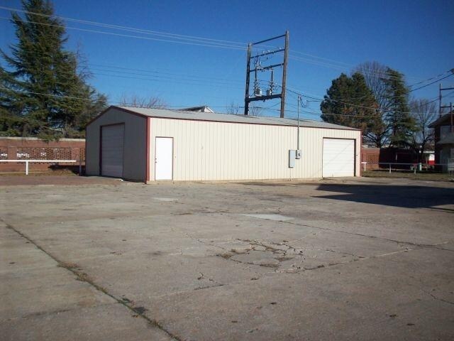
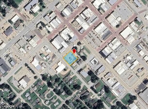
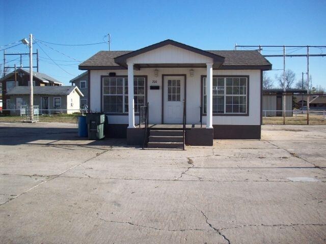
Property Record
200 S Walnut St, Pauls Valley, OK 73075
NEARBY LISTINGS FOR SALE OR LEASE
Property Detail
200 S Walnut St
0205-00-092-004-0-000-00
Pauls Valley City
Autorepair
BLOCK 92 PV LOT 4 & NWLY 40' LOT 3 SPWD/2159-210
AE
Garvin
40099C0025C
Oklahoma
2025
3,4
2025
0.45 AC
681300
Oklahoma East Area
1,500 SF
Other Market Areas
DEMOGRAPHICS near 200 S Walnut St
1 mile
3 mile
5 mile
2024 Total Population
4,507
7,304
8,722
2029 Population
4,617
7,427
8,833
Pop Growth 2024-2029
+ 2.44%
+ 1.68%
+ 1.27%
Average Age
40
40
41
2024 Total Households
1,772
2,954
3,512
HH Growth 2024-2029
+ 2.54%
+ 1.66%
+ 1.28%
Median Household Inc
$41,661
$42,255
$43,669
Avg Household Size
2.40
2.40
2.40
2024 Avg HH Vehicles
2.00
2.00
2.00
Median Home Value
$97,346
$117,565
$129,934
Median Year Built
1961
1967
1969
Nearby Places
Map Layers
Map Styles
 Street
 Aerial
Transit
 Traffic
 Biking
Places
Listings with unknown addresses are not visible on the map
- Restaurants
- Banks
- Shops
- Fitness
- Groceries
PUBLIC TRANSPORTATION
COMMUTER RAIL
Pauls Valley Amtrak Station (Heartland Flyer - Amtrak)
Drive
Walk
Distance
Pauls Valley Amtrak Station (Heartland Flyer - Amtrak)
1 min
7 min
0.4 mi
Freight Ports
Tulsa Port Of Catoosa
Drive
Walk
Distance
Tulsa Port Of Catoosa
194 min
170.6 mi
Nearby Properties
Address
Land Use
TOTAL SIZE
Lot Size
Zoning
Address
Land Use
TOTAL SIZE
Lot Size
Zoning
24,967 SF
93.31 AC
NP
Address
Land Use
TOTAL SIZE
Lot Size
Zoning
104,307 SF
16.21 AC
Address
Land Use
TOTAL SIZE
Lot Size
Zoning
54,056 SF
2.07 AC
Address
Land Use
TOTAL SIZE
Lot Size
Zoning
8,080 SF
15 AC
C1
Address
Land Use
TOTAL SIZE
Lot Size
Zoning
40,020 SF
2.38 AC
Address
Land Use
TOTAL SIZE
Lot Size
Zoning
2,145 SF
10.57 AC
C1
Address
Land Use
TOTAL SIZE
Lot Size
Zoning
35,031 SF
2.08 AC
Address
Land Use
TOTAL SIZE
Lot Size
Zoning
37,250 SF
1.79 AC
Address
Land Use
TOTAL SIZE
Lot Size
Zoning
1,840 SF
5.02 AC
C1
Address
Land Use
TOTAL SIZE
Lot Size
Zoning
4,056 SF
3.12 AC
Address
Land Use
TOTAL SIZE
Lot Size
Zoning
184,902 SF
10 AC
C1
Address
Land Use
TOTAL SIZE
Lot Size
Zoning
6,272 SF
1.40 AC
Address
Land Use
TOTAL SIZE
Lot Size
Zoning
18,000 SF
18.52 AC
Address
Land Use
TOTAL SIZE
Lot Size
Zoning
7,000 SF
1 AC
C1
Address
Land Use
TOTAL SIZE
Lot Size
Zoning
16,686 SF
2.42 AC
Address
Land Use
TOTAL SIZE
Lot Size
Zoning
22,286 SF
0.99 AC
C1
Address
Land Use
TOTAL SIZE
Lot Size
Zoning
7,680 SF
5.50 AC
Address
Land Use
TOTAL SIZE
Lot Size
Zoning
1,466 SF
0.24 AC
Address
Land Use
TOTAL SIZE
Lot Size
Zoning
11,685 SF
3.71 AC
Address
Land Use
TOTAL SIZE
Lot Size
Zoning
2,808 SF
2.13 AC
Address
Land Use
TOTAL SIZE
Lot Size
Zoning
4,456 SF
2.73 AC
C1
Address
Land Use
TOTAL SIZE
Lot Size
Zoning
45,489 SF
5.90 AC
C1
Address
Land Use
TOTAL SIZE
Lot Size
Zoning
21,296 SF
4.49 AC
C1
Address
Land Use
TOTAL SIZE
Lot Size
Zoning
4,475 SF
0.92 AC
C1
Address
Land Use
TOTAL SIZE
Lot Size
Zoning
2,250 SF
0.32 AC
Address
Land Use
TOTAL SIZE
Lot Size
Zoning
9,874 SF
0.69 AC
C1
Address
Land Use
TOTAL SIZE
Lot Size
Zoning
30,246 SF
1.29 AC
C1
Address
Land Use
TOTAL SIZE
Lot Size
Zoning
3,428 SF
2 AC
C1
Address
Land Use
TOTAL SIZE
Lot Size
Zoning
6,007 SF
163.53 AC
TM
Address
Land Use
TOTAL SIZE
Lot Size
Zoning
7,920 SF
0.48 AC
C1
The World's #1 Commercial Real Estate Marketplace
Connect with us
© 2026 CoStar Group
The information above has been obtained from sources believed reliable. While we do not doubt its accuracy we have not verified it and make no guarantee, warranty or representation about it. It is your responsibility to independently confirm its accuracy and completeness. Any projections, opinions, assumptions, or estimates used are for example only and do not represent the current or future performance of the property. The value of this transaction to you depends on tax and other factors which should be evaluated by your tax, financial, and legal advisors. You and your advisors should conduct a careful, independent investigation of the property to determine to your satisfaction the suitability of the property for your needs.