Property Record
200 Schettler Rd, Cleburne, TX 76031
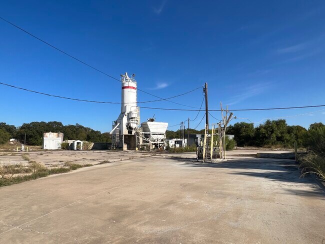

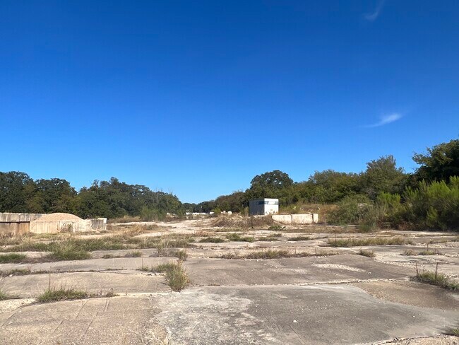
Property Detail
200 Schettler Rd
126-0002-03340
ABST 2 TR 77 H ADDISON 126.5534.98682
Industrialgeneral
JOHNSON
A Areas with a 1% annual chance of flooding and a 26% chance of flooding over the life of a 30-year mortgage.
Texas
2024
4.17 AC
2025
Johnson County
130303
Dallas/Ft Worth
528 SF
Dallas-Fort Worth-Arlington, TX
NEARBY LISTINGS FOR SALE OR LEASE
DEMOGRAPHICS near 200 Schettler Rd
1 mile
3 mile
5 mile
2025 Total Population
1,542
12,661
52,266
2030 Population
1,771
14,452
59,793
Pop Growth 2025-2030
+ 14.85%
+ 14.15%
+ 14.40%
Average Age
40
39
38
2025 Total Households
573
4,493
17,879
HH Growth 2025-2030
+ 14.66%
+ 13.96%
+ 14.10%
Median Household Inc
$70,961
$64,970
$64,061
Avg Household Size
2.60
2.60
2.80
2025 Avg HH Vehicles
2.00
2.00
2.00
Median Home Value
$325,000
$308,460
$250,748
Median Year Built
1990
1993
1988
Nearby Places
Map Layers
Map Styles
 Street
 Aerial
Transit
 Traffic
 Biking
Places
Listings with unknown addresses are not visible on the map
- Restaurants
- Banks
- Shops
- Fitness
- Groceries
PUBLIC TRANSPORTATION
COMMUTER RAIL
Cleburne Amtrak Station (Texas Eagle - Amtrak)
Drive
Walk
Distance
Cleburne Amtrak Station (Texas Eagle - Amtrak)
9 min
5.3 mi
Freight Ports
Port of Shreveport
Drive
Walk
Distance
Port of Shreveport
264 min
242.1 mi
SALE & LEASE HISTORY
LISTING DATE
SALE/LEASE

Mar 06, 2024
For Sale
Nearby Properties
Address
Land Use
TOTAL SIZE
Lot Size
Zoning
Address
Land Use
TOTAL SIZE
Lot Size
Zoning
296,991 SF
71.84 AC
Address
Land Use
TOTAL SIZE
Lot Size
Zoning
1 SF
0.21 AC
Address
Land Use
TOTAL SIZE
Lot Size
Zoning
1.14 AC
Address
Land Use
TOTAL SIZE
Lot Size
Zoning
1.14 AC
Address
Land Use
TOTAL SIZE
Lot Size
Zoning
910,071 SF
0.21 AC
Address
Land Use
TOTAL SIZE
Lot Size
Zoning
1.14 AC
Address
Land Use
TOTAL SIZE
Lot Size
Zoning
11,176 SF
0.08 AC
Address
Land Use
TOTAL SIZE
Lot Size
Zoning
16.56 AC
Address
Land Use
TOTAL SIZE
Lot Size
Zoning
11.04 AC
Address
Land Use
TOTAL SIZE
Lot Size
Zoning
1 SF
37.15 AC
Address
Land Use
TOTAL SIZE
Lot Size
Zoning
271,345 SF
0.21 AC
Address
Land Use
TOTAL SIZE
Lot Size
Zoning
69,592 SF
29.56 AC
Address
Land Use
TOTAL SIZE
Lot Size
Zoning
24.44 AC
Address
Land Use
TOTAL SIZE
Lot Size
Zoning
612,261 SF
0.21 AC
Address
Land Use
TOTAL SIZE
Lot Size
Zoning
668,640 SF
0.08 AC
Address
Land Use
TOTAL SIZE
Lot Size
Zoning
221,203 SF
15.60 AC
Address
Land Use
TOTAL SIZE
Lot Size
Zoning
394,274 SF
Address
Land Use
TOTAL SIZE
Lot Size
Zoning
1 SF
35.23 AC
Address
Land Use
TOTAL SIZE
Lot Size
Zoning
70,258 SF
5.50 AC
Address
Land Use
TOTAL SIZE
Lot Size
Zoning
46,839 SF
15.51 AC
Address
Land Use
TOTAL SIZE
Lot Size
Zoning
Address
Land Use
TOTAL SIZE
Lot Size
Zoning
14.40 AC
Address
Land Use
TOTAL SIZE
Lot Size
Zoning
143,327 SF
20 AC
Address
Land Use
TOTAL SIZE
Lot Size
Zoning
129,408 SF
16.72 AC
Address
Land Use
TOTAL SIZE
Lot Size
Zoning
11.98 AC
Address
Land Use
TOTAL SIZE
Lot Size
Zoning
13,910 SF
12.54 AC
Address
Land Use
TOTAL SIZE
Lot Size
Zoning
42,182 SF
11.19 AC
Address
Land Use
TOTAL SIZE
Lot Size
Zoning
82,669 SF
11.50 AC
Address
Land Use
TOTAL SIZE
Lot Size
Zoning
43,070 SF
7.57 AC
Address
Land Use
TOTAL SIZE
Lot Size
Zoning
8,822 SF
0.42 AC
The World's #1 Commercial Real Estate Marketplace
Connect with us
© 2026 CoStar Group
The information above has been obtained from sources believed reliable. While we do not doubt its accuracy we have not verified it and make no guarantee, warranty or representation about it. It is your responsibility to independently confirm its accuracy and completeness. Any projections, opinions, assumptions, or estimates used are for example only and do not represent the current or future performance of the property. The value of this transaction to you depends on tax and other factors which should be evaluated by your tax, financial, and legal advisors. You and your advisors should conduct a careful, independent investigation of the property to determine to your satisfaction the suitability of the property for your needs.